Skip to search
Skip to main content
Skip to first result
Digital Commonwealth
Folders
Sign Up / Log In
Search for
Search
Search
Search
Basic
Advanced
Explore
Map
Collections
Institutions
Formats
For Educators
Primary Source Sets
Lesson Plans
Using Primary Sources
Searching Digital Commonwealth
For Institutions
Join Digital Commonwealth
Conferences, Trainings, & Events
How to Contribute Collections
Digitization Services
Board & Committees
Frequently Asked Questions
About
About Digital Commonwealth
News & Announcements
Copyright & Terms of Use
Harmful Content Statement
Partners
API
Contact Us
Search
Search Constraints
Start Over
Save Search
Your search:
More Like
commonwealth:t435gf54h
✖
Remove constraint More Like: commonwealth:t435gf54h
« Prev.
|
401
-
500
of
1,449
|
Next »
Sort
by relevance
relevance
title
date (asc)
date (desc)
Number of results to display per page
100
per page
per page
10
per page
20
per page
50
per page
100
per page
View results as:
List
list view
Maps
map view
Gallery
grid view
Search Results
401.
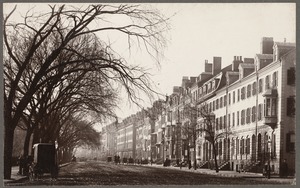
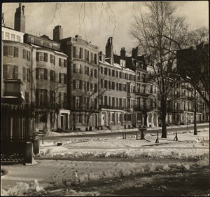
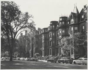
Boston, Massachusetts. Beacon Street, opposite Public Garden, 1887
402.
Boston, Massachusetts. Corner Boylston and Park Square
403.
Boston, Massachusetts. Louisburg Square. West side, showing corner of Mt. Vernon Street
404.
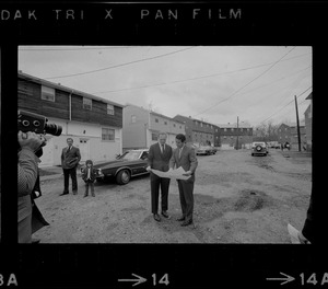
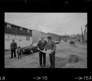
Boston Mayor Kevin White and another man looking at plans on tour of Stony Brook neighborhood
405.
Boston Mayor Kevin White and another man looking at plans on tour of Stony Brook neighborhood
406.
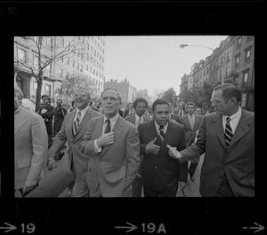
Boston Mayor Kevin White, left, Newark Mayor Kenneth Gibson, center, and Wilmington Mayor Harry Haskell, right talking while on...
407.
Boston Mayor Kevin White, right, points something out to Seattle Mayor Wesley C. Uhlman, left, and New Orleans Mayor Moon...
408.
Boston misc
409.
Boston misc
410.
Boston police cruiser in front of building
411.
Boston suburban aerial view, Belmont
412.
Boston suburban aerial view, Belmont
413.
Boston suburban aerial view, Belmont
414.
Boston suburban aerial view, Belmont
415.
Boston suburban aerial view, Belmont
416.
Boston suburban aerial view (unspecified location), unspecified Boston suburb
417.
Boston suburban aerial view (unspecified location), unspecified Boston suburb
418.
Boston suburban aerial view (unspecified location), unspecified Boston suburb
419.
Boston suburban aerial view (unspecified location), unspecified Boston suburb
420.
Boston suburban aerial view (unspecified location), unspecified Boston suburb
421.
Boston suburban aerial view (unspecified location), unspecified Boston suburb
422.
Boston suburban aerial view (unspecified location), unspecified Boston suburb
423.
Boston suburban aerial view (unspecified location), unspecified Boston suburb
424.
Boston suburban aerial view (unspecified location), unspecified Boston suburb
425.
Boston suburban aerial view (unspecified location), unspecified Boston suburb
426.
Boston suburban aerial view (unspecified location), unspecified Boston suburb
427.
Boston suburban aerial view (unspecified location), unspecified Boston suburb
428.
Boston suburban aerial view (unspecified location), unspecified Boston suburb
429.
Boston suburban aerial view (unspecified location), unspecified Boston suburb
430.
Boston suburban aerial view (unspecified location), unspecified Boston suburb
431.
Boston suburban aerial view (unspecified location), unspecified Boston suburb
432.
Boylston St. & Belmore Terrace, Jamaica Plain, Mass.
433.
Boylston St., Jamaica Plain, Mass.
434.
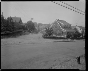
Brentwood St. and Salem St. SW corner view looking southerly, July 18, 1936
435.
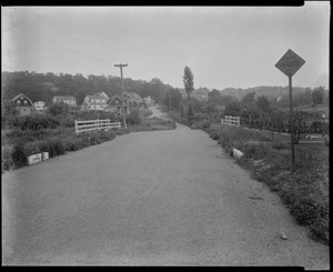
Brentwood St. view looking northerly from street near Grant Rd., July 18, 1936
436.
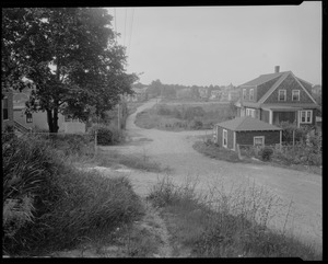
Brentwood St. view looking Sly from in front of #12, July 18, 1936
437.
Brookline
438.
Bunker Hill Monument from shadow of elm on Monument Avenue
439.
Burr Street. Jamaica Plain, Massachusetts
440.
Burroughs Street. Jamaica Plain, Massachusetts
441.
Bus crossing intersection in Beacon Hill with view of Massachusetts State House dome in distance
442.
Byron St.
443.
Las Casas St., 10 July '97
444.
Castle of San Lorenzo ; Louisburg Square, Boston
445.
Chambers Street in the West End, Boston
446.
Chandler Street - South End
447.
Chandler Street -- South End
448.
Charles St. N. Middlesex
449.
Charles Street
450.
Charles Street
451.
Charles Street
452.
Charles Street
453.
A Charlestown street
454.
Chauncy St. from Exeter Place
455.
Chestnut Street, Salem, Mass.
456.
Chestnut toward State House
457.
Children in Onset, Mass. cleanup debris along road etc.
458.
Children in Onset, Mass. cleanup debris along road etc.
459.
Children in Onset, Mass. cleanup debris along road etc.
460.
Children in Onset, Mass. cleanup debris along road etc.
461.
Children in Onset, Mass. cleanup debris along road etc.
462.
Children in Onset, Mass. cleanup debris along road etc.
463.
Children in Onset, Mass. cleanup debris along road etc.
464.
Children in Onset, Mass. cleanup debris along road etc.
465.
Clifton at Kernwood west
466.
"Col. Samuel Jaques house"
467.
Colonnade Row, Tremont St., 1860
468.
Columbia looking Nly from Cherry St., 9/10/35
469.
Columbia St. looking southerly from Sylvan St., Sept. 10, 1935
470.
Commonwealth Ave. between Arlington & Berkeley Streets.
471.
Commonwealth Ave. between Arlington & Berkeley Streets.
472.
Commonwealth Ave. between Arlington & Berkeley Streets.
473.
Commonwealth Ave. between Arlington & Berkeley Streets.
474.
Commonwealth Ave. between Arlington & Berkeley Streets.
475.
Commonwealth Ave., Boston
476.
Commonwealth Ave. Boston, Mass.
477.
Commonwealth Ave.: Near Dartmouth St.
478.
Commonwealth Ave. near Dartmouth St.: Statue of William Lloyd Garrison
479.
Commonwealth Avenue
480.
Commonwealth Avenue
481.
Commonwealth Avenue
482.
Commonwealth Avenue in process
483.
Commonwealth Avenue. North side
484.
Commonwealth Avenue. North side
485.
Commonwealth Avenue. November 27, 1901
486.
Commonwealth Avenue. South side
487.
Commonwealth Avenue. South side
488.
Concord Avenue near Lexington Street
489.
Concord Street
490.
Congdon St., Prov.
491.
Constance St. view looking NEly from Home St., Sept. 23, 1933
492.
Constance St. view looking SW from Bowman St., Sept. 23, 1933
493.
Cor. Kingston St. & Summer St., 1851
494.
Cordaville Street
495.
Cordis Street
496.
Cordis Street in summer, 1941
497.
Cordis Street in winter, 1898
498.
Cordis Street not ploughed
499.
Corner of Berkeley St., Back Bay
500.
Corner of Ditson & Charles St., Dorchester
« Previous
Next »
1
2
3
4
5
6
7
8
9
…
14
15
Limit your search
Subject
Residential streets
701
Houses
343
Street railroad tracks
298
Elevated railroads
176
Massachusetts Bay Transportation Authority
175
Cities & towns
120
Trees
79
WHS student
76
more
Subject
»
Place
North and Central America
1,125
United States
1,123
Massachusetts
1,079
Suffolk (county)
519
Boston
516
Middlesex (county)
369
Watertown
180
Malden
122
more
Place
»
Format
Photographs
1,199
Prints
108
Maps/Atlases
68
Postcards/Cards
35
Manuscripts
22
Documents
18
Posters
15
Newspapers
7
more
Format
»
Available to use
Creative Commons license
898
No known restrictions
211
Date
View distribution
Current results range from
1687
to
2000
Date range begin
Date range end
View larger »
Unknown
6
Collection
Watertown People
212
Along the Elevated: Photographs of the Orange Line
170
Malden Houses
122
Boston Pictorial Archive (Collection of Distinction)
111
Emerson Collection
78
Leslie Jones Collection
68
Watertown Maps
65
Watertown Miscellaneous
61
more
Collection
»
Institution
Boston Public Library
577
Watertown Free Public Library
465
Malden Public Library
122
Longmeadow Historical Society
78
Phillips Library at the Peabody Essex Museum
38
Jamaica Plain Historical Society
29
Billerica Public Library
23
Fall River Public Library
23
more
Institution
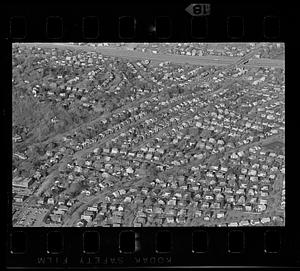
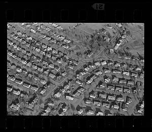
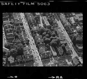
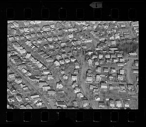
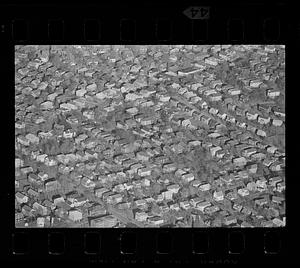
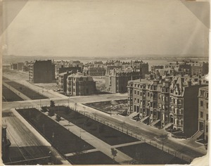
»