Skip to search
Skip to main content
Skip to first result
Digital Commonwealth
Folders
Sign Up / Log In
Search for
Search
Search
Search
Basic
Advanced
Explore
Map
Collections
Institutions
Formats
For Educators
Primary Source Sets
Lesson Plans
Using Primary Sources
Searching Digital Commonwealth
For Institutions
Join Digital Commonwealth
Conferences, Trainings, & Events
How to Contribute Collections
Digitization Services
Board & Committees
Frequently Asked Questions
About
About Digital Commonwealth
News & Announcements
Copyright & Terms of Use
Harmful Content Statement
Partners
API
Contact Us
Search
Search Constraints
Start Over
Save Search
Your search:
More Like
commonwealth:qv33t937t
✖
Remove constraint More Like: commonwealth:qv33t937t
« Prev.
|
601
-
647
of
647
| Next »
Sort
by relevance
relevance
title
date (asc)
date (desc)
Number of results to display per page
100
per page
per page
10
per page
20
per page
50
per page
100
per page
View results as:
List
list view
Maps
map view
Gallery
grid view
Search Results
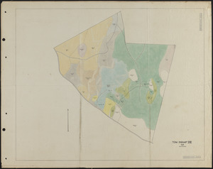
601.
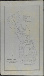
Tom Swamp VIII 1928 stand map
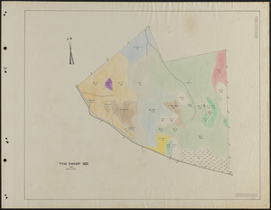
602.
Tom Swamp VIII 1937 stand map
603.
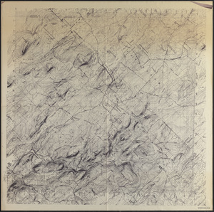
Topographic Map of Harvard Forest
604.
Topographic Map of Harvard Forest
605.
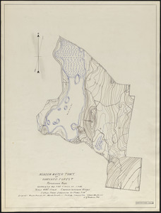
Topographic map of Meadow-water Tract (TS I-VII)
606.
Topographic map of Meadow-water Tract (TS I-VII)
607.
Topographic map of Meadow-water Tract (TS I-VII)
608.
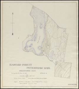
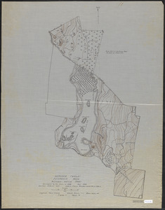
Topographic map of Meadow-water Tract (TS I-VIII)
609.
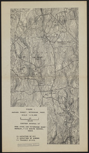
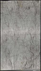
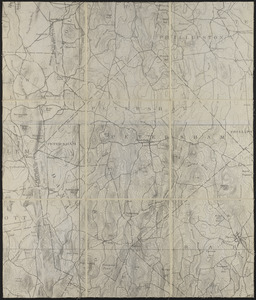
Topographic Map of Petersham
610.
Topographic Map of Petersham
611.
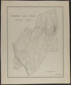
Topographic Map of Prospect Hill Tract
612.
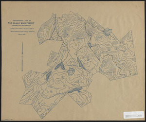
Topographic map of the Black Rock Forest
613.
Topographic Maps of 7.5' Athol
614.
Topographic maps of 7.5' Athol quad
615.
Topographic Maps of 7.5' Barre
616.
Topographic Maps of 7.5' Orange
617.
Topographic maps of 7.5' Orange, Athol, Templeton, Quabbin Reservoir and Petersham quads
618.
Topographic Maps of 7.5' Petersham
619.
Topographic maps of 7.5' Petersham quad
620.
Topographic Maps of 7.5' Quabbin Reservoir
621.
Topographic maps of 7.5' Quabbin Reservoir quad
622.
Topographic Maps of 7.5' Templeton
623.
Topographic Maps of the Athol Quads
624.
Topographic Maps of the Barre Sheet
625.
Topographic Maps of the Petersham Quads
626.
Topographic Maps of the Winchendon Sheet
627.
Topographic Maps of Tom Swamp-North 1948
628.
Topographic maps of Tom Swamp-South 1948
629.
Topographical Survey of Harvard Farm - 1911
630.
Topographical Survey of Harvard Farm - 1911
631.
Topography of Prospect Hill, including Camel's Hump and vicinity
632.
Topography Town of Petersham 1938
633.
Town of Petersham, Land Use and Protected Lands
634.
Town of Petersham Tax Map
635.
Town of Petersham Tax Map
636.
Tract Map (Without Grid) Flood Control - Tully Reservoir
637.
Trail mowing operations, roads and trails Tom Swamp South
638.
Trail mowing operations, Tom Swamp North
639.
Tully Dam Reservoir Map
640.
Type and height or age map of TS II-VI
641.
Type and operations maps of the Adams-Fay Lot (TS IX)
642.
Type and reproduction cutting map of TS IX 1934
643.
Type Map of Slab City Tract Compartments III - VIII
644.
Upham Lot Harvard Forest
645.
The Waldo Tract Tom Swamp X 1971
646.
Wilder Lot Petersham
647.
Wilder Lot Petersham
« Previous
Next »
1
2
3
4
5
6
7
Limit your search
Subject
Boundaries
151
Forest operations
47
1937
44
1938
41
Hurricanes
37
Land use
37
1946
31
Forest Operations
27
more
Subject
»
Place
North and Central America
647
United States
647
Massachusetts
624
Worcester (county)
597
Petersham
588
Tom Swamp
158
Prospect Hill
153
Tom Swamp Tract
97
more
Place
»
Format
Maps/Atlases
646
Manuscripts
4
Photographs
1
Available to use
Creative Commons license
647
Date
View distribution
Current results range from
1755
to
2016
Date range begin
Date range end
View larger »
Collection
The Harvard Forest Map Collection
647
Institution
Harvard University
647