Skip to search
Skip to main content
Skip to first result
Digital Commonwealth
Folders
Sign Up / Log In
Search for
Search
Search
Search
Basic
Advanced
Explore
Map
Collections
Institutions
Formats
For Educators
Primary Source Sets
Lesson Plans
Using Primary Sources
Searching Digital Commonwealth
For Institutions
Join Digital Commonwealth
Conferences, Trainings, & Events
How to Contribute Collections
Digitization Services
Board & Committees
Frequently Asked Questions
About
About Digital Commonwealth
News & Announcements
Copyright & Terms of Use
Harmful Content Statement
Partners
API
Contact Us
Search
Search Constraints
Start Over
Save Search
Your search:
More Like
commonwealth:qv33t937t
✖
Remove constraint More Like: commonwealth:qv33t937t
« Prev.
|
61
-
80
of
647
|
Next »
Sort
by date (desc)
relevance
title
date (asc)
date (desc)
Number of results to display per page
20
per page
per page
10
per page
20
per page
50
per page
100
per page
View results as:
List
list view
Maps
map view
Gallery
grid view
Search Results
61.
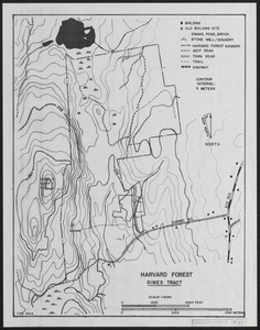
Harvard Forest Simes Tract
62.
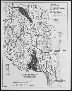
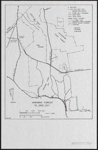
Harvard Forest Tom Swamp Tract
63.
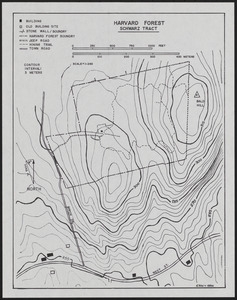
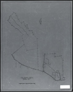
Schwarz Tract 1994
64.
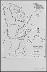
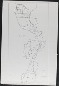
Slab City Base Map - 1994
65.
Tom Swamp Tract - 1994
66.
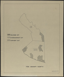
Tom Swamp North
67.
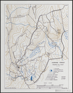
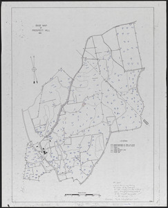
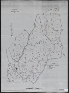
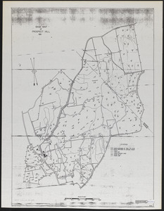
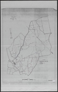
Prospect Hill 1992 Base Map with Trails, roads, stonewalls, cellar holes, buildings
68.
Slab City
69.
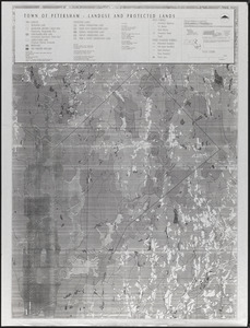
Town of Petersham, Land Use and Protected Lands
70.
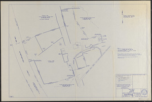
Plan of Land in Petersham - Estate of Georgina P. (Fisher) Howland
71.
Pisgah Border and Research Plot Location Map
72.
Forest operations, Tom Swamp North
73.
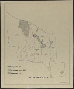
Forest operations, Tom Swamp South
74.
Prospect Hill 1937 Plot Location - David Foster Research HF 1995-26a
75.
Prospect Hill 1937 Plot Location - David Foster Research HF 1995-26a
76.
Prospect Hill 1937 Plot Location - David Foster Research HF 1995-26a
77.
Prospect Hill 1937 Plot Location - David Foster Research HF 1995-26a
78.
Prospect Hill Experimental Blowdown
79.
Tom Swamp I Simulated Hurricane Experiment - Control Plot
80.
Tom Swamp I Simulated Hurricane Experimental - Pulldown Plot
« Previous
Next »
1
2
3
4
5
6
7
8
…
32
33
Limit your search
Subject
Boundaries
151
Forest operations
47
1937
44
1938
41
Hurricanes
37
Land use
37
1946
31
Forest Operations
27
more
Subject
»
Place
North and Central America
647
United States
647
Massachusetts
624
Worcester (county)
597
Petersham
588
Tom Swamp
158
Prospect Hill
153
Tom Swamp Tract
97
more
Place
»
Format
Maps/Atlases
646
Manuscripts
4
Photographs
1
Available to use
Creative Commons license
647
Date
View distribution
Current results range from
1755
to
2016
Date range begin
Date range end
View larger »
Collection
The Harvard Forest Map Collection
647
Institution
Harvard University
647