Skip to search
Skip to main content
Skip to first result
Digital Commonwealth
Folders
Sign Up / Log In
Search for
Search
Search
Search
Basic
Advanced
Explore
Map
Collections
Institutions
Formats
For Educators
Primary Source Sets
Lesson Plans
Using Primary Sources
Searching Digital Commonwealth
For Institutions
Join Digital Commonwealth
Conferences, Trainings, & Events
How to Contribute Collections
Digitization Services
Board & Committees
Frequently Asked Questions
About
About Digital Commonwealth
News & Announcements
Copyright & Terms of Use
Harmful Content Statement
Partners
API
Contact Us
Search
Search Constraints
Start Over
Save Search
Your search:
More Like
commonwealth:qv33t172r
✖
Remove constraint More Like: commonwealth:qv33t172r
« Prev.
|
161
-
180
of
652
|
Next »
Sort
by relevance
relevance
title
date (asc)
date (desc)
Number of results to display per page
20
per page
per page
10
per page
20
per page
50
per page
100
per page
View results as:
List
list view
Maps
map view
Gallery
grid view
Search Results
161.
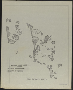
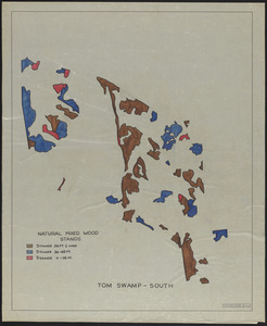
Natural mixed wood stands, Tom Swamp-South
162.
Natural mixed wood stands, Tom Swamp-South
163.
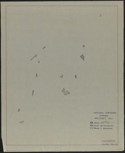
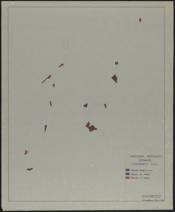
Natural Softwood Stands Prospect Hill - overlay
164.
Natural Softwood Stands Prospect Hill - overlay
165.
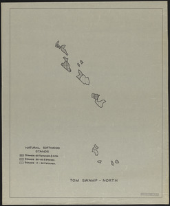
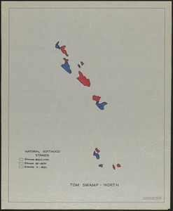
Natural softwood stands, Tom Swamp-North
166.
Natural softwood stands, Tom Swamp-North
167.
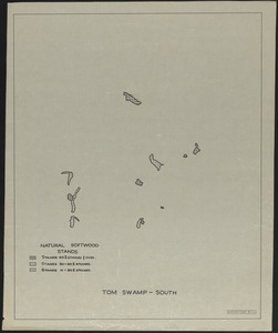
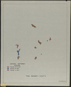
Natural softwood stands, Tom Swamp-South
168.
Natural softwood stands, Tom Swamp-South
169.
Old Growth Sample Plot Mount Pisgah Showing Distribution of Trees
170.
Onesime E. and Charlotte E. Nault Land
171.
Open Fields, Pastures, Abandoned Fields, and House Influence Zones in Petersham
172.
Open Lands in Petersham 1970
173.
Open Lands in Petersham, 1974
174.
Parcel 568 - Estate of Susan Willard Flint
175.
Parcel 576, Robert A. Clark and Fifi Scoufopoulos Land
176.
Petersham Cellar Holes
177.
Petersham Map Showing State, Town, and Discontinued Roads
178.
Petersham Property Map Atlas - Map Key
179.
Petersham Property Map Delineating Open Water, Swamps, Slopes 8-15%, 15+%
180.
Petersham property maps
« Previous
Next »
1
2
…
5
6
7
8
9
10
11
12
13
…
32
33
Limit your search
Subject
Boundaries
151
Forest operations
47
1937
44
1938
41
Hurricanes
37
Land use
37
1946
31
Forest Operations
27
more
Subject
»
Place
North and Central America
647
United States
647
Massachusetts
623
Worcester (county)
596
Petersham
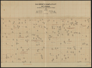
587
Tom Swamp
158
Prospect Hill
152
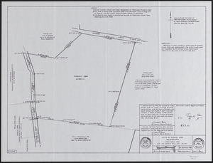
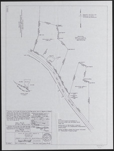
Tom Swamp Tract
97
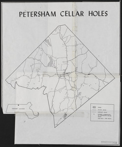
more
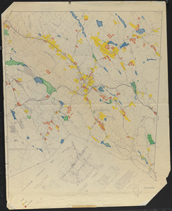
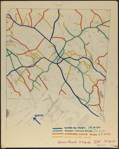
Place
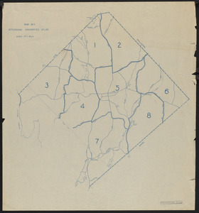
»
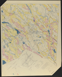
Format
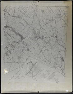
Maps/Atlases
646
Audio recordings (nonmusical)
5
Manuscripts
4
Photographs
1
Available to use
Creative Commons license
647
Date
View distribution
Current results range from
1755
to
2016
Date range begin
Date range end
View larger »
Collection
The Harvard Forest Map Collection
647
American Archive of Public Broadcasting Collection
5
Institution
Harvard University
647
Illinois Public Media (WILL)
5