Skip to search
Skip to main content
Skip to first result
Digital Commonwealth
Folders
Sign Up / Log In
Search for
Search
Search
Search
Basic
Advanced
Explore
Map
Collections
Institutions
Formats
For Educators
Primary Source Sets
Lesson Plans
Using Primary Sources
Searching Digital Commonwealth
For Institutions
Join Digital Commonwealth
Conferences, Trainings, & Events
How to Contribute Collections
Digitization Services
Board & Committees
Frequently Asked Questions
About
About Digital Commonwealth
News & Announcements
Copyright & Terms of Use
Harmful Content Statement
Partners
API
Contact Us
Search
Search Constraints
Start Over
Save Search
Your search:
More Like
commonwealth:n8710699z
✖
Remove constraint More Like: commonwealth:n8710699z
« Prev.
|
101
-
120
of
167
|
Next »
Sort
by relevance
relevance
title
date (asc)
date (desc)
Number of results to display per page
20
per page
per page
10
per page
20
per page
50
per page
100
per page
View results as:
List
list view
Maps
map view
Gallery
grid view
Search Results
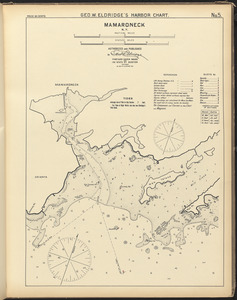
101.
Mamaroneck, N.Y.
102.
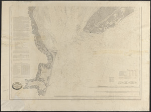
Map of Delaware Bay and River
103.
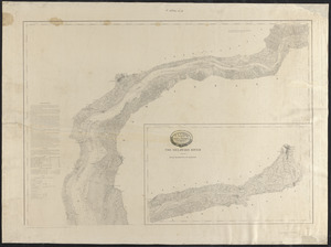
Map of Delaware River
104.
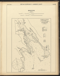
Marion, Mass.
105.
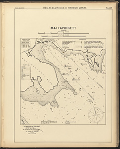
Mattapoisett, Mass.
106.
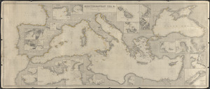
Mediterranean Sea, &c.
107.
Mediterranean Sea, part I
108.
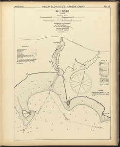
Milford, Conn.
109.
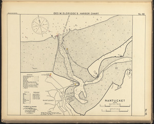
Nantucket, Mass.
110.
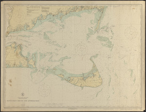
Nantucket Sound and approaches
111.
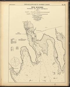
New Bedford, Fairhaven and South Dartmouth, Mass.
112.
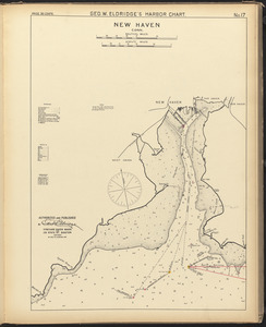
New Haven, Conn.
113.
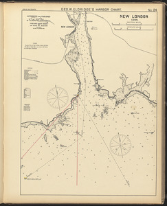
New London, Conn.
114.
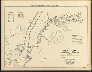
New York Bay and Harbor
115.
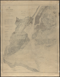
New York, from Governor's Id. to Throgs Neck, N.Y.
116.
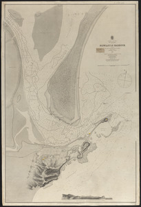
Newcastle Harbour
117.
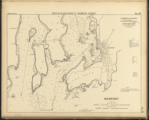
Newport, R.I.
118.
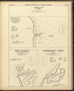
Nonquitt, Mass. ; West Falmouth or Hog Island Har. Mass. ; Quamquissett Harbor, Mass.
119.
North America. Atlantic coast of the United States and southern part of Nova Scotia, Halifax to New York
120.
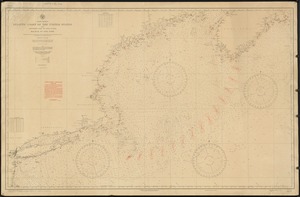
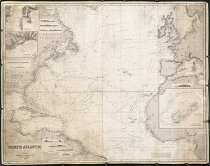
North Atlantic
« Previous
Next »
1
2
3
4
5
6
7
8
9
Limit your search
Subject
Harbors
52
Coastlines
27
Bays (Bodies of water)
23
Oceans
11
Rivers
10
Channels
9
Islands
8
Seas
4
more
Subject
»
Place
North and Central America
99
United States
91
Massachusetts
30
Connecticut
17
Asia
11
Dukes (county)
10
Rhode Island
10
Barnstable (county)
9
more
Place
»
Format
Maps/Atlases
167
Available to use
Creative Commons license
167
Date
View distribution
Current results range from
1821
to
1919
Date range begin
Date range end
View larger »
Collection
Nautical Chart Collection of the Chatham Historical Society
167
Institution
Atwood Museum of the Chatham Historical Society
167