Skip to search
Skip to main content
Skip to first result
Digital Commonwealth
Folders
Sign Up / Log In
Search for
Search
Search
Search
Basic
Advanced
Explore
Map
Collections
Institutions
Formats
For Educators
Primary Source Sets
Lesson Plans
Using Primary Sources
Searching Digital Commonwealth
For Institutions
Join Digital Commonwealth
Conferences, Trainings, & Events
How to Contribute Collections
Digitization Services
Board & Committees
Frequently Asked Questions
About
About Digital Commonwealth
News & Announcements
Copyright & Terms of Use
Harmful Content Statement
Partners
API
Contact Us
Search
Search Constraints
Start Over
Save Search
Your search:
More Like
commonwealth:kh04mk586
✖
Remove constraint More Like: commonwealth:kh04mk586
« Prev.
|
21
-
40
of
3,837
|
Next »
Sort
by relevance
relevance
title
date (asc)
date (desc)
Number of results to display per page
20
per page
per page
10
per page
20
per page
50
per page
100
per page
View results as:
List
list view
Maps
map view
Gallery
grid view
Search Results
21.
Aerial view of Cape Cod Light, Truro, National Seashore, Cape Cod, Mass.
22.
Aerial view of outer Cape Cod
23.
Aerial view of the sand dunes of the Outer Cape
24.
Along Cape Cod Bay and Pilgrim Lake, North Truro, Cape Cod
25.
The approaching storm
26.
Arrowhead Farm Cabins, between North Truro and Provincetown on State Hiway 6
27.
Atwood House, Hill. North Truro, Mass.
28.
Atwood House, Hill. North Truro, Mass.
29.
Atwood House, Hill. North Truro, Mass.
30.
"Aunt Hannah's" oldest house in Truro
31.
Ballston Beach 1909.
32.
Ballston Beach, Head O'Pamet, Truro, Mass. Coast Guard Life Saving Station in foreground.
33.
Ballston Beach Inn - Cape Cod, Truro, Mass.
34.
Ballston Beach, Truro, Mass.
35.
Ballston Beach, Truro, Mass.
36.
Ballston Beach, Truro, Mass.
37.
Ballston Beach, Truro, Mass.
38.
Ballston Beach, Truro, Mass.
39.
Barge Colerain Cottage and Highland Light, North Truro, Mass.
40.
Barge Colerain Cottage and Highland Light, North Truro, Mass.
« Previous
Next »
1
2
3
4
5
6
…
191
192
Limit your search
Subject
Roads
3,428
Cities and towns
1,680
Land use mapping
1,680
Soil mapping
1,680
United States. Work Projects Administration
1,680
United States. Works Progress Administration
1,680
Trees
281
Houses
170
more
Subject
»
Place
North and Central America
3,408
United States
3,369
Massachusetts
2,925
Barnstable (county)
532
Essex (county)
447
Middlesex (county)
387
Worcester (county)
327
Berkshire (county)
284
more
Place
»
Format
Maps/Atlases
1,692
Postcards/Cards
1,016
Photographs
924
Prints
181
Manuscripts
32
Film/Video
29
Albums/Scrapbooks
18
Ephemera
18
more
Format
»
Available to use
No known restrictions
2,619
Creative Commons license
657
Date
View distribution
Current results range from
1683
to
2011
Date range begin
Date range end
View larger »
Unknown
22
Collection
Land study maps, 1936-1937
1,680
Tichnor Brothers Postcard Collection
576
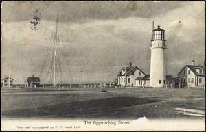
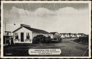
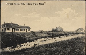
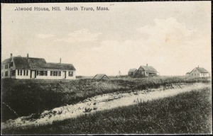
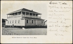
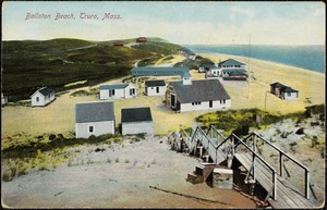
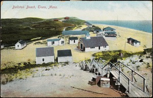
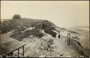
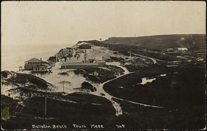
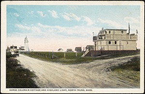
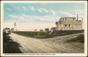
Truro, Massachusetts Historical Postcard Collection from the Truro Historical Society 1905-1986
425
Bill Lane Photograph Collection
217
Leon Abdalian Collection
70
Alexander Davidson Photography
48
Edmund L. Mitchell Collection
42
Hamilton Historical Society Collection
41
more
Collection
»
Institution
Massachusetts Archives
1,680
Boston Public Library
993
Truro Historical Society, Cobb Archive
425
Newburyport Public Library
217
Williams College
48
Hamilton Historical Society
41
Lenox Library Association
35
Spinner Publications
29
more
Institution
»