Skip to search
Skip to main content
Skip to first result
Digital Commonwealth
Folders
Sign Up / Log In
Search for
Search
Search
Search
Basic
Advanced
Explore
Map
Collections
Institutions
Formats
For Educators
Primary Source Sets
Lesson Plans
Using Primary Sources
Searching Digital Commonwealth
For Institutions
Join Digital Commonwealth
Conferences, Trainings, & Events
How to Contribute Collections
Digitization Services
Board & Committees
Frequently Asked Questions
About
About Digital Commonwealth
News & Announcements
Copyright & Terms of Use
Harmful Content Statement
Partners
API
Contact Us
Search
Search Constraints
Start Over
Save Search
Your search:
More Like
commonwealth:kh04mh76q
✖
Remove constraint More Like: commonwealth:kh04mh76q
« Prev. |
1
-
20
of
5,684
|
Next »
Sort
by relevance
relevance
title
date (asc)
date (desc)
Number of results to display per page
20
per page
per page
10
per page
20
per page
50
per page
100
per page
View results as:
List
list view
Maps
map view
Gallery
grid view
Search Results
1.
Entrance to Pamet River. Truro on Cape Cod.
2.
Entrance to Pamet River. Truro on Cape Cod.
3.
Mouth of Pamet River, Truro, Mass.
4.
Mouth of Pamet River, Truro, Mass.
5.
Across the moor, North Truro, Mass.
6.
Aerial view, head of Meadow Beach National Seashore, Truro - Cape Cod - Mass.
7.
Aerial view of Cape Cod Light, Truro, National Seashore, Cape Cod, Mass.
8.
Aerial view of Cape Cod Light, Truro, National Seashore, Cape Cod, Mass.
9.
Aerial view of Cape Cod Light, Truro, National Seashore, Cape Cod, Mass.
10.
Aerial view of outer Cape Cod
11.
Aerial view of the sand dunes of the Outer Cape
12.
Along Cape Cod Bay and Pilgrim Lake, North Truro, Cape Cod
13.
The approaching storm
14.
Arrowhead Farm Cabins, between North Truro and Provincetown on State Hiway 6
15.
Atwood House, Hill. North Truro, Mass.
16.
Atwood House, Hill. North Truro, Mass.
17.
Atwood House, Hill. North Truro, Mass.
18.
"Aunt Hannah's" oldest house in Truro
19.
Ballston Beach 1909.
20.
Ballston Beach, Head O'Pamet, Truro, Mass. Coast Guard Life Saving Station in foreground.
« Previous
Next »
1
2
3
4
5
…
284
285
Limit your search
Subject
Rivers
5,263
Bridges
1,054
Cities & towns
674
Boats
600
Trees
420
Bodies of water
343
Houses
325
Waterfronts
312
more
Subject
»
Place
North and Central America
4,487
United States
4,419
Massachusetts
3,162
Barnstable (county)
819
Charles
740
Suffolk (county)
607
Essex (county)
604
Europe
579
more
Place
»
Format
Photographs
3,464
Postcards/Cards
1,217
Prints
891
Manuscripts
55
Maps/Atlases
49
Paintings
49
Drawings/Illustrations
43
Ephemera
23
more
Format
»
Available to use
No known restrictions
2,550
Creative Commons license
1,389
Date
View distribution
Current results range from
1747
to
2016
Date range begin
Date range end
View larger »
Unknown
27
Collection
Project DOCUMERICA Photographs by Ernst Halberstadt
609
Tichnor Brothers Postcard Collection
543
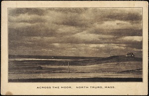
Truro, Massachusetts Historical Postcard Collection from the Truro Historical Society 1905-1986
425
Historical Society of Old Yarmouth Archives and Local History Collection
349
British Artists
330
Stereograph Collection
287
Bill Lane Photograph Collection
270
Arthur Griffin Photographs
256
more
Collection
»
Institution
Boston Public Library
3,042
Truro Historical Society, Cobb Archive
425
Historical Society of Old Yarmouth
383
Newburyport Public Library
270
Griffin Museum of Photography
256
Historical Society of Old Newbury
173
The Medford Historical Society & Museum
157
Phillips Library at the Peabody Essex Museum
142
more
Institution
»