Skip to search
Skip to main content
Skip to first result
Digital Commonwealth
Folders
Sign Up / Log In
Search for
Search
Search
Search
Basic
Advanced
Explore
Map
Collections
Institutions
Formats
For Educators
Primary Source Sets
Lesson Plans
Using Primary Sources
Searching Digital Commonwealth
For Institutions
Join Digital Commonwealth
Conferences, Trainings, & Events
How to Contribute Collections
Digitization Services
Board & Committees
Frequently Asked Questions
About
About Digital Commonwealth
News & Announcements
Copyright & Terms of Use
Harmful Content Statement
Partners
API
Contact Us
Search
Search Constraints
Start Over
Save Search
Your search:
More Like
commonwealth:gb19j458h
✖
Remove constraint More Like: commonwealth:gb19j458h
« Prev. |
1
-
20
of
7,529
|
Next »
Sort
by relevance
relevance
title
date (asc)
date (desc)
Number of results to display per page
20
per page
per page
10
per page
20
per page
50
per page
100
per page
View results as:
List
list view
Maps
map view
Gallery
grid view
Search Results
1.
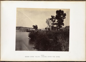
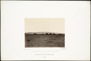
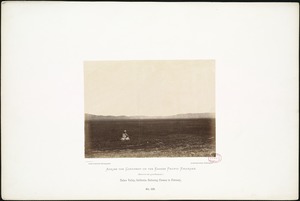
Green River Valley, looking down the river.
2.
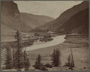
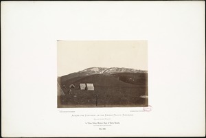
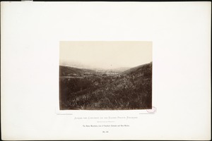
Valley of the Rio Grande at Wagon Wheel Gap
3.
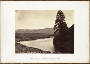
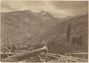
Weber Valley, from Willhelmina Pass.
4.
Banks of the Kaw, near Fort Riley, 135 miles west of Missouri River.
5.
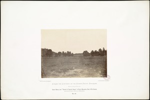
Canon Blanco, near "Summit of Spanish Range" of Rocky Mountains, East of Rio Grande, 6,917 feet above tide, 800 miles west of...
6.
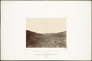
Entrance to Panoche Grande Pass, Coast Range from Tulare Valley, California, 1,850 miles west of Missouri River.
7.
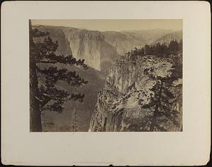
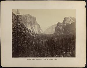
First view of Yosemite Valley from Mariposa Trail
8.
Head of the Tulare Valley, California, 1,740 miles from Missouri River.
9.
In the Valley of the Rio Grande, near Belin, New Mexico.
10.
In Tulare Valley, Western Slope of Sierra Nevada, 1,740 miles west of Missouri River.
11.
The Mount of the Holy Cross
12.
The Mount of the Holy Cross
13.
On the Rio Grande, between Albuquerque and Fort Craig.
14.
The Raton Mountains, Line of Southern Colorado and New Mexico.
15.
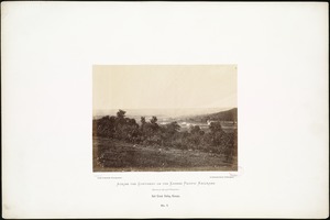
Salt Creek Valley, Kansas.
16.
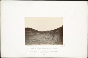
"Tijeras Canon," New Mexico, in the Great Organ Range descending westward to the Rio Grande, 850 miles west of Missouri River.
17.
Tulare Valley, California; gathering flowers in February,
18.
Up Yosemite Valley from Mariposa Trail
19.
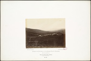
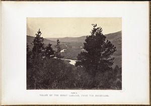
Valley of the Great Laramie, from the mountains.
20.
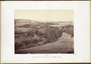
Valley of the Little Laramie River.
« Previous
Next »
1
2
3
4
5
…
376
377
Limit your search
Subject
Rivers
5,289
Fishing
1,115
Bridges
1,079
Boats
730
Cities & towns
717
Trees
487
Railroad tracks
473
Bodies of water
413
more
Subject
»
Place
North and Central America
5,503
United States
5,365
Massachusetts
3,398
Charles
742
Suffolk (county)
734
Essex (county)
686
Barnstable (county)
669
Boston
641
more
Place
»
Format
Photographs
5,095
Postcards/Cards
1,131
Prints
1,003
Documents
94
Paintings
68
Manuscripts
59
Drawings/Illustrations
49
Maps/Atlases
49
more
Format
»
Available to use
No known restrictions
3,688
Creative Commons license
1,265
Date
View distribution
Current results range from
1747
to
2016
Date range begin
Date range end
View larger »
Unknown
198
Collection
Tichnor Brothers Postcard Collection
753
Project DOCUMERICA Photographs by Ernst Halberstadt
633
Photographs of the American West
570
Stereograph Collection
454
Historical Society of Old Yarmouth Archives and Local History Collection
372
British Artists
357
Arthur Griffin Photographs
332
American Artists
320
more
Collection
»
Institution
Boston Public Library
4,524
Historical Society of Old Yarmouth
416
Griffin Museum of Photography
332
Newburyport Public Library
318
Historical Society of Old Newbury
189
Provincetown History Preservation Project
189
The Medford Historical Society & Museum
164
Phillips Library at the Peabody Essex Museum
157
more
Institution
»