Skip to search
Skip to main content
Skip to first result
Digital Commonwealth
Folders
Sign Up / Log In
Search for
Search
Search
Search
Basic
Advanced
Explore
Map
Collections
Institutions
Formats
For Educators
Primary Source Sets
Lesson Plans
Using Primary Sources
Searching Digital Commonwealth
For Institutions
Join Digital Commonwealth
Conferences, Trainings, & Events
How to Contribute Collections
Digitization Services
Board & Committees
Frequently Asked Questions
About
About Digital Commonwealth
News & Announcements
Copyright & Terms of Use
Harmful Content Statement
Partners
API
Contact Us
Search
Search Constraints
Start Over
Save Search
Your search:
More Like
commonwealth:dz0110493
✖
Remove constraint More Like: commonwealth:dz0110493
« Prev.
|
161
-
180
of
227
|
Next »
Sort
by relevance
relevance
title
date (asc)
date (desc)
Number of results to display per page
20
per page
per page
10
per page
20
per page
50
per page
100
per page
View results as:
List
list view
Maps
map view
Gallery
grid view
Search Results
161.
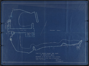
Plan of wharf, upland and flats at Rockport, Mass.
162.
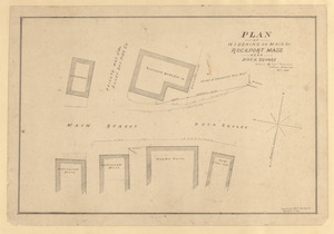
Plan of widening on Main St., Rockport, Mass., near Dock Square
163.
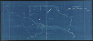
Plan of woodland at Cape Pond, Rockport, Mass.
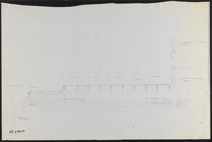
164.
Plan showing details for the construction of a bulkhead at Long Beach, Rockport, Mass., to be built by the Town of Rockport
165.
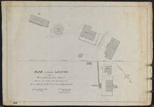
Plan showing location of buildings at Long Beach and the division line between the City of Gloucester and Town of Rockport
166.
Plan showing lots on Saratoga Heights at Rockport, Mass.
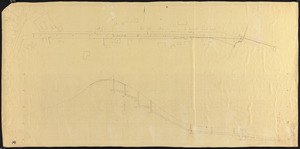
167.
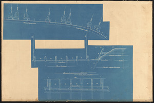
Plan showing profile, cross section and method of construction of work
168.
Plan showing proposed location 8" water main from Thatcher Road to Long Beach, Rockport, Mass.
169.
Plan showing proposed route for power line easement, Rockport, Mass., from Squam Hill Road to J. Leonard Johnson Quarries
170.
Plan showing proposed route for power line easement, Rockport, Mass., from Squam Hill Road to J. Leonard Johnson Quarries
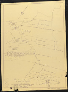
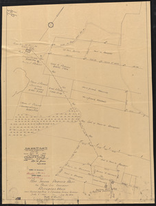
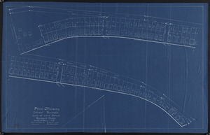
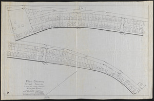
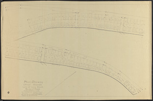
171.
Plan showing street bounds, lots at Long Beach, Rockport, Mass.
172.
Plan showing street bounds, lots at Long Beach, Rockport, Mass.
173.
Plan showing street bounds lots at Long Beach, Rockport, Mass.
174.
Plan with High St. and Main St.
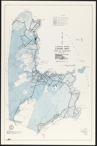
175.
Planning board zoning map, Town of Rockport
176.
Planting plan - high school
177.
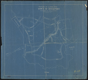
Portion of Lands End, Town of Rockport
178.
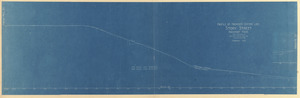
Profile on proposed center line, Story Street, Rockport, Mass.
179.
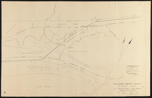
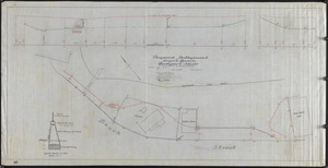
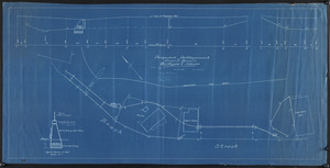
Proposed development of Front Beach, Rockport, Mass. : Recommended by special committee
180.
Proposed development of Front Beach, Rockport, Mass. : Recommended by special committee
« Previous
Next »
1
2
…
5
6
7
8
9
10
11
12
Limit your search
Subject
Streets
76
Sewers
7
Beaches
6
Parks
6
Retaining walls
6
Piers & wharves
4
Land use
3
Bays (Bodies of water)
2
more
Subject
»
Place
Essex (county)
227
Massachusetts
227
North and Central America
227
United States
227
Rockport
186
Pigeon Cove
20
Pool Hill
7
Gloucester
4
more
Place
»
Format
Maps/Atlases
219
Manuscripts
100
Prints
5
Documents
1
Drawings/Illustrations
1
Photographs
1
Available to use
No known restrictions
227
Date
View distribution
Current results range from
1823
to
1974
Date range begin
Date range end
View larger »
Collection
Rockport Town Clerk, Street, Roads and Maps
227
Institution
Town of Rockport
227