Skip to search
Skip to main content
Skip to first result
Digital Commonwealth
Folders
Sign Up / Log In
Search for
Search
Search
Search
Basic
Advanced
Explore
Map
Collections
Institutions
Formats
For Educators
Primary Source Sets
Lesson Plans
Using Primary Sources
Searching Digital Commonwealth
For Institutions
Join Digital Commonwealth
Conferences, Trainings, & Events
How to Contribute Collections
Digitization Services
Board & Committees
Frequently Asked Questions
About
About Digital Commonwealth
News & Announcements
Copyright & Terms of Use
Harmful Content Statement
Partners
API
Contact Us
Search
Search Constraints
Start Over
Save Search
Your search:
More Like
commonwealth:dz0110493
✖
Remove constraint More Like: commonwealth:dz0110493
« Prev.
|
201
-
220
of
227
|
Next »
Sort
by relevance
relevance
title
date (asc)
date (desc)
Number of results to display per page
20
per page
per page
10
per page
20
per page
50
per page
100
per page
View results as:
List
list view
Maps
map view
Gallery
grid view
Search Results
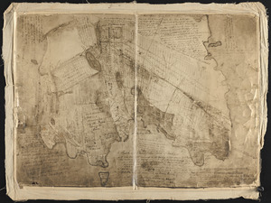
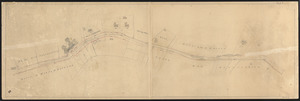
201.
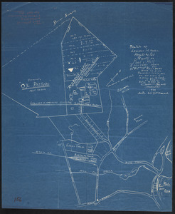
A sketch of a plan of the Town of Rockport as it was laid out previous to its being settled
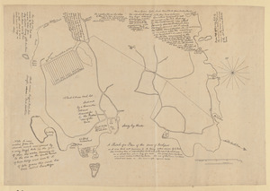
202.
A sketch of a plan of the Town of Rockport as it was laid out previous to its being settled
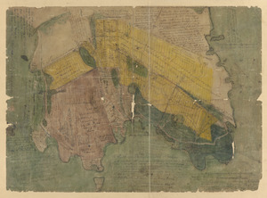
203.
A sketch of a plan of the Town of Rockport as it was laid out previous to its being settled
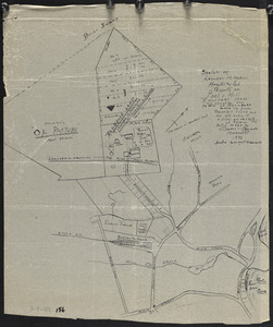
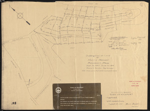
204.
Sketch of Leander M. Haskins Hospital and park property on Pools Hill, Rockport, Mass., now owned by the Town of Rockport :...
205.
Sketch of Leander M. Haskins Hospital and park property on Pools Hill, Rockport, Mass., now owned by the Town of Rockport :...
206.
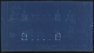
Sketch of proposed field house & bleechers, Evans Field, Town of Rockport, Mass.
207.
Sketch showing suggested development for Pool Hill area, Rockport
208.
Sketch showing suggested development for Pool Hill area, Rockport
209.
South End at Turk's Head
210.
Steep Bank Landing
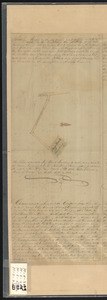
211.
Subdivision of land of Morris Massell, Rockport, Mass.
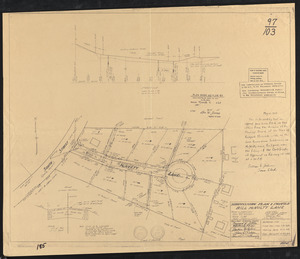
212.
Subdivision plan & profile Bill McNulty Lane
213.
Survey of Back Beach
214.
Survey of Long Cove Landing at Sandy Bay by order of the Town of Gloucester
215.
Survey of the School House Beach
216.
Thatcher Rd., Rockport
217.
Topographical plan, land belonging to Pingree Recreative Assoc., Pigeon Cove, Rockport, Mass.
218.
Topographical plan, land belonging to Pingree Recreative Assoc., Pigeon Cove, Rockport, Mass.
219.
Topographical plan, land belonging to Pingree Recreative Assoc., Pigeon Cove, Rockport, Mass.
220.
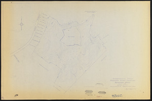
Topographical survey, proposed dump location, Rockport, Mass.
« Previous
Next »
1
2
…
7
8
9
10
11
12
Limit your search
Subject
Streets
76
Sewers
7
Beaches
6
Parks
6
Retaining walls
6
Piers & wharves
4
Land use
3
Bays (Bodies of water)
2
more
Subject
»
Place
Essex (county)
227
Massachusetts
227
North and Central America
227
United States
227
Rockport
186
Pigeon Cove
20
Pool Hill
7
Gloucester
4
more
Place
»
Format
Maps/Atlases
219
Manuscripts
100
Prints
5
Documents
1
Drawings/Illustrations
1
Photographs
1
Available to use
No known restrictions
227
Date
View distribution
Current results range from
1823
to
1974
Date range begin
Date range end
View larger »
Collection
Rockport Town Clerk, Street, Roads and Maps
227
Institution
Town of Rockport
227