Skip to search
Skip to main content
Skip to first result
Digital Commonwealth
Folders
Sign Up / Log In
Search for
Search
Search
Search
Basic
Advanced
Explore
Map
Collections
Institutions
Formats
For Educators
Primary Source Sets
Lesson Plans
Using Primary Sources
Searching Digital Commonwealth
For Institutions
Join Digital Commonwealth
Conferences, Trainings, & Events
How to Contribute Collections
Digitization Services
Board & Committees
Frequently Asked Questions
About
About Digital Commonwealth
News & Announcements
Copyright & Terms of Use
Harmful Content Statement
Partners
API
Contact Us
Search
Search Constraints
Start Over
Save Search
Your search:
More Like
commonwealth:dz011012f
✖
Remove constraint More Like: commonwealth:dz011012f
« Prev.
|
41
-
60
of
227
|
Next »
Sort
by relevance
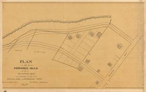
relevance
title
date (asc)
date (desc)
Number of results to display per page
20
per page
per page
10
per page
20
per page
50
per page
100
per page
View results as:
List
list view
Maps
map view
Gallery
grid view
Search Results
41.
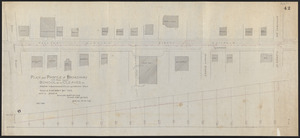
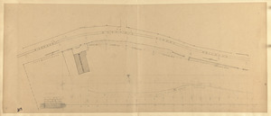
Plan and profile of Broadway from School St. to Cleaves St., showing locations and grade of proposed drain
42.
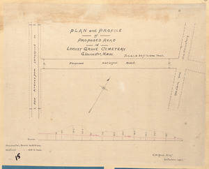
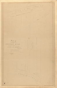
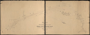
Plan and profile of proposed road in Locust Grove Cemetery, Gloucester, Mass.
43.
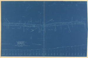
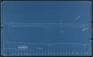
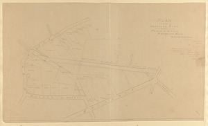
Plan and profile of proposed state highway in Rockport
44.
Plan and profile of proposed state highway in Rockport
45.
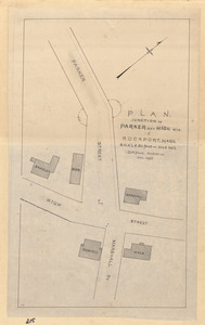
Plan, junction of Parker and High Sts. in Rockport, Mass.
46.
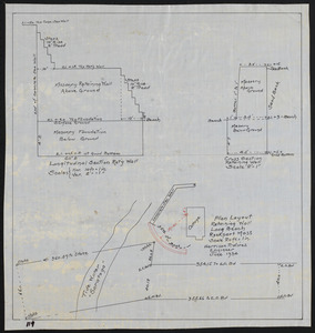
Plan layout retaining wall, Long Beach, Rockport, Mass.
47.
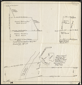
Plan layout retaining wall, Long Beach, Rockport, Mass.
48.
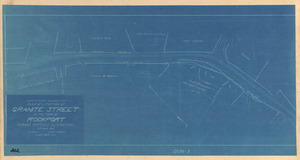
Plan of a portion of Granite Street in the town of Rockport showing proposed alterations
49.
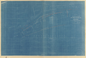
Plan of a portion of Mt. Pleasant St. in the Town of Rockport showing proposed alterations
50.
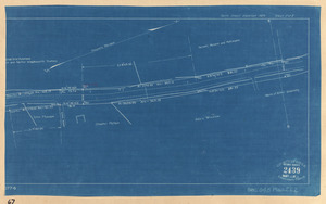
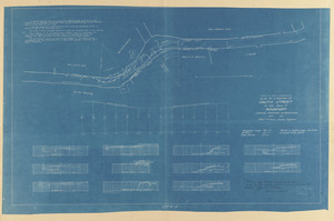
Plan of a portion of South Street from Thatcher's Road Northerly in the Town of Rockport as altered
51.
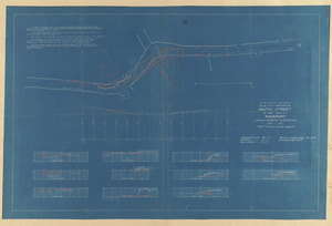
Plan of a portion of South Street in the Town of Rockport showing proposed alterations
52.
Plan of a portion of South Street in the Town of Rockport showing proposed alterations
53.
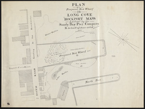
Plan of a proposed new wharf in Long Cove, Rockport, Mass., laid out by the Sandy Bay Pier Company
54.
Plan of a proposed road from King to North St., Rockport
55.
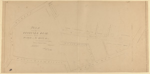
Plan of a proposed road from Main to High St., Rockport
56.
Plan of a proposed road from Main to High St., Rockport, Mass.
57.
Plan of a proposed road in Rockport, Mass. from the headland to Marmion Way
58.
Plan of a proposed town way Pigeon Cove, Rockport, Mass., as laid out by the Board of Selectmen
59.
Plan of a request of Electric Street Railroad
60.
Plan of a road, No. 1, Sandy Bay
« Previous
Next »
1
2
3
4
5
6
7
…
11
12
Limit your search
Subject
Streets
76
Sewers
7
Beaches
6
Parks
6
Retaining walls
6
Piers & wharves
4
Land use
3
Bays (Bodies of water)
2
more
Subject
»
Place
Essex (county)
227
Massachusetts
227
North and Central America
227
United States
227
Rockport
186
Pigeon Cove
20
Pool Hill
7
Gloucester
4
more
Place
»
Format
Maps/Atlases
219
Manuscripts
100
Prints
5
Documents
1
Drawings/Illustrations
1
Photographs
1
Available to use
No known restrictions
227
Date
View distribution
Current results range from
1823
to
1974
Date range begin
Date range end
View larger »
Collection
Rockport Town Clerk, Street, Roads and Maps
227
Institution
Town of Rockport
227