Skip to search
Skip to main content
Skip to first result
Digital Commonwealth
Folders
Sign Up / Log In
Search for
Search
Search
Search
Basic
Advanced
Explore
Map
Collections
Institutions
Formats
For Educators
Primary Source Sets
Lesson Plans
Using Primary Sources
Searching Digital Commonwealth
For Institutions
Join Digital Commonwealth
Conferences, Trainings, & Events
How to Contribute Collections
Digitization Services
Board & Committees
Frequently Asked Questions
About
About Digital Commonwealth
News & Announcements
Copyright & Terms of Use
Harmful Content Statement
Partners
API
Contact Us
Search
Search Constraints
Start Over
Save Search
Your search:
More Like
commonwealth:dz010x818
✖
Remove constraint More Like: commonwealth:dz010x818
« Prev.
|
1,001
-
1,017
of
1,017
| Next »
Sort
by relevance
relevance
title
date (asc)
date (desc)
Number of results to display per page
20
per page
per page
10
per page
20
per page
50
per page
100
per page
View results as:
List
list view
Maps
map view
Gallery
grid view
Search Results
1001.
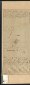
Steep Bank Landing
1002.
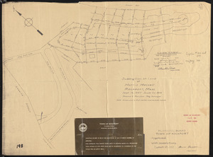
Subdivision of land of Morris Massell, Rockport, Mass.
1003.
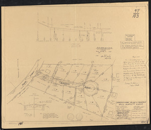
Subdivision plan & profile Bill McNulty Lane
1004.
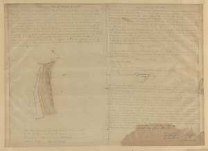
Survey of Back Beach
1005.
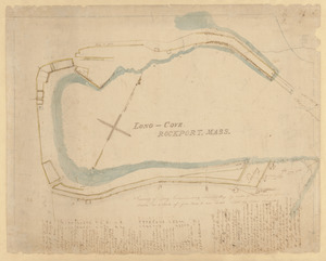
Survey of Long Cove Landing at Sandy Bay by order of the Town of Gloucester
1006.
Survey of the School House Beach
1007.
Thatcher Rd., Rockport
1008.
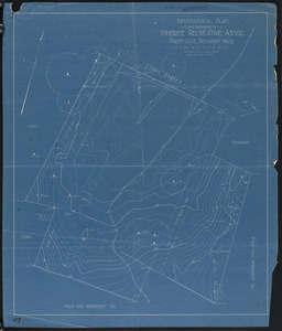
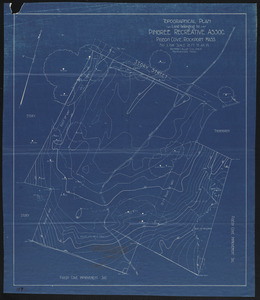
Topographical plan, land belonging to Pingree Recreative Assoc., Pigeon Cove, Rockport, Mass.
1009.
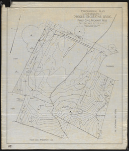
Topographical plan, land belonging to Pingree Recreative Assoc., Pigeon Cove, Rockport, Mass.
1010.
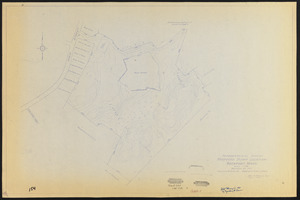
Topographical plan, land belonging to Pingree Recreative Assoc., Pigeon Cove, Rockport, Mass.
1011.
Topographical survey, proposed dump location, Rockport, Mass.
1012.
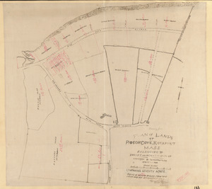
Tracing from plan of lands at Pigeon Cove, Rockport, Mass. belonging to David and Horatio Babson
1013.
Unidentified auditorium seat plan
1014.
Upland wharf and flats at Bearskin Neck, Rockport, Mass.
1015.
Worcester & Frost Land, South End
1016.
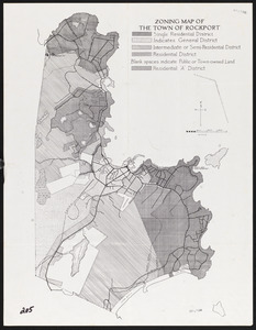
Zoning map of the Town of Rockport
1017.
Zoning map of the Town of Rockport
« Previous
Next »
1
2
…
47
48
49
50
51
Limit your search
Subject
Sewers
796
Streets
783
Construction
45
Tunnels
16
Bricks
14
Beaches
6
Parks
6
Retaining walls
6
more
Subject
»
Place
North and Central America
991
Massachusetts
990
United States
990
Essex (county)
953
Lawrence
710
Rockport
186
Middlesex (county)
29
Billerica
26
more
Place
»
Format
Maps/Atlases
922
Manuscripts
803
Photographs
77
Drawings/Illustrations
7
Prints
7
Letters/Correspondence
2
Documents
2
Available to use
No known restrictions
964
Creative Commons license
28
Date
View distribution
Current results range from
1756
to
1979
Date range begin
Date range end
View larger »
Collection
Lawrence, Mass. Engineering Department. City Sewers
710
Rockport Town Clerk, Street, Roads and Maps
227
Billerica, Massachusetts: History captured on glass
26
Edgar Sutton Dorr Photograph Collection
24
Bill Lane Photograph Collection
16
Leslie Jones Collection
4
Waban Historical Collection
2
Boston Bridge Works
1
more
Collection
»
Institution
Lawrence Public Library
711
Town of Rockport
227
Boston Public Library
30
Billerica Public Library
26
Newburyport Public Library
16
Newton Free Library
3
Holyoke Public Library
1
Needham Free Public Library
1
more
Institution
»