Search
Limit your search
- Streets9,794
- Hurricanes1,957
- Houses1,437
- Buildings1,408
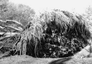
- Trees890
- Cities & towns838
- Sewers709
- Automobiles656
- North and Central America9,855
- United States9,715
- Massachusetts9,118
- Essex (county)3,726
- Suffolk (county)1,834
- Boston1,660
- Lawrence1,558
- Newburyport1,075
- Photographs9,052
- Maps/Atlases1,577
- Manuscripts1,531
- Postcards/Cards1,270
- Prints331
- Ephemera62
- Drawings/Illustrations43
- Albums/Scrapbooks30
- Bill Lane Photograph Collection952
- Boston Herald-Traveler Photo Morgue943
- Lawrence, Mass. Engineering Department. City Sewers720
- Lawrence, Mass. Engineering Department. City Streets667
- Arlington Historical Society Collection569
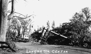
- Lancaster, Massachusetts Historical Image Collection425
- Samuel Chamberlain Photograph Negatives Collection, 1928-1971, undated415
- Boston Pictorial Archive (Collection of Distinction)361