Skip to search
Skip to main content
Skip to first result
Digital Commonwealth
Folders
Sign Up / Log In
Search for
Search
Search
Search
Basic
Advanced
Explore
Map
Collections
Institutions
Formats
For Educators
Primary Source Sets
Lesson Plans
Using Primary Sources
Searching Digital Commonwealth
For Institutions
Join Digital Commonwealth
Conferences, Trainings, & Events
How to Contribute Collections
Digitization Services
Board & Committees
Frequently Asked Questions
About
About Digital Commonwealth
News & Announcements
Copyright & Terms of Use
Harmful Content Statement
Partners
API
Contact Us
Search
Search Constraints
Start Over
Save Search
Your search:
More Like
commonwealth:70796j511
✖
Remove constraint More Like: commonwealth:70796j511
« Prev.
|
761
-
780
of
789
|
Next »
Sort
by relevance
relevance
title
date (asc)
date (desc)
Number of results to display per page
20
per page
per page
10
per page
20
per page
50
per page
100
per page
View results as:
List
list view
Maps
map view
Gallery
grid view
Search Results
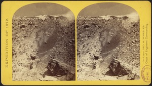
761.
View in the Grand Cañon of the Colorado River
762.
View near Fort Harker, Kansas, 216 miles west of Missouri River.
763.
View near head of Conejos River, Col.
764.
View of the Grand Cañon walls, near mouth of Diamond River
765.
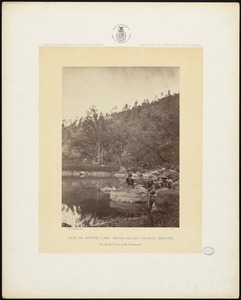
View on Apache Lake, Sierra Blanca Range, Arizona
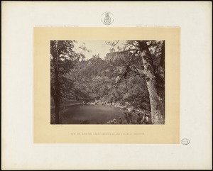
766.
View on Apache Lake, Sierra Blanca Range, Arizona
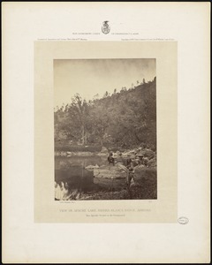
767.
View on Apache Lake, Sierra Blanca Range, Arizona. Two Apache scouts in the foreground
768.
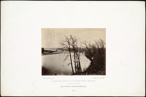
View on Kaw River, in Delaware Reservation, Kansas.
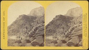
769.
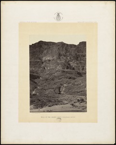
Wall in the Grand Cañon, Colorado River
770.
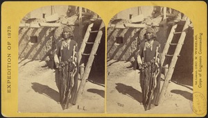
War Chief of the Zuni Indians
771.
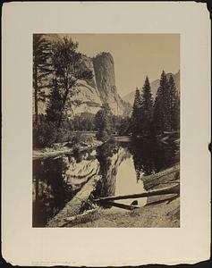
Washington Column, mirror view, Yosemite
772.
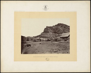
Water rhyolites, near Logan Springs, Nevada
773.
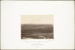
Waukerusa Valley, south from Lawrence, Kansas.
774.
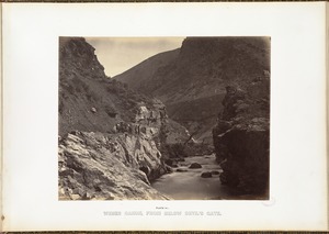
Weber Canon, from below Devil's Gate.
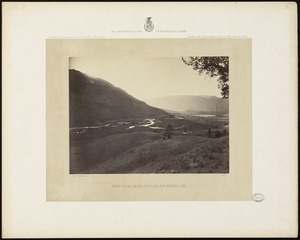
775.
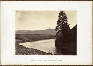
Weber Valley, from Willhelmina Pass.
776.
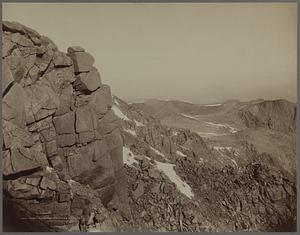
West from summit of Pikes Peak
777.
Western descent of the Sierra Nevada, in California, 1,730 miles from Missouri River.
778.
Western foot of Sierra Nevada at Tehachapa Pass, California, 1,730 miles west of Missouri River.
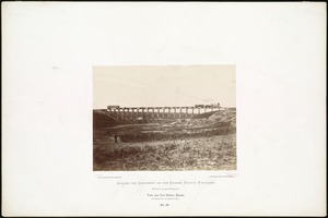
779.
"Westward the Course of Empire takes it Way." Laying track, 300 miles west of Missouri River, 19th October, 1867.
780.
Willhelmina Pass, from the east.
« Previous
Next »
1
2
…
35
36
37
38
39
40
Limit your search
Subject
Indians of North America
334
Indigenous peoples
140
Trans-Mississippi and International Exposition (1898 : Omaha, Neb.)
113
Mountains
80
Union Pacific Railroad Company
50
Rivers
45
Rock formations
32
Trees
31
more
Subject
»
Place
North and Central America
541
United States
496
Massachusetts
103
Arizona
76
California
75
Colorado
60
New Mexico
56
Western United States
50
more
Place
»
Format
Photographs
740
Prints
20
Objects/Artifacts
7
Books
6
Ephemera
5
Documents
4
Manuscripts
4
Paintings
4
more
Format
»
Available to use
No known restrictions
599
Creative Commons license
17
Date
View distribution
Current results range from
1765
to
2019
Date range begin
Date range end
View larger »
Unknown
2
Collection
Photographs of the American West
570
Leslie Jones Collection
96
Stereograph Collection
56
Arthur Griffin Photographs
36
Plymouth Tercentenary Photographs
9
Social and Political Cartoons
9
Art and Artifacts Collection
7
Boston Children’s Museum Lantern Slides
6
more
Collection
»
Institution
Boston Public Library
685
Griffin Museum of Photography
36
Historical Society of Old Yarmouth
9
Plymouth Public Library
9
Nahant Public Library
7
Boston Children's Museum
6
Amherst College Archives & Special Collections
5
Arlington Historical Society
4
more
Institution
»