Skip to search
Skip to main content
Skip to first result
Digital Commonwealth
Folders
Sign Up / Log In
Search for
Search
Search
Search
Basic
Advanced
Explore
Map
Collections
Institutions
Formats
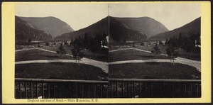
For Educators
Primary Source Sets
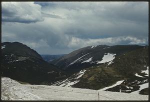
Lesson Plans
Using Primary Sources
Searching Digital Commonwealth
For Institutions
Join Digital Commonwealth
Conferences, Trainings, & Events
How to Contribute Collections
Digitization Services
Board & Committees
Frequently Asked Questions
About
About Digital Commonwealth
News & Announcements
Copyright & Terms of Use
Harmful Content Statement
Partners
API
Contact Us
Search
Search Constraints
Start Over
Save Search
Your search:
More Like
commonwealth:70796g314
✖
Remove constraint More Like: commonwealth:70796g314
« Prev. |
1
-
20
of
2,331
|
Next »
Sort
by relevance
relevance
title
date (asc)
date (desc)
Number of results to display per page
20
per page
per page
10
per page
20
per page
50
per page
100
per page
View results as:
List
list view
Maps
map view
Gallery
grid view
Search Results
1.
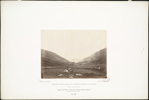
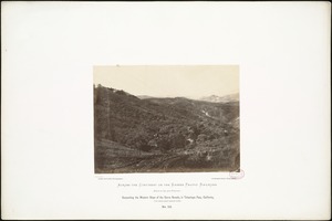
Canada de las Uvas, or Tejon Pass in Sierra Nevada, California, 1,690 miles west of Missouri River.
2.
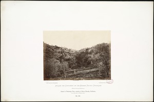
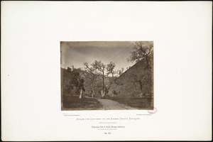
Canon in Tehachapa Pass, crossing of Sierra Nevada, California, 1,712 miles west of Missouri River.
3.
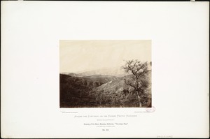
Crossing of the Sierra Nevadas, California; "Tehachapa Pass," 1,720 miles west of Missouri River.
4.
Crossing of the Sierras at Tehachapa Pass, California,
5.
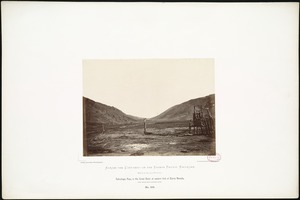
Decesending the Western Slope of the Sierra Nevada, in Tehachapa Pass, California, 1,710 miles from Missouri River.
6.
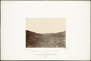
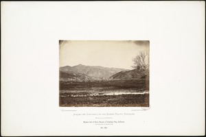
Entrance to Panoche Grande Pass, Coast Range from Tulare Valley, California, 1,850 miles west of Missouri River.
7.
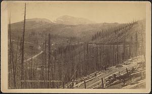
Marshall Pass and Mt. Ouray
8.
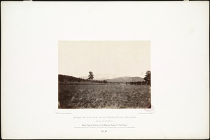
Mount Agassiz, Arizona, on the Mogoyon Range, in "Tonto Pass," near highest summit of the line, which is 7,510 feet above tide;...
9.
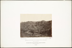
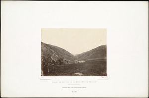
Near Dunlap's Ranche, crossing of Sierra Nevada at Tehachapa Pass, California, 1,720 miles west of Missouri River.
10.
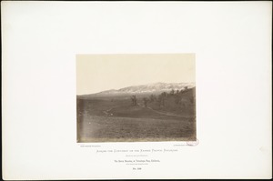
The Sierra Nevadas, at Tehachapa Pass, California, 1,700 miles from Missouri River.
11.
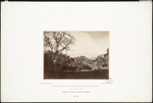
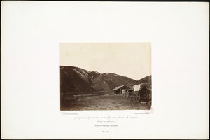
Sinks of Tehachapa, California.
12.
Tehachapa Pass in Sierra Nevada, California. 1,730 miles west of Missouri River.
13.
Tehachapa Pass, in the Great Basin at eastern foot of Sierra Nevada, 1,690 miles from Missouri River.
14.
Tehachapa Pass, in the Sierra Nevada, California.
15.
Western foot of Sierra Nevada at Tehachapa Pass, California, 1,730 miles west of Missouri River.
16.
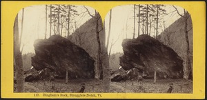
Bingham's Rock, Smugglers Notch, Vt.
17.
Elephant and gate of notch - White Mountains, N. H.
18.
Entrance from the north to Stony Clove Notch
19.
Fall River Pass, Colorado
20.
Fall River Pass, Colorado
« Previous
Next »
1
2
3
4
5
…
116
117
Limit your search
Subject
Mountains
1,810
Lakes & ponds
256
Rivers
190
Trees
176
Indians of North America
123
Cities & towns
118
Trans-Mississippi and International Exposition (1898 : Omaha, Neb.)
113
Roads
95
more
Subject
»
Place
North and Central America
1,635
United States
1,490
Europe
275
New Hampshire
265
California
203
Colorado
153
Massachusetts
119
Mariposa (county)
118
more
Place
»
Format
Photographs
1,418
Postcards/Cards
541
Prints
383
Posters
42
Ephemera
29
Albums/Scrapbooks
19
Manuscripts
15
Paintings
11
more
Format
»
Available to use
No known restrictions
1,838
Creative Commons license
252
Date
View distribution
Current results range from
1794
to
2012
Date range begin
Date range end
View larger »
Unknown
6
Collection
Photographs of the American West
570
Tichnor Brothers Postcard Collection
478
Stereograph Collection
352
Louis Prang & Company Chromolithographs
177
Edmund L. Mitchell Collection
157
Nicholas Catsimpoolas Collection
79
British Artists
75
Arthur Griffin Photographs
59
more
Collection
»
Institution
Boston Public Library
2,020
Griffin Museum of Photography
59
The Trustees of Reservations, Archives & Research Center
50
Lenox Library Association
45
Phillips Library at the Peabody Essex Museum
43
The Medford Historical Society & Museum
29
Holyoke Community College
13
Williams College
10
more
Institution
»