Skip to search
Skip to main content
Skip to first result
Digital Commonwealth
Folders
Sign Up / Log In
Search for
Search
Search
Search
Basic
Advanced
Explore
Map
Collections
Institutions
Formats
For Educators
Primary Source Sets
Lesson Plans
Using Primary Sources
Searching Digital Commonwealth
For Institutions
Join Digital Commonwealth
Conferences, Trainings, & Events
How to Contribute Collections
Digitization Services
Board & Committees
Frequently Asked Questions
About
About Digital Commonwealth
News & Announcements
Copyright & Terms of Use
Harmful Content Statement
Partners
API
Contact Us
Search
Search Constraints
Start Over
Save Search
Your search:
More Like
commonwealth:70796d21g
✖
Remove constraint More Like: commonwealth:70796d21g
« Prev. |
1
-
20
of
1,653
|
Next »
Sort
by relevance
relevance
title
date (asc)
date (desc)
Number of results to display per page
20
per page
per page
10
per page
20
per page
50
per page
100
per page
View results as:
List
list view
Maps
map view
Gallery
grid view
Search Results
1.
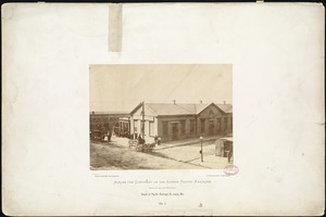
Depot of Pacific Railroad, St. Louis, Mo.
2.
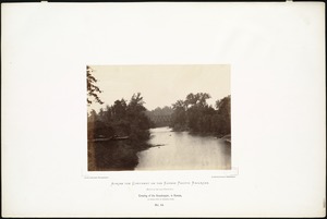
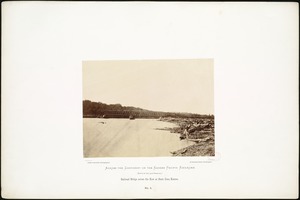
Banks of the Kaw, near Fort Riley, 135 miles west of Missouri River.
3.
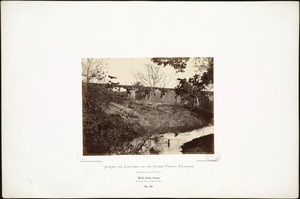
Crossing of the Grasshopper, in Kansas, 50 miles west of Missouri River.
4.
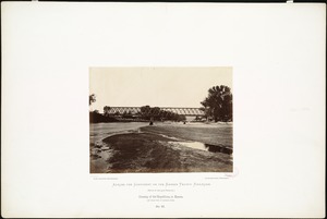
Crossing of the Republican, in Kansas, 136 miles west of Missouri River.
5.
Muddy Creek, Kansas, 162 miles west of Missouri River.
6.
On the Great Plains, Kansas, September, 1867, 296 miles west of Missouri River.
7.
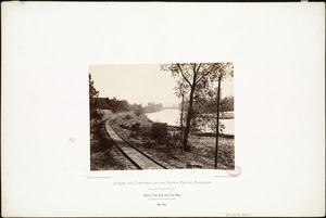
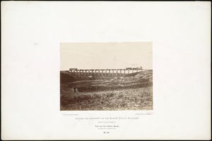
Railroad Bridge across the Kaw at state line, Kansas.
8.
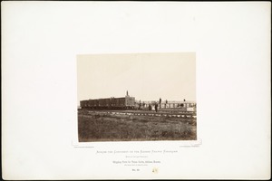
Shipping Point for Texan Cattle, Abilene, Kansas, 162 miles west of Missouri River.
9.
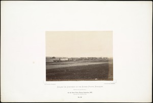
View near Fort Harker, Kansas, 216 miles west of Missouri River.
10.
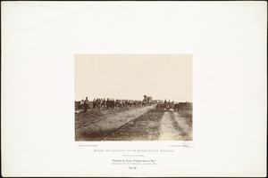
"Westward the Course of Empire takes it Way." Laying track, 300 miles west of Missouri River, 19th October, 1867.
11.
Andover Street, Lawrence, 1965
12.
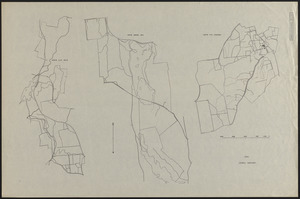
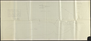
Base Map of Prospect Hill, Tom Swamp, and Slab City Tracts
13.
Beirne B. Brues Property Deeded to President and Fellows of Harvard College – Tall Timbers
14.
Bound Brook-division between Plymouth and Massachusetts colonies
15.
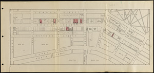
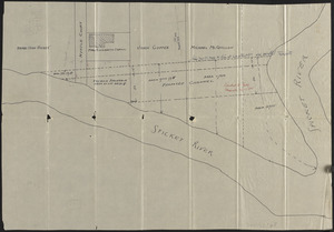
Braodway to Jackson Sts., Common to Canal Sts.
16.
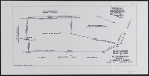
Clarence C. Harris Land
17.
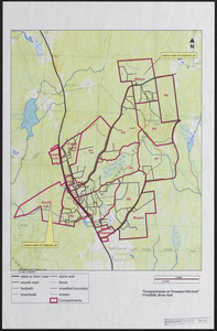
Compartments on Prospect Hill - 2008
18.
Document and plan Myrtle St. 1885
19.
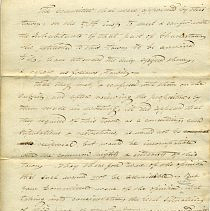
Documents
20.
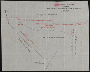
Exchange of land between Mrs. Phebe C. Brigham & City of Lawrence
« Previous
Next »
1
2
3
4
5
…
82
83
Limit your search
Subject
Railroad stations
878
Boundaries
206
Indians of North America
123
Trans-Mississippi and International Exposition (1898 : Omaha, Neb.)
113
Mountains
87
Railroads
85
Rivers
65
Streets
62
more
Subject
»
Place
North and Central America
1,377
United States
1,329
Massachusetts
702
Worcester (county)
172
Petersham
143
Suffolk (county)
121
Boston
120
Essex (county)
118
more
Place
»
Format
Photographs
1,118
Postcards/Cards
187
Maps/Atlases
182
Drawings/Illustrations
99
Manuscripts
52
Prints
47
Ephemera
14
Albums/Scrapbooks
6
more
Format
»
Available to use
No known restrictions
956
Creative Commons license
371
Date
View distribution
Current results range from
1687
to
2016
Date range begin
Date range end
View larger »
Unknown
46
Collection
Photographs of the American West
570
The Harvard Forest Map Collection
151
Peabody & Stearns Architectural Records
97
Stereograph Collection
94
Tichnor Brothers Postcard Collection
83
Leslie Jones Collection
75
Parker Collection
45
Boston Pictorial Archive (Collection of Distinction)
44
more
Collection
»
Institution
Boston Public Library
1,016
Harvard University
151
Thomas Crane Public Library
51
Newton Free Library
38
Lawrence Public Library
35
Hamilton Historical Society
30
Fall River Public Library
26
Lucius Beebe Memorial Library
26
more
Institution
»