Search
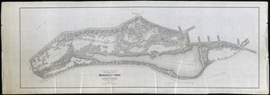
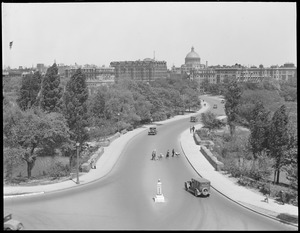
![Planning Study for Northern Portion [pi]/; Scale 40' = 1" [r]](https://bpldcassets.blob.core.windows.net/derivatives/images/commonwealth:rf55zj12s/image_thumbnail_300.jpg)
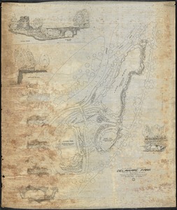
![Topo[pi]/ x Section 14-28[v]/ Audubon Park[v]](https://bpldcassets.blob.core.windows.net/derivatives/images/commonwealth:rf55zj14b/image_thumbnail_300.jpg)
Limit your search
- Rivers5,224
- Bridges1,069
- Cities & towns791
- Boats589
- Houses558
- Trees473
- Public Library of Brookline385
- Public libraries366
- North and Central America5,839
- United States5,745
- Massachusetts4,497
- Norfolk (county)1,895
- Brookline1,755
- Charles740
- Suffolk (county)608
- Essex (county)603
- Brookline Photograph Collection2,092
- Project DOCUMERICA Photographs by Ernst Halberstadt609
- Tichnor Brothers Postcard Collection543
- Historical Society of Old Yarmouth Archives and Local History Collection349
- British Artists330
- Stereograph Collection287
- Bill Lane Photograph Collection270
- Arthur Griffin Photographs256