Skip to search
Skip to main content
Skip to first result
Digital Commonwealth
Folders
Sign Up / Log In
Search for
Search
Search
Search
Basic
Advanced
Explore
Map
Collections
Institutions
Formats
For Educators
Primary Source Sets
Lesson Plans
Using Primary Sources
Searching Digital Commonwealth
For Institutions
Join Digital Commonwealth
Conferences, Trainings, & Events
How to Contribute Collections
Digitization Services
Board & Committees
Frequently Asked Questions
About
About Digital Commonwealth
News & Announcements
Copyright & Terms of Use
Harmful Content Statement
Partners
API
Contact Us
Search
Search Constraints
Start Over
Save Search
Your search:
More Like
commonwealth:3j3337393
✖
Remove constraint More Like: commonwealth:3j3337393
« Prev.
|
61
-
80
of
132
|
Next »
Sort
by relevance
relevance
title
date (asc)
date (desc)
Number of results to display per page
20
per page
per page
10
per page
20
per page
50
per page
100
per page
View results as:
List
list view
Maps
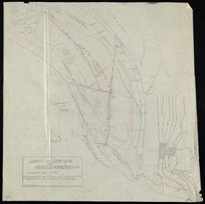
map view
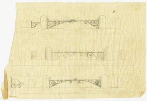
Gallery
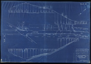
grid view
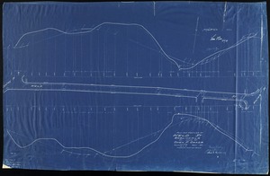
Search Results
61.
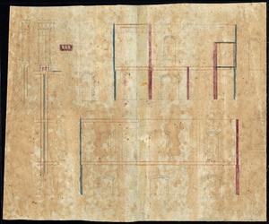
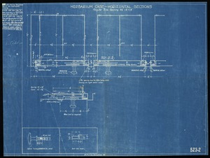
Herbarium case- horizontal sections
62.
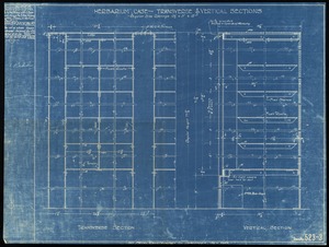
Herbarium case- transverse & vertical sections
63.
[Herbarium cases] finish front and both ends
64.
Laboratory doors, transverse brick wall, greenhouse door, rear chimnies, lecture room, brick wall
65.
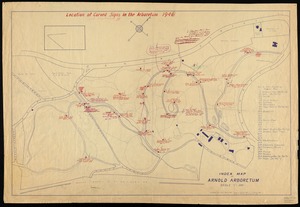
Location of carved signs in the Arboretum
66.
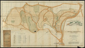
Map of Arnold Arboretum showing location of the trees and shrubs
67.
Map of Arnold Arboretum showing location of the trees and shrubs
68.
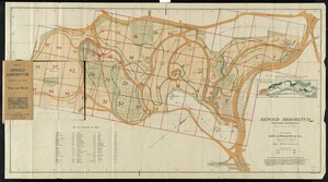
Map of Arnold Arboretum with routes from steam and electric car lines
69.
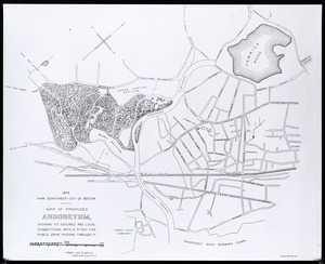
Map of proposed arboretum, showing its outline and local connections
70.
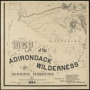
Map of the Adirondack Wilderness and adjoining territory
71.
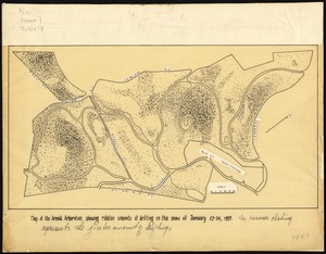
Map of the Arnold Arboretum showing relative amount of drifting in the snow ...
72.
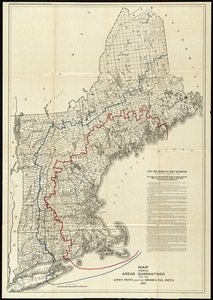
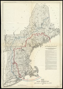
Map showing areas quarantined for the gipsy moth and the brown-tail moth, 1914.
73.
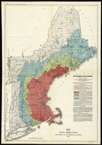
Map showing areas quarantined for the gipsy moth and the brown-tail moth, 1915.
74.
Map showing areas quarantined for the gipsy moth and the brown-tail moth, 1916.
75.
Maps relating to 1090 Centre street
76.
Mass. state project No. H64-IT: new public health laboratory building
77.
North corner of Arnold Arboretum
78.
Pencil drawings for gate
79.
Plan and profile showing the relocation, widening and established grade of Centre St. West Roxbury from Church St. to the Arborway
80.
Plan and profiles of Weld St., Roslindale on land of Owen F. Oakes
« Previous
Next »
1
2
3
4
5
6
7
Limit your search
Subject
Arnold Arboretum
74
Bussey Institution
19
Temperature
6
Storage furniture
4
Animal migration
3
Moths
3
Bird, Robert C.
2
Gates
2
more
Subject
»
Place
North and Central America
109
United States
104
Boston
98
Massachusetts
98
Suffolk (county)
98
Jamaica Plain
65
West Roxbury
20
New England
3
more
Place
»
Format
Maps/Atlases
93
Drawings/Illustrations
37
Objects/Artifacts
2
Date
View distribution
Current results range from
1840
to
2012
Date range begin
Date range end
View larger »
Unknown
1
Collection
Arnold Arboretum Maps and Plans
130
Bird Collection
2
Institution
Arnold Arboretum Horticultural Library
130
Arlington Historical Society
2
![[Herbarium cases] finish front and both ends](https://bpldcassets.blob.core.windows.net/derivatives/images/commonwealth:3j3334300/image_thumbnail_300.jpg)