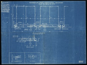
Skip to search
Skip to main content
Skip to first result
Digital Commonwealth
Folders
Sign Up / Log In
Search for
Search
Search
Search
Basic
Advanced
Explore
Map
Collections
Institutions
Formats
For Educators
Primary Source Sets
Lesson Plans
Using Primary Sources
Searching Digital Commonwealth
For Institutions
Join Digital Commonwealth
Conferences, Trainings, & Events
How to Contribute Collections
Digitization Services
Board & Committees
Frequently Asked Questions
About
About Digital Commonwealth
News & Announcements
Copyright & Terms of Use
Harmful Content Statement
Partners
API
Contact Us
Search
Search Constraints
Start Over
Save Search
Your search:
More Like
commonwealth:3j333424v
✖
Remove constraint More Like: commonwealth:3j333424v
« Prev.
|
41
-
60
of
138
|
Next »
Sort
by date (desc)
relevance
title
date (asc)
date (desc)
Number of results to display per page
20
per page
per page
10
per page
20
per page
50
per page
100
per page
View results as:
List
list view
Maps
map view
Gallery
grid view
Search Results
41.
Shaker shoemakers bench
42.
Plan of the Harvard Botanical garden-Atkins Institution of the Arnold Arboretum: Soledad, Cienfuegos, Cuba
43.
Plan of the Harvard Botanical garden-Atkins Institution of the Arnold Arboretum: Soledad, Cienfuegos, Cuba
44.
[Herbarium cases] finish front and both ends
45.
Proposed Herbarium cases, Arnold Arboretum
46.
Plan and profile showing the relocation, widening and established grade of Centre St. West Roxbury from Church St. to the Arborway
47.
Herbarium case- horizontal sections
48.
Map of Arnold Arboretum showing location of the trees and shrubs
49.
A sketch map to show the approximate location of proposed parkway on property of Arnold Arboretum
50.
Plan and profiles of Weld St., Roslindale on land of Owen F. Oakes
51.
Plan of land in West Roxbury- Mass.
52.
Bird's-eye view of Arnold Arboretum
53.
Map of Arnold Arboretum with routes from steam and electric car lines
54.
Plan of the Arnold Arboretum: list of genera
55.
Plan of land in Boston Mass.
56.
Profile of Bussey Brook
57.
Arnold Arboretum: topographical plan of land in Boston, Mass.
58.
Arnold Arboretum topographical plan of land
59.
Plot plan-Peters Hill-Arnold Arboretum: showing dwelling and proposed driveway and garage at 162 Walter St.
60.
Map showing areas quarantined for the gipsy moth and the brown-tail moth, 1916.
« Previous
Next »
1
2
3
4
5
6
7
Limit your search
Subject
Arnold Arboretum
74
Bussey Institution
19
Storage furniture
11
Temperature
5
Animal migration
3
Moths
3
Chests
2
Gates
2
more
Subject
»
Place
North and Central America
115
United States
109
Massachusetts
103
Boston
98
Suffolk (county)
98
Jamaica Plain
65
West Roxbury
20
North America
4
more
Place
»
Format
Maps/Atlases
94
Drawings/Illustrations
36
Photographs
7
Objects/Artifacts
1
Available to use
No known restrictions
3
Creative Commons license
1
Date
View distribution
Current results range from
1700
to
2012
Date range begin
Date range end
View larger »
Unknown
1
Collection
Arnold Arboretum Maps and Plans
130
Bill Lane Photograph Collection
2
Arlington Historical Society Collection
1
Frank Cousins Glass Plate Negatives Collection, 1890-1920
1
Lawrence History Center Photograph Collection
1
Photographs from Stevens-Coolidge Place Collection
1
The Massachusetts WPA Federal Art Project Photograph Collection
1
Watertown Arsenal Photographs
1
Institution
Arnold Arboretum Horticultural Library
130
Newburyport Public Library
2
Arlington Historical Society
1
Boston Public Library
1
Lawrence History Center
1
National Archives at Boston
1
Phillips Library at the Peabody Essex Museum
1
The Trustees of Reservations, Archives & Research Center
1