Skip to search
Skip to main content
Skip to first result
Digital Commonwealth
Folders
Sign Up / Log In
Search for
Search
Search
Search
Basic
Advanced
Explore
Map
Collections
Institutions
Formats
For Educators
Primary Source Sets
Lesson Plans
Using Primary Sources
Searching Digital Commonwealth
For Institutions
Join Digital Commonwealth
Conferences, Trainings, & Events
How to Contribute Collections
Digitization Services
Board & Committees
Frequently Asked Questions
About
About Digital Commonwealth
News & Announcements
Copyright & Terms of Use
Harmful Content Statement
Partners
API
Contact Us
Search
Search Constraints
Start Over
Save Search
Your search:
More Like
commonwealth:25152p40n
✖
Remove constraint More Like: commonwealth:25152p40n
« Prev.
|
121
-
140
of
726
|
Next »
Sort
by date (asc)
relevance
title
date (asc)
date (desc)
Number of results to display per page
20
per page
per page
10
per page
20
per page
50
per page
100
per page
View results as:
List
list view
Maps
map view
Gallery
grid view
Search Results
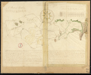
121.
Plan of Pembroke, surveyor's name not given, dated 1794-5.
122.
Plan of Penobscot surveyed by John Peters, dated 1794.
123.
Plan of Pepperellborough (Saco) surveyed by Daniel Grainger, dated 1794.
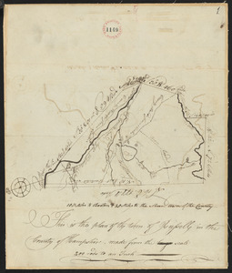
124.
Plan of Peru (Partridgefield), surveyor's name not given, dated 1794-5.
125.
Plan of Pittsfield surveyor's name not given, dated December 8, 1794.
126.
Plan of Plymouth, surveyor's name not given.
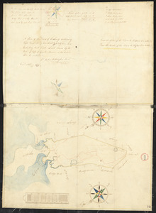
127.
Plan of Quincy surveyed by W French, dated 1794-5.
128.
Plan of Raynham, surveyor's name not given, dated 1794-5.
129.
Plan of Readfield, Washington Plantation and Belgrade (Mt. Vernon), made by J Prescott, dated 1794-5.
130.
Plan of Reading and Lynnfield, made by Daniel Needham, dated November 1794. Scale 200 rds to 1 in.
131.
Plan of Rehoboth, surveyor's name not given, dated 1794-5.
132.
Plan of Rochester, surveyor's name not given, dated 1794-5.
133.
Plan of Rowley surveyed by Joseph Chapin, dated December, 1794.
134.
Plan of Roxbury, made by Mather Withington, dated November 1794.
135.
Plan of Royalston, made by William Town, dated November 1794.
136.
Plan of Russell, surveyor's name not given, dated 1794.
137.
Plan of Salem, surveyor's name not given, dated 1794.
138.
Plan of Salisbury, surveyor's name not given, dated 1794-5.
139.
Plan of Sanford, ME, surveyor's name not given, dated 1794-5.
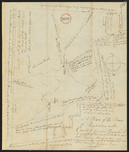
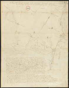
140.
Plan of Scituate, made by Charles Turner, dated 1794-5.
« Previous
Next »
1
2
3
4
5
6
7
8
9
10
11
…
36
37
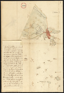
Limit your search
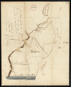
Place
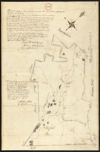
North and Central America
724
United States
723
Massachusetts
295
Maine
128
Worcester (county)
109
Middlesex (county)
77
Franklin (county)
61
Berkshire (county)
59
more
Place
»
Format
Maps/Atlases
726
Available to use
No known restrictions
726
Date
View distribution
Current results range from
1786
to
1898
Date range begin
Date range end
View larger »
Collection
Town plans, 1794
403
Town plans, 1830
323
Institution
Massachusetts Archives
726