Skip to search
Skip to main content
Skip to first result
Digital Commonwealth
Folders
Sign Up / Log In
Search for
Search
Search
Search
Basic
Advanced
Explore
Map
Collections
Institutions
Formats
For Educators
Primary Source Sets
Lesson Plans
Using Primary Sources
Searching Digital Commonwealth
For Institutions
Join Digital Commonwealth
Conferences, Trainings, & Events
How to Contribute Collections
Digitization Services
Board & Committees
Frequently Asked Questions
About
About Digital Commonwealth
News & Announcements
Copyright & Terms of Use
Harmful Content Statement
Partners
API
Contact Us
Search
Search Constraints
Start Over
Save Search
Your search:
More Like
commonwealth:25152p40n
✖
Remove constraint More Like: commonwealth:25152p40n
« Prev.
|
101
-
120
of
726
|
Next »
Sort
by date (asc)
relevance
title
date (asc)
date (desc)
Number of results to display per page
20
per page
per page
10
per page
20
per page
50
per page
100
per page
View results as:
List
list view
Maps
map view
Gallery
grid view
Search Results
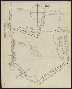
101.
Plan of Middlefield surveyor's name not given, dated 1794-5.
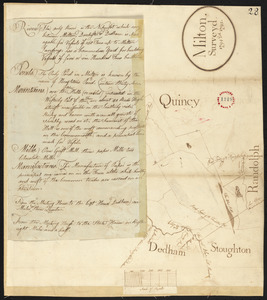
102.
Plan of Milton, surveyor's name not given, dated 1794-5.
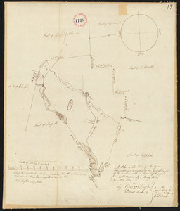
103.
Plan of Montague made by Elisha Root, dated November 1794.
104.
Plan of Montgomery, surveyor's name not given, dated November 1794.
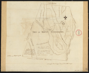
105.
Plan of Mt. Washington surveyed by David Fairchild, dated December, 1794.
106.
Plan of Needham surveyed by Jonathan Kingsbury, dated 1794.
107.
Plan of New Braintree, made by David Pratt, dated 1794.
108.
Plan of New Gloucester, surveyor's name not given, datd 1794.
109.
Plan of New Marlborough, surveyor's name not given, dated 1794-5.
110.
Plan of New Sharon surveyed by Ephraim Ballard, dated 1794-5.
111.
Plan of Newcastle surveyed by Thomas Boyd, dated December 24, 1794.
112.
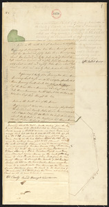
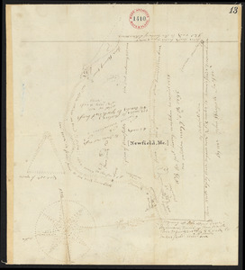
Plan of Newfield, surveyor's name not given, dated 1794-5.
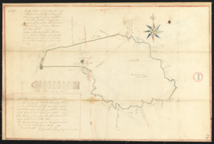
113.
Plan of Newton surveyed by Jonathan Kingsbury, dated 1794.
114.
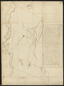
Plan of North Yarmouth surveyed by Asa Lewis, dated 1794-5.
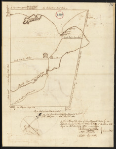
115.
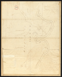
Plan of Northampton surveyed by J Denison, dated November, 1794.
116.
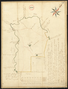
Plan of Norton surveyed by Silas Cobb, dated November, 1794.
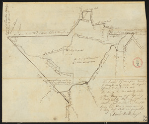
117.
Plan of Oakham, made by Daniel Walker, dated 1794-5.
118.
Plan of Otis (Loudon), surveyor's name not given, dated October 30, 1794.
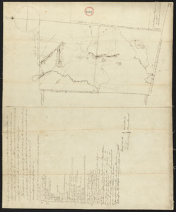
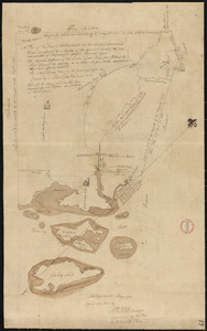
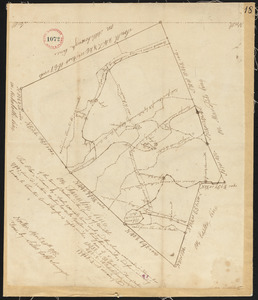
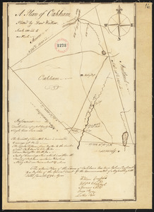
119.
Plan of Otisfield, made by Oliver Prescott, Jr., dated 1794-5, showing Shepard's Grant i.e. Phillips Gore.
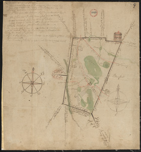
120.
Plan of Oxford made by Ebenezer Waters, dated November 1794.
« Previous
Next »
1
2
3
4
5
6
7
8
9
10
…
36
37
Limit your search
Place
North and Central America
724
United States
723
Massachusetts
295
Maine
128
Worcester (county)
109
Middlesex (county)
77
Franklin (county)
61
Berkshire (county)
59
more
Place
»
Format
Maps/Atlases
726
Available to use
No known restrictions
726
Date
View distribution
Current results range from
1786
to
1898
Date range begin
Date range end
View larger »
Collection
Town plans, 1794
403
Town plans, 1830
323
Institution
Massachusetts Archives
726