Skip to search
Skip to main content
Skip to first result
Digital Commonwealth
Folders
Sign Up / Log In
Search for
Search
Search
Search
Basic
Advanced
Explore
Map
Collections
Institutions
Formats
For Educators
Primary Source Sets
Lesson Plans
Using Primary Sources
Searching Digital Commonwealth
For Institutions
Join Digital Commonwealth
Conferences, Trainings, & Events
How to Contribute Collections
Digitization Services
Board & Committees
Frequently Asked Questions
About
About Digital Commonwealth
News & Announcements
Copyright & Terms of Use
Harmful Content Statement
Partners
API
Contact Us
Search
Search Constraints
Start Over
Save Search
Your search:
More Like
commonwealth:25152n463
✖
Remove constraint More Like: commonwealth:25152n463
« Prev.
|
641
-
660
of
726
|
Next »
Sort
by date (asc)
relevance
title
date (asc)
date (desc)
Number of results to display per page
20
per page
per page
10
per page
20
per page
50
per page
100
per page
View results as:
List
list view
Maps
map view
Gallery
grid view
Search Results
641.
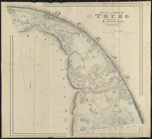
Plan of Truro made by John G. Hales, dated 1831
642.
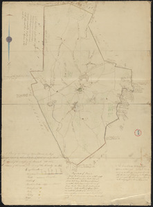
Plan of Upton made by Nahum W. Holbrook, dated 1831
643.
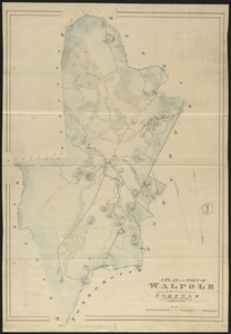
Plan of Walpole made by John G. Hales, dated 1831
644.
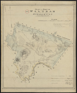
Plan of Waltham made by John G Hales, dated 1831
645.
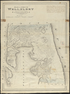
Plan of Wellfleet made by John G. Hales, dated 1831
646.
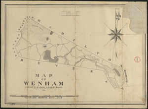
Plan of Wenham made by Philander Anderson, dated 1831
647.
Plan of West Stockbridge made by B. H. Lewis, dated 1831
648.
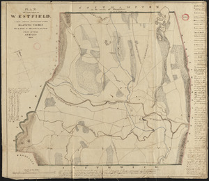
Plan of Westfield made by Allen, D. E., dated 1831
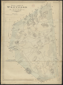
649.
Plan of Westford made by John G. Hales, dated 1831
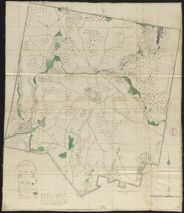
650.
Plan of Westhampton, surveyor's name not given, dated 1831
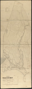
651.
Plan of Westport made by Silvanus Bourne dated 1831
652.
Plan of Winchendon made by Elias Whitney, dated January 1831
653.
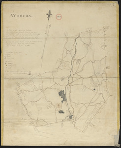
Plan of Woburn made by Bartholomew Richardson, dated 1831
654.
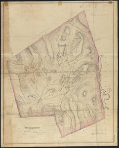
Plan of Worcester made by H. Stebbins, dated 1831
655.
Plan of Mt. Washington, surveyor's name not given, dated January 4, 1831
656.
Plan of Peru, surveyor's name not given, dated January 4, 1831
657.
Plan of Ward (Auburn) made by Hervey Peirce, dated February 1831
658.
Plan of Royalston made by Jonathan Blake, Jr., dated February 3, 1831
659.
Plan of Orange made by Jonathan Blake, Jr., dated February 15, 1831
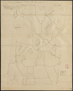
660.
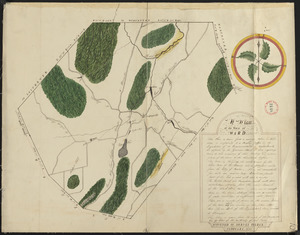
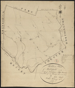
Plan of Middlefield made by Luke Barber, dated February 26, 1831
« Previous
Next »
1
2
…
29
30
31
32
33
34
35
36
37
Limit your search
Place
North and Central America
724
United States
723
Massachusetts
297
Maine
128
Worcester (county)
109
Middlesex (county)
77
Franklin (county)
61
Berkshire (county)
59
more
Place
»
Format
Maps/Atlases
726
Available to use
No known restrictions
726
Date
View distribution
Current results range from
1786
to
1898
Date range begin
Date range end
View larger »
Collection
Town plans, 1794
403
Town plans, 1830
323
Institution
Massachusetts Archives
726