Skip to search
Skip to main content
Skip to first result
Digital Commonwealth
Folders
Sign Up / Log In
Search for
Search
Search
Search
Basic
Advanced
Explore
Map
Collections
Institutions
Formats
For Educators
Primary Source Sets
Lesson Plans
Using Primary Sources
Searching Digital Commonwealth
For Institutions
Join Digital Commonwealth
Conferences, Trainings, & Events
How to Contribute Collections
Digitization Services
Board & Committees
Frequently Asked Questions
About
About Digital Commonwealth
News & Announcements
Copyright & Terms of Use
Harmful Content Statement
Partners
API
Contact Us
Search
Search Constraints
Start Over
Save Search
Your search:
More Like
commonwealth:25152n44j
✖
Remove constraint More Like: commonwealth:25152n44j
« Prev.
|
401
-
500
of
726
|
Next »
Sort
by relevance
relevance
title
date (asc)
date (desc)
Number of results to display per page
100
per page
per page
10
per page
20
per page
50
per page
100
per page
View results as:
List
list view
Maps
map view
Gallery
grid view
Search Results
401.
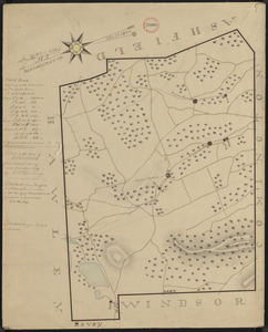
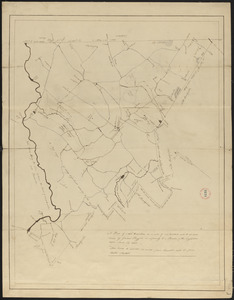
Plan of New Ashford made by Phinehas Harmon, dated October 1830
402.
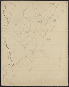
Plan of New Ashford surveyed by John Burchett, dated June 5, 1795.
403.
Plan of New Bedford surveyor's name not given, dated February 1795.
404.
Plan of New Braintree, made by David Pratt, dated 1794.
405.
Plan of New Braintree made by Gardner Ruggles, dated 1830
406.
Plan of New Braintree made by Gardner Ruggles, dated 1830
407.
Plan of New Gloucester, surveyor's name not given, datd 1794.
408.
Plan of New Marlborough made by Henry Wheeler, dated April 1831
409.
Plan of New Marlborough, surveyor's name not given, dated 1794-5.
410.
Plan of New Milford (Alna) surveyed by John T Foye, dated December 24, 1795.
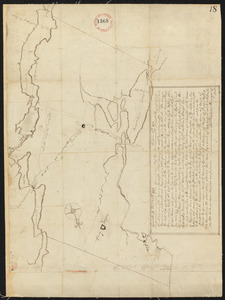
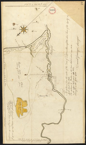
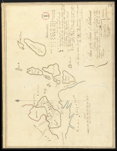
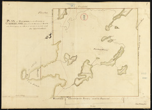
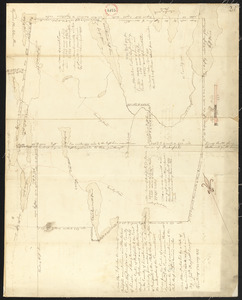
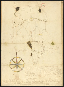
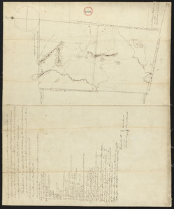
411.
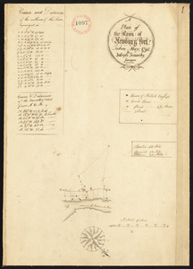
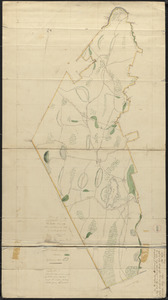
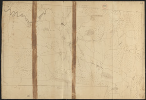
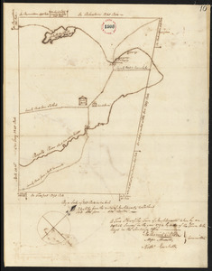
Plan of [New] Pennacook (Rumford) surveyed by Francis Keyes, dated December 26, 1795.
412.
Plan of New Salem, made by Joseph Metcalf, dated May 1795.
413.
Plan of New Salem, surveyor's name not given, dated June 1830
414.
Plan of New Sharon surveyed by Ephraim Ballard, dated 1794-5.
415.
Plan of New Vineyard, ME, surveyor's name not given, dated 1796
416.
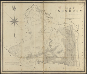
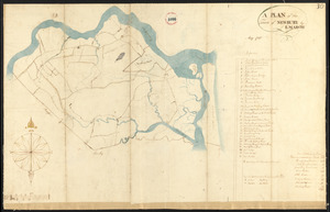
Plan of Newbury made by Philander Anderson, dated June, 1830
417.
Plan of Newbury surveyed by E. March, dated May 1795.
418.
Plan of Newburyport, made by Joseph Somerby, dated May 1795.
419.
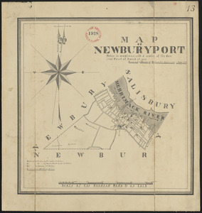
Plan of Newburyport made by Philander Anderson, dated May 1830
420.
Plan of Newcastle surveyed by Thomas Boyd, dated December 24, 1794.
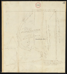
421.
Plan of Newfield, surveyor's name not given, dated 1794-5.
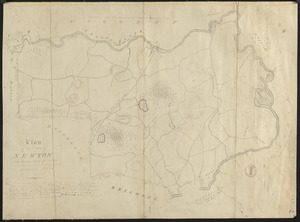
422.
Plan of Newton made by E. F. Woodward and W. F. Ward, dated 1831
423.
Plan of Newton surveyed by Jonathan Kingsbury, dated 1794.
424.
Plan of No Man's Land (Chilmark), surveyor's name not given, dated 1830
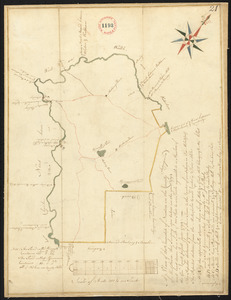
425.
Plan of No Town (Princeton), surveyor's name not given, dated 1838
426.
Plan of Nobleborough, made by Ephraim Robings, dated March 24, 1795.
427.
Plan of Norridgewock, made by Daniel Steward, dated March 2, 1795.
428.
Plan of North Brookfield made by Bonum Nye, dated 1830
429.
Plan of North Yarmouth surveyed by Asa Lewis, dated 1794-5.
430.
Plan of Northampton made by John G. Hales, dated 1831
431.
Plan of Northampton surveyed by J Denison, dated November, 1794.
432.
Plan of Northborough made by Gill Valentine, dated 1830
433.
Plan of Northborough surveyed by Silas Keyes, dated February 23, 1795.
434.
Plan of Northbridge made by Frederic Taft, dated November 1830
435.
Plan of Northbridge surveyed by Jonathan Adams and Amariah Preston, dated Mar. 2, 1795.
436.
Plan of Northfield made by Arthur W. Hoyt, dated 1830
437.
Plan of Northfield surveyed by Xenophon Janes,dated May 1795.
438.
Plan of Norton made by C. Leonard and E. Lincoln, dated October 1830
439.
Plan of Norton made by E. Lincoln and C. Leonard, dated October 1830
440.
Plan of Norton surveyed by Silas Cobb, dated November, 1794.
441.
Plan of Norway (Rustfield), surveyor's name not given, dated December 1795.
442.
Plan of Norwich (Huntington) made by Joseph Kirkland, dated 1831
443.
Plan of Oakham, made by Daniel Walker, dated 1794-5.
444.
Plan of Oakham made by James Allen, dated November 1830
445.
Plan of Orange made by Jonathan Blake, Jr., dated February 15, 1831
446.
Plan of Orange, surveyor's name not given, dated May 1795.
447.
Plan of Orrington surveyed by Levi Carter, dated April 28, 1795.
448.
Plan of Otis (Loudon), surveyor's name not given, dated October 30, 1794.
449.
Plan of Otis made by Luke Barber, dated Mar. 10, 1831
450.
Plan of Otisfield, made by Oliver Prescott, Jr., dated 1794-5, showing Shepard's Grant...
451.
Plan of Oxford made by Ebenezer Waters, dated November 1794.
452.
Plan of Oxford made by Sylvester McIntyre, dated April 1830
453.
Plan of Oxford surveyed by Nathaniel Chamberlin dated December 23, 1795.
454.
Plan of Palmer made by William Woods, dated 1830
455.
Plan of Palmer surveyed by Admatha Blodgett, dated May, 1795.
456.
Plan of Paris, surveyor's name not given, dated February 21, 1795.
457.
Plan of Parsonsfield, surveyor's name not given, dated May 10, 1795.
458.
Plan of Pawtucket made by Edward Wolcott, dated 1827
459.
Plan of Paxton surveyed by Ephraim Carruth, dated May 23, 1795.
460.
Plan of Paxton, surveyor's name not given, dated 1830
461.
Plan of Pelham made by Cook, Zeba, and John Parmenter, dated October, 1830
462.
Plan of Pelham, surveyors' name not given, dated 1795.
463.
Plan of Pembroke made by John G. Hales, dated 1831
464.
Plan of Pembroke, surveyor's name not given, dated 1794-5.
465.
Plan of Penobscot surveyed by John Peters, dated 1794.
466.
Plan of Pepperell made by Caleb Butler, dated 1830
467.
Plan of Pepperellborough (Saco) surveyed by Daniel Grainger, dated 1794.
468.
Plan of Peru (Partridgefield), surveyor's name not given, dated 1794-5.
469.
Plan of Peru, surveyor's name not given, dated January 4, 1831
470.
Plan of Petersham made by David Lee and Samuel Lee, dated November 30, 1830
471.
Plan of Petersham made by Jeremiah Robinson, dated May 1795.
472.
Plan of Phillipston made by Jason Lamb, dated November 1830
473.
Plan of Pittsfield, surveyor's name not given, dated 1831
474.
Plan of Pittsfield surveyor's name not given, dated December 8, 1794.
475.
Plan of Plainfield District, surveyor's name not given, dated May 20, 1795.
476.
Plan of Plainfield made by E. S. Darling, dated November, 1830
477.
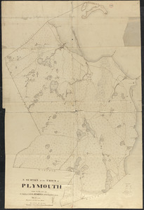
Plan of Plymouth made by S. Bourne, dated 1830
478.
Plan of Plymouth, surveyor's name not given.
479.
Plan of Plympton, surveyor's name not given, dated June 1, 1795.
480.
Plan of Poland (Bakerstown) surveyed by Osgood Carleton, dated 1792.
481.
Plan of Portland made by Peleg Wadsworth, dated May 1795.
482.
Plan of Pownalborough (Wiscasset, etc.) surveyed by John T Foye, dated May, 1795.
483.
Plan of Prescott made by E. S. Darling, dated October, 1830
484.
Plan of Princeton made by Amos Meriam, dated October 1830
485.
Plan of Princeton, surveyor's name not given, dated May 6, 1795.
486.
Plan of Prospect, ME, survyed by Robert Houston, dated May 1795.
487.
Plan of Provincetown, surveyor's name not given, dated 1831
488.
Plan of Provincetown, surveyor's name not given, dated May 11, 1795.
489.
Plan of Quincy made by John G. Hales, dated 1830
490.
Plan of Quincy surveyed by W French, dated 1794-5.
491.
Plan of Randolph made by Royal Turner, dated 1830
492.
Plan of Randolph, made by "Set Turner Junior" according to Seth Turner Crawford of...
493.
Plan of Raymond surveyed by Osgood Carleton, dated 1798.
494.
Plan of Raynham made by Godfrey Robinson, dated September 27, 1831
495.
Plan of Raynham, surveyor's name not given, dated 1794-5.
496.
Plan of Readfield, Washington Plantation and Belgrade (Mt. Vernon), made by J...
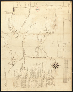
497.
Plan of Reading and Lynnfield, made by Daniel Needham, dated November 1794. Scale 200...
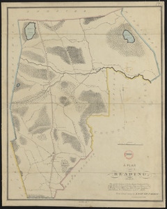
498.
Plan of Reading made by Edmund Parker, dated 1830
499.
Plan of Rehoboth, surveyor's name not given, dated 1794-5.
500.
Plan of Rehoboth, surveyor's name not given, dated 1830
« Previous
Next »
1
2
3
4
5
6
7
8
Limit your search
Place
North and Central America
724
United States
723
Massachusetts
296
Maine
128
Worcester (county)
108
Middlesex (county)
77
Franklin (county)
61
Berkshire (county)
59
more
Place
»
Format
Maps/Atlases
726
Available to use
No known restrictions
726
Date
View distribution
Current results range from
1786
to
1898
Date range begin
Date range end
View larger »
Collection
Town plans, 1794
403
Town plans, 1830
323
Institution
Massachusetts Archives
726

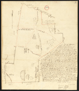
![Plan of [New] Pennacook (Rumford) surveyed by Francis Keyes, dated December 26, 1795.](https://bpldcassets.blob.core.windows.net/derivatives/images/commonwealth:2227nj20f/image_thumbnail_300.jpg)