Skip to search
Skip to main content
Skip to first result
Digital Commonwealth
Folders
Sign Up / Log In
Search for
Search
Search
Search
Basic
Advanced
Explore
Map
Collections
Institutions
Formats
For Educators
Primary Source Sets
Lesson Plans
Using Primary Sources
Searching Digital Commonwealth
For Institutions
Join Digital Commonwealth
Conferences, Trainings, & Events
How to Contribute Collections
Digitization Services
Board & Committees
Frequently Asked Questions
About
About Digital Commonwealth
News & Announcements
Copyright & Terms of Use
Harmful Content Statement
Partners
API
Contact Us
Search
Search Constraints
Start Over
Save Search
Your search:
More Like
commonwealth:25152n44j
✖
Remove constraint More Like: commonwealth:25152n44j
« Prev.
|
61
-
80
of
726
|
Next »
Sort
by date (desc)
relevance
title
date (asc)
date (desc)
Number of results to display per page
20
per page
per page
10
per page
20
per page
50
per page
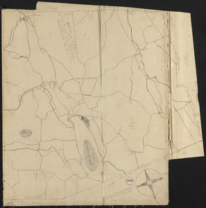
100
per page
View results as:
List
list view
Maps
map view
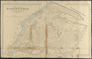
Gallery
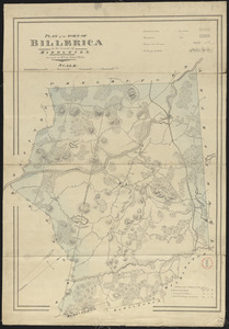
grid view
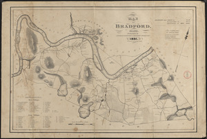
Search Results
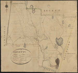
61.
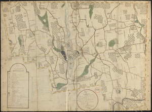
Plan of Otis made by Luke Barber, dated Mar. 10, 1831
62.
Plan of Attleborough made by Joseph W. Capron, dated March, 1831
63.
Plan of Dighton made by George Walker, Jr., dated March, 1831
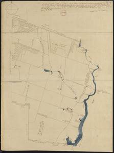
64.
Plan of South Hadley made by Daniel Paine, dated March 1831
65.
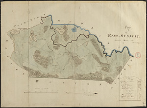
Plan of Wayland (East Sudbury) made by William C Grout, dated March, 1831
66.
Plan of Dudley made by Zephaniah Keach, dated February 28, 1831
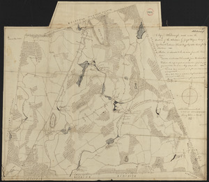
67.
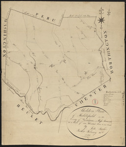
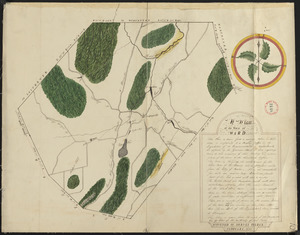
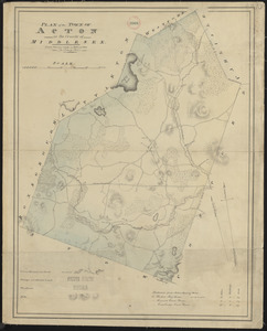
Plan of Middlefield made by Luke Barber, dated February 26, 1831
68.
Plan of Orange made by Jonathan Blake, Jr., dated February 15, 1831
69.
Plan of Royalston made by Jonathan Blake, Jr., dated February 3, 1831
70.
Plan of Ward (Auburn) made by Hervey Peirce, dated February 1831
71.
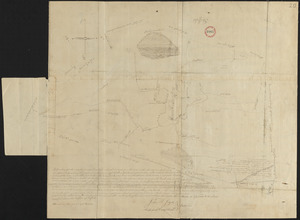
Plan of Mt. Washington, surveyor's name not given, dated January 4, 1831
72.
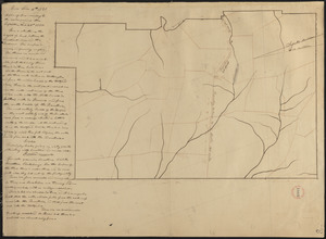
Plan of Peru, surveyor's name not given, dated January 4, 1831
73.
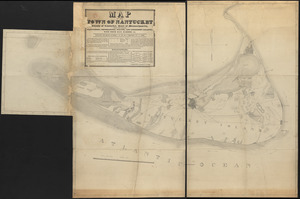
Map of Nantucket made by J. Prescott, dated 1831
74.
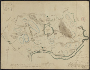
Plan of Acton made by John G. Hales, dated 1831
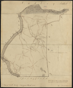
75.
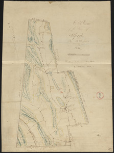
Plan of Alford made by B. H. Lewis, dated 1831
76.
Plan of Amesbury made by W. Nichols and J. S. Morse, dated 1831
77.
Plan of Ashfield made by Levi Leonard, dated December 25, 1830
78.
Plan of Barnstable made by John G. Hales, dated 1831
79.
Plan of Billerica made by John G. Hales, dated 1831
80.
Plan of Bradford made by Benjamin Greenleaf and Jeremiah Spofford, dated 1831
« Previous
Next »
1
2
3
4
5
6
7
8
…
36
37
Limit your search
Place
North and Central America
724
United States
723
Massachusetts
295
Maine
128
Worcester (county)
108
Middlesex (county)
77
Franklin (county)
61
Berkshire (county)
59
more
Place
»
Format
Maps/Atlases
726
Available to use
No known restrictions
726
Date
View distribution
Current results range from
1786
to
1898
Date range begin
Date range end
View larger »
Collection
Town plans, 1794
403
Town plans, 1830
323
Institution
Massachusetts Archives
726