Skip to search
Skip to main content
Skip to first result
Digital Commonwealth
Folders
Sign Up / Log In
Search for
Search
Search
Search
Basic
Advanced
Explore
Map
Collections
Institutions
Formats
For Educators
Primary Source Sets
Lesson Plans
Using Primary Sources
Searching Digital Commonwealth
For Institutions
Join Digital Commonwealth
Conferences, Trainings, & Events
How to Contribute Collections
Digitization Services
Board & Committees
Frequently Asked Questions
About
About Digital Commonwealth
News & Announcements
Copyright & Terms of Use
Harmful Content Statement
Partners
API
Contact Us
Search
Search Constraints
Start Over
Save Search
Your search:
More Like
commonwealth:25152n44j
✖
Remove constraint More Like: commonwealth:25152n44j
« Prev.
|
51
-
100
of
726
|
Next »
Sort
by relevance
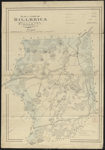
relevance
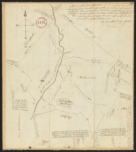
title
date (asc)
date (desc)
Number of results to display per page
50
per page
per page
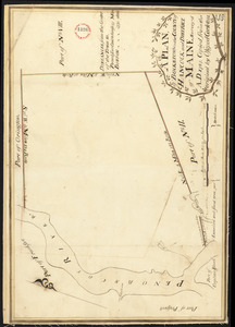
10
per page
20
per page
50
per page
100
per page
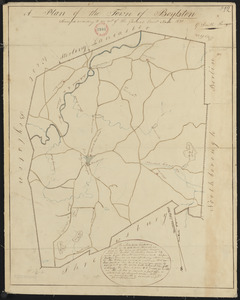
View results as:
List
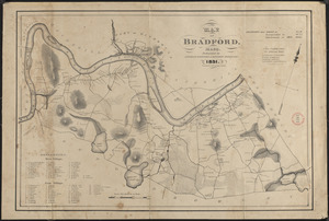
list view
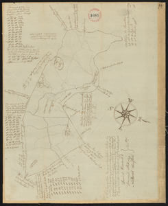
Maps
map view
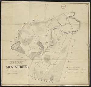
Gallery
grid view
Search Results
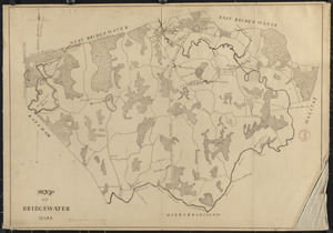
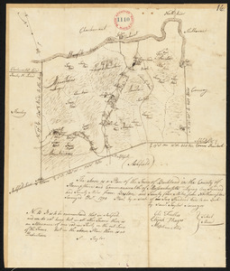
51.
Plan of Berwick surveyor's name not given, dated February 13, 1795.
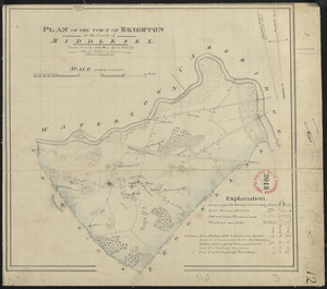
52.
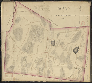
Plan of Bethel (Sudbury Canada) made by Eli Twitchell, dated December 18, 1795.
53.
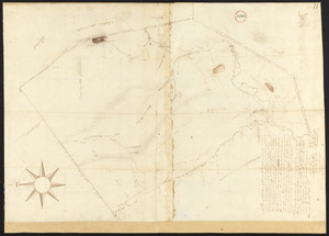
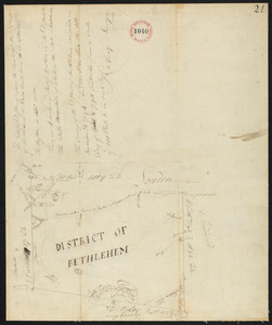
Plan of Bethlehem District (Otis) surveyed by Christopher Crary, dated April 8, 1795.
54.
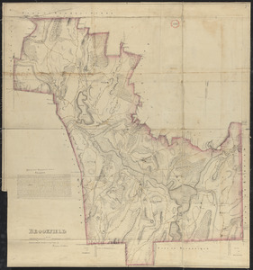
Plan of Beverly, made by Jonathan Smith, dated May 31, 1795.
55.
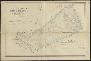
Plan of Beverly made by T. Wilson Flagg, dated 1830
56.
Plan of Biddeford, made by Partridge Richardson, dated 1794.
57.
Plan of Billerica made by John G. Hales, dated 1831
58.
Plan of Billerica, made by Samuel Whiting, dated November, 1794.
59.
Plan of Blandford made by Luke Barber, dated October 24, 1831
60.
Plan of Blandford, surveyor's name not given, dated 1794-5.
61.
Plan of Blue Hill made by John Peters, dated 1794.
62.
Plan of Bolton made by Silas Holman, dated 1830
63.
Plan of Bolton surveyed by Nathaniel Longley Jr., dated November 1794.
64.
Plan of Boothbay made by Thomas Boyd, dated May 20, 1795.
65.
Plan of Boston Corner made by Augustus Tremain, dated June 7, 1840
66.
Plan of Boston surveyed by Osgood Carleton, dated 1795.
67.
Plan of Bowdoin made by James Shurtleff dated 1794-5.
68.
Plan of Bowdoinham made by Ephraim Ballard and Sylverster J. Moore, dated April, 1795.
69.
Plan of Boxborough made by Hoar and Foster, dated September 1, 1831
70.
Plan of Boxborough made by Silas Holman, dated November, 1794.
71.
Plan of Boxford made by Moses Dorman, Jr. dated 1830
72.
Plan of Boxford surveyor's name not given dated June 16, 1795.
73.
Plan of Boylston made by Aaron Sawyer, Jr. dated May, 1795.
74.
Plan of Boylston made by G. Smith dated 1830
75.
Plan of Bradford made by Benjamin Greenleaf and Jeremiah Spofford, dated 1831
76.
Plan of Bradford, surveyor's name not given, dated December 2, 1794.
77.
Plan of Bradley's and Eastman's Land (Stow, Me) surveyor's name not given, dated 1794-1795.
78.
Plan of Braintree made by Jonathan Thayer, dated May 25, 1795.
79.
Plan of Braintree, surveyor's name not given, dated 1831
80.
Plan of Bridgeton surveyed by Benjamin Kimball, Jr, dated May 21, 1795.
81.
Plan of Bridgewater, surveyor's name not given, dated 1794.
82.
Plan of Bridgewater, surveyor's name not given, dated 1830
83.
Plan of Brighton made by John G. Hales, dated April 1830
84.
Plan of Brimfield, made by Jonas Blodgett, dated December 22, 1794.
85.
Plan of Brimfield, surveyor's name not given, dated 1831
86.
Plan of Bristol (Pemaquid) surveyed by Thomas Boyd, dated June 20, 1795.
87.
Plan of Brockton (North Bridgewater) made by Jesse Perkins, dated 1830
88.
Plan of Brookfield made by Herman Stebbins dated 1830
89.
Plan of Brookfield surveyed by Thomas Hale Jr., dated November, 1794.
90.
Plan of Brookline made by John G. Hales, dated August 1830
91.
Plan of Brookline surveyed by Jonathan Kingsbury, dated 1794.
92.
Plan of Brownfield (Prescott's Grant) made by Nathaniel Merrill, dated December 1795.
93.
Plan of Brunswick, made by Daniel Given, dated May 20, 1795
94.
Plan of Buckfield surveyed by Thomas Joselyn, dated by 1794-5.
95.
Plan of Buckland made by John Tobey, dated December 1830
96.
Plan of Buckland made by Samuel Taylor dated December, 1794.
97.
Plan of Bucksport, surveyed by Osgood Carleton, dated 1787.
98.
Plan of Burlington made by Bartholomew Richardson, dated October, 1831
99.
Plan of Buxton, surveyor's name not given, dated June 10, 1795.
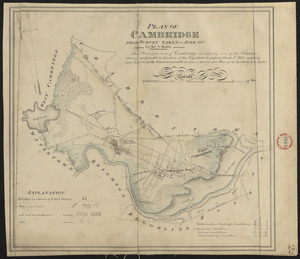
100.
Plan of Cambridge made by John G. Hales, dated June 1830
« Previous
Next »
1
2
3
4
5
6
…
14
15
Limit your search
Place
North and Central America
724
United States
723
Massachusetts
295
Maine
128
Worcester (county)
108
Middlesex (county)
77
Franklin (county)
61
Berkshire (county)
59
more
Place
»
Format
Maps/Atlases
726
Available to use
No known restrictions
726
Date
View distribution
Current results range from
1786
to
1898
Date range begin
Date range end
View larger »
Collection
Town plans, 1794
403
Town plans, 1830
323
Institution
Massachusetts Archives
726