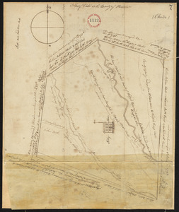
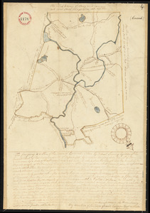
121. Plan of Chester surveyor's name not given, dated October 8, 1794. Format: Maps/Atlases Collection: Town plans, 1794 Date: 1794 Institution: Massachusetts Archives
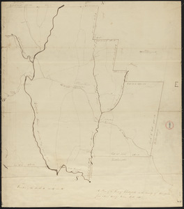
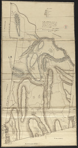
122. Plan of Chesterfield, surveyor's name not given, dated 1830 Format: Maps/Atlases Collection: Town plans, 1830 Date: 1830 Institution: Massachusetts Archives
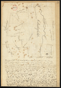
123. Plan of Chesterfield, surveyor's name not given, dated April, 1795. Format: Maps/Atlases Collection: Town plans, 1794 Date: 1795 Institution: Massachusetts Archives
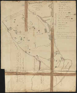
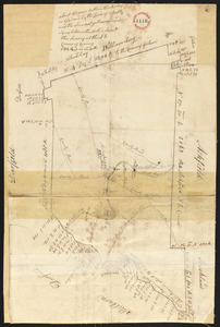
124. Plan of Chilmark made by Thomas Dunham, dated May 1831 Creator: Dunham, Thomas Format: Maps/Atlases Collection: Town plans, 1830 Date: May 1831 Institution: Massachusetts Archives
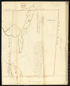
125. Plan of China (Harlem), Me, surveyor's name not given, dated December 9, 1795. Format: Maps/Atlases Collection: Town plans, 1794 Date: 1795 Institution: Massachusetts Archives
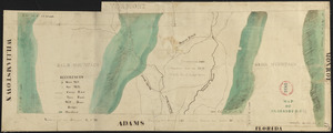
126. Plan of Clarksburg, surveyor's name not given, dated 1830 Format: Maps/Atlases Collection: Town plans, 1830 Date: 1830 Institution: Massachusetts Archives
127. Plan of Clinton, Me., surveyor's name not given, dated 1794. Format: Maps/Atlases Collection: Town plans, 1794 Date: 1794 Institution: Massachusetts Archives
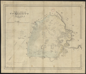
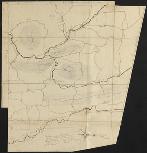
128. Plan of Cohasset made by John G. Hales, dated 1831 Creator: Hales, John Groves Format: Maps/Atlases Collection: Town plans, 1830 Date: 1831 Institution: Massachusetts Archives
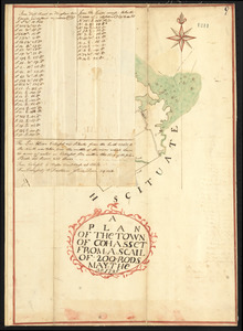
129. Plan of Cohasset, surveyor's name not given, dated May 30, 1795. Format: Maps/Atlases Collection: Town plans, 1794 Date: 1795 Institution: Massachusetts Archives
130. Plan of Colrain made by Levi Leonard, dated November 29, 1830 Creator: Leonard, Levi Format: Maps/Atlases Collection: Town plans, 1830 Date: November 29, 1830 Institution: Massachusetts Archives
131. Plan of Colrain made by Phineas Munn, dated October, 1794. Creator: Munn, Phineas Format: Maps/Atlases Collection: Town plans, 1794 Date: 1794 Institution: Massachusetts Archives
132. Plan of Colrain, surveyor's name not given, dated May, 1798. Format: Maps/Atlases Collection: Town plans, 1794 Date: 1798 Institution: Massachusetts Archives
133. Plan of Concord, made by Ephraim Wood, dated 1794-5. Creator: Wood, Ephraim, 1733-1814 Format: Maps/Atlases Collection: Town plans, 1794 Date: 1794–1795 Institution: Massachusetts Archives
134. Plan of Concord made by John G. Hales, dated 1830 Creator: Hales, John Groves Format: Maps/Atlases Collection: Town plans, 1830 Date: 1830 Institution: Massachusetts Archives
135. Plan of Conway made by Arthur W. Hoyt, dated 1830 Creator: Hoyt, Arthur W. Format: Maps/Atlases Collection: Town plans, 1830 Date: 1830 Institution: Massachusetts Archives
136. Plan of Conway, surveyor's name not given, dated November, 1794. Format: Maps/Atlases Collection: Town plans, 1794 Date: 1794 Institution: Massachusetts Archives
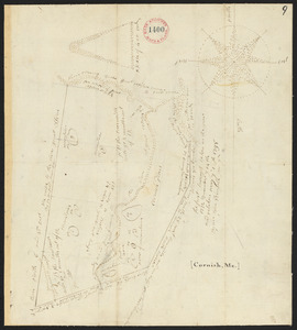
137. Plan of Cornish, made by John Wingate, dated May 1, 1795. Creator: Wingate, John Format: Maps/Atlases Collection: Town plans, 1794 Date: 1795 Institution: Massachusetts Archives
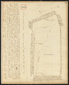
138. Plan of Cummington, made by Adam Packard, dated May 15, 1795. Creator: Packard, Adam Format: Maps/Atlases Collection: Town plans, 1794 Date: 1795 Institution: Massachusetts Archives
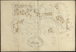
139. Plan of Cummington, surveyor's name not given, dated June 1831 Format: Maps/Atlases Collection: Town plans, 1830 Date: June 1831 Institution: Massachusetts Archives
140. Plan of Cushing surveyed by James Malcolm, dated April 16, 1795. Creator: Malcolm, James Format: Maps/Atlases Collection: Town plans, 1794 Date: 1795 Institution: Massachusetts Archives