Skip to search
Skip to main content
Skip to first result
Digital Commonwealth
Folders
Sign Up / Log In
Search for
Search
Search
Search
Basic
Advanced
Explore
Map
Collections
Institutions
Formats
For Educators
Primary Source Sets
Lesson Plans
Using Primary Sources
Searching Digital Commonwealth
For Institutions
Join Digital Commonwealth
Conferences, Trainings, & Events
How to Contribute Collections
Digitization Services
Board & Committees
Frequently Asked Questions
About
About Digital Commonwealth
News & Announcements
Copyright & Terms of Use
Harmful Content Statement
Partners
API
Contact Us
Search
Search Constraints
Start Over
Save Search
Your search:
More Like
commonwealth:25152g94q
✖
Remove constraint More Like: commonwealth:25152g94q
« Prev.
|
301
-
400
of
726
|
Next »
Sort
by relevance
relevance
title
date (asc)
date (desc)
Number of results to display per page
100
per page
per page
10
per page
20
per page
50
per page
100
per page
View results as:
List
list view
Maps
map view
Gallery
grid view
Search Results
301.
Plan of Jay, Maine, surveyor's name not given, dated 1795.
302.
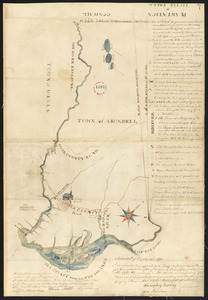
Plan of Kennebunk and Kennebunkport (Arundell) made by Seth Burnham, dated November 3, 1794.
303.
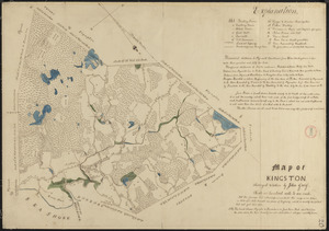
Plan of Kingston made by John Gray, dated 1831
304.
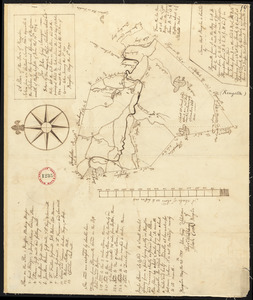
Plan of Kingston surveyed by John Gray, dated May 6, 1795.
305.
Plan of Kittery, made by Benjamin Parker, dated November 1794.
306.
Plan of Lancaster made by Jacob Fisher, dated November 26, 1830
307.
Plan of Lancaster surveyed by Matthias Mossman and Caleb Wilder, Jr., dated May 29, 1795.
308.
Plan of Lanesborough, made by William Douglas, dated November 1794.
309.
Plan of Lanesborough, surveyor's name not given, dated November 1830
310.
Plan of Lebanon (Towwoh) made by Daniel Wood, dated March 7, 1795.
311.
Plan of Lee made by Daniel Wilcox, dated 1795.
312.
Plan of Lee, surveyor's name not given, dated October 1830
313.
Plan of Leicester, made by Peter Silvester, Jr. dated May 23, 1795.
314.
Plan of Leicester, surveyor's name not given, dated 1831
315.
Plan of Lenox, made by Eldad Lewis, dated November 1794.
316.
Plan of Lenox made by Solomon Cole, dated May 1831
317.
Plan of Leominster, surveyor's name not given, dated 1794-5.
318.
Plan of Leominster, surveyor's name not given, dated 1830
319.
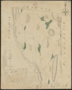
Plan of Leverett made by E. S. Darling, dated July 1830
320.
Plan of Leverett surveyed by William Bowman, dated November, 1794.
321.
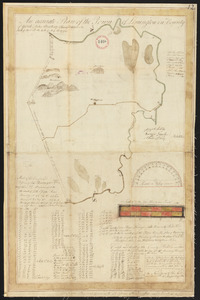
Plan of Lewiston, surveyor's name not given, dated November 1795.
322.
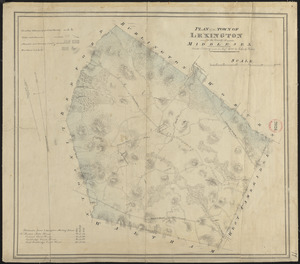
Plan of Lexington made by John G. Hales, dated August, 1830
323.
Plan of Lexington made by Samuel Thompson, dated November 1794.
324.
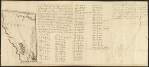
Plan of Leyden made by H. Newcomb Jr, dated May 3, 1831
325.
Plan of Leyden surveyed by Caleb Chapin, dated 1794-5.
326.
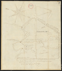
Plan of Limerick, made by John Wingate, dated March 11, 1795.
327.
Plan of Limington, surveyor's name not given, dated May 10, 1795.
328.
Plan of Lincoln made by John G. Hales, dated 1830
329.
Plan of Lincoln surveyed by Samuel Hoar, dated May, 1795.
330.
Plan of Lisbon (Little River Plantation), surveyor's name not given, dated December 1795.
331.
Plan of Litchfield, made by James Shurtleff, dated 1794-5.
332.
Plan of Little Falls (Hollis) surveyed by Daniel Grainger, dated 1795.
333.
Plan of Littleton, made by William Prentice, dated May 27, 1795.
334.
Plan of Livermore (Port Royal) surveyed by Sylvanus Boardman, dated 1795.
335.
Plan of Longmeadow, surveyor's name not given, dated 1794-5.
336.
Plan of Longmeadow, surveyor's name not given, dated April 1831
337.
Plan of Lovell and Sweden (New Suncook), made by Nathaniel Merrill, dated December 1795.
338.
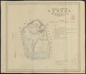
Plan of Lowell made by John G. Hales, dated 1831
339.
Plan of Ludlow surveyed by Isreal Chapin, dated May 20, 1795.
340.
Plan of Ludlow, surveyor's name not given, dated 1830
341.
Plan of Lunenburg made by Cyrus Kilburn, dated 1831
342.
Plan of Lunenburg, made by Jacob Welch, dated March 1795.
343.
Plan of Lyman (Coxhall), made by Robert Swainson, dated May 20, 1795.
344.
Plan of Lynn made by Alonzo Lewis, dated 1829
345.
Plan of Lynn surveyed by Daniel Needham, dated April 1795.
346.
Plan of Lynnfield made by Alonzo Lewis dated October 1831
347.
Plan of Machias, ME, made by William Chaloner, dated December 1795.
348.
Plan of Malden made by John G. Hales, dated September 1830
349.
Plan of Malden made by Peter Tufts, Jr., dated 1795.
350.
Plan of Manchester made by Philander Anderson, dated December 1830
351.
Plan of Manchester surveyed by Delucens Bingham, dated May 1795.
352.
Plan of Mansfield made by Elijah Hewins dated October 1831
353.
Plan of Mansfield made by John Williams, dated May 26, 1795.
354.
Plan of Marblehead made by Alfred Ingalls, dated October 1795.
355.
Plan of Marblehead made by John G. Hales, dated 1830
356.
Plan of Marlborough, made by Andrew Peters, dated November 1794.
357.
Plan of Marlborough made by William H. Wood, dated 1830
358.
Plan of Marshfield made by John Ford, Jr., dated 1831
359.
Plan of Marshfield, surveyor's name not given, dated 1794-5.
360.
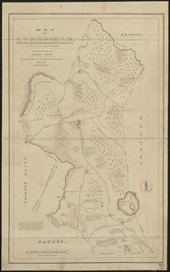
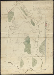
Plan of Mashpee made by John G. Hales, dated 1831
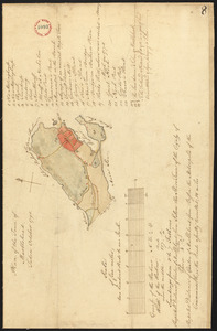
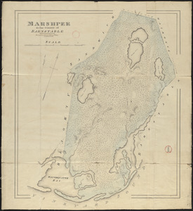
361.
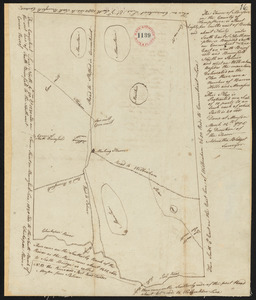
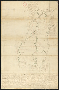
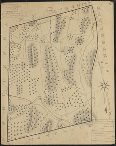
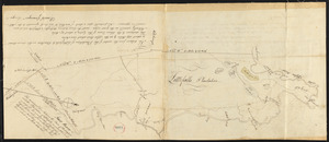
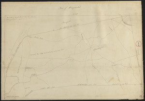
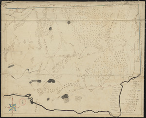
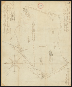
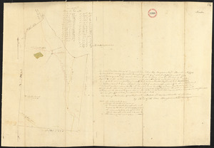
Plan of Mashpee, surveyor's name not given, probably Gideon Wood, dated [Fall, 1795]. See letter of Rev. Gideon Hawley, dated...
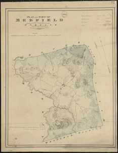
362.
Plan of Medfield made by John G. Hales, dated 1831
363.
Plan of Medfield, surveyor's name not given, dated October 1794.
364.
Plan of Medford made by John Sparrell, dated 1830
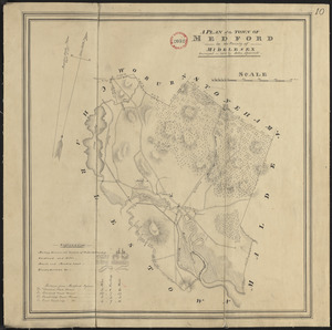
365.
Plan of Medford made by Peter Tufts, Jr., dated 1794.
366.
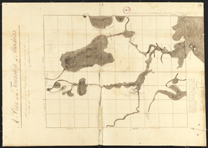
Plan of Medumcook Plantation (Friendship) surveyed by John Malcolm, dated December 28, 1795.
367.
Plan of Medway made by John G. Hales, dated 1831
368.
Plan of Medway surveyed by John Ellis Jr., probable date September 25, 1794.
369.
Plan of Mendon made by Benjamin Read, dated November 1794.
370.
Plan of Mendon made by Newell Nelson, dated June 1830
371.
Plan of Methuen made by Stephen Barker, 2nd, dated July 1831
372.
Plan of Methuen, surveyor's name not given, dated November 1795.
373.
Plan of Middleborough, surveyor's name not given, dated 1794-5.
374.
Plan of Middleborough, surveyor's name not given, dated 1830
375.
Plan of Middlefield made by Luke Barber, dated February 26, 1831
376.
Plan of Middlefield surveyor's name not given, dated 1794-5.
377.
Plan of Middleton made by Moses Dorman, Jr., dated 1830
378.
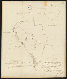
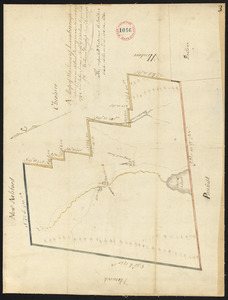
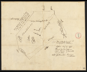
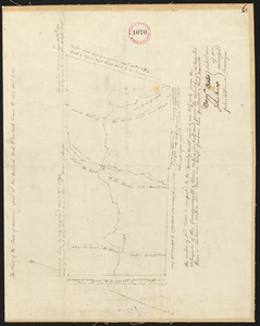
Plan of Middleton surveyed by Simeon Kenney, dated April 25, 1795. [description]
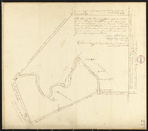
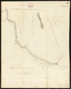
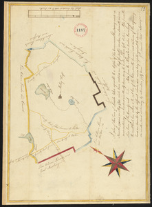
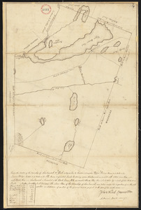
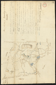
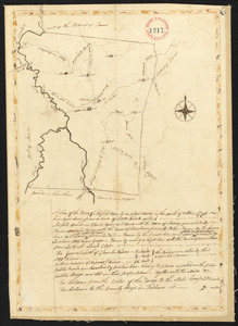
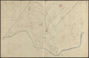
379.
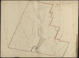
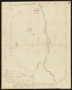
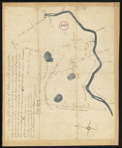
Plan of Middleton surveyed by Simeon Kenney, dated April 25, 1795.[map]
380.
Plan of Milford, made by Joseph Sumner, dated 1795.
381.
Plan of Milford made by Newell Nelson, dated 1831
382.
Plan of Millbury made by Hervey Peirce, dated January 1831
383.
Plan of Milton, surveyor's name not given, dated 1794-5.
384.
Plan of Monmouth, made by Jedediah Prescott, dated April 16, 1798.
385.
Plan of Monroe, surveyor's name not given, dated 1830
386.
Plan of Monson surveyed by Admatha Blodgett, dated March 14, 1795.
387.
Plan of Montague made by Elisha Root, dated November 1794.
388.
Plan of Montague made by Josiah Gould, dated August, 1830
389.
Plan of Montgomery, surveyor's name not given, dated 1831
390.
Plan of Montgomery, surveyor's name not given, dated November 1794.
391.
Plan of Mount Desert, made by John Peters, dated 1795.
392.
Plan of Mt. Washington surveyed by David Fairchild, dated December, 1794.
393.
Plan of Mt. Washington, surveyor's name not given, dated January 4, 1831
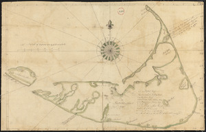
394.
Plan of Nantucket, surveyor's name not given, dated May 1, 1795.
395.
Plan of Natick made by Jonas Clayes, dated 1831
396.
Plan of Natick surveyed by Isaac Coolidge, dated February, 1795.
397.
Plan of Needham made by Asa Kingsbury, dated 1831
398.
Plan of Needham made by Asa Kingsbury, dated 1831
399.
Plan of Needham surveyed by Jonathan Kingsbury, dated 1794.
400.
Plan of New Ashford made by Phinehas Harmon, dated October 1830
« Previous
Next »
1
2
3
4
5
6
7
8
Limit your search
Place
North and Central America
724
United States
723
Massachusetts
296
Maine
128
Worcester (county)
109
Middlesex (county)
77
Franklin (county)
61
Berkshire (county)
59
more
Place
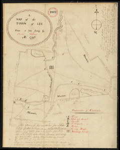
»
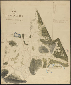
Format
Maps/Atlases
726
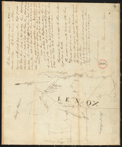
Available to use
No known restrictions
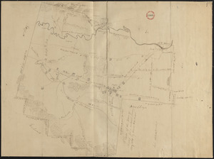
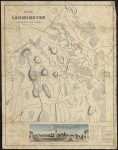
726
Date
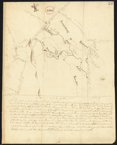
View distribution
Current results range from
1786
to
1898
Date range begin
Date range end
View larger »
Collection
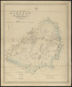
Town plans, 1794
403
Town plans, 1830
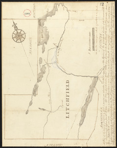
323
Institution
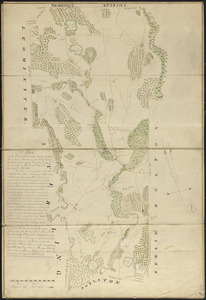
Massachusetts Archives
726

![Plan of Mashpee, surveyor's name not given, probably Gideon Wood, dated [Fall, 1795]. See letter of Rev. Gideon Hawley, dated March 24, 1797, bound with, as to errors, etc.](https://bpldcassets.blob.core.windows.net/derivatives/images/commonwealth:2227nm877/image_thumbnail_300.jpg)
![Plan of Middleton surveyed by Simeon Kenney, dated April 25, 1795. [description]](https://bpldcassets.blob.core.windows.net/derivatives/images/commonwealth:2227nk51n/image_thumbnail_300.jpg)
![Plan of Middleton surveyed by Simeon Kenney, dated April 25, 1795.[map]](https://bpldcassets.blob.core.windows.net/derivatives/images/commonwealth:2227nk49m/image_thumbnail_300.jpg)