Skip to search
Skip to main content
Skip to first result
Digital Commonwealth
Folders
Sign Up / Log In
Search for
Search
Search
Search
Basic
Advanced
Explore
Map
Collections
Institutions
Formats
For Educators
Primary Source Sets
Lesson Plans
Using Primary Sources
Searching Digital Commonwealth
For Institutions
Join Digital Commonwealth
Conferences, Trainings, & Events
How to Contribute Collections
Digitization Services
Board & Committees
Frequently Asked Questions
About
About Digital Commonwealth
News & Announcements
Copyright & Terms of Use
Harmful Content Statement
Partners
API
Contact Us
Search
Search Constraints
Start Over
Save Search
Your search:
More Like
commonwealth:2227np080
✖
Remove constraint More Like: commonwealth:2227np080
« Prev.
|
101
-
200
of
726
|
Next »
Sort
by relevance
relevance
title
date (asc)
date (desc)
Number of results to display per page
100
per page
per page
10
per page
20
per page
50
per page
100
per page
View results as:
List
list view
Maps
map view
Gallery
grid view
Search Results
101.
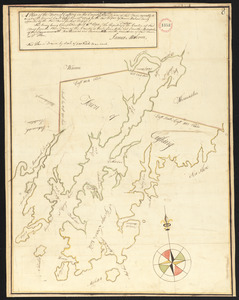
Plan of Camden, surveyor's name not given, dated May 1795.
102.
Plan of Canaan surveyed by Samuel Weston, dated May 20, 1795.
103.
Plan of Canton made by Joseph Hodges, dated October 1830
104.
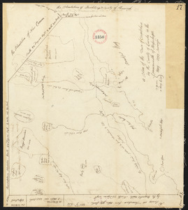
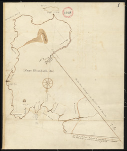
Plan of Cape Elizabeth, surveyor's name not given, dated 1794-1795.
105.
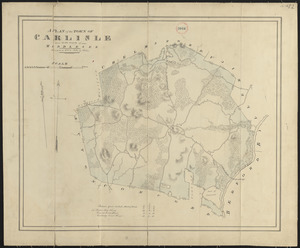
Plan of Carlisle made by John G. Hales, dated 1831
106.
Plan of Carver surveyed by Nehemiah Cobb, dated 1794-5.
107.
Plan of Charlemont made by Levi Leonard, dated September 1830
108.
Plan of Charlemont surveyed by Jesse King, dated 1794-5.
109.
Plan of Charlemont (Zoar) made by John Tobey, dated June 1839
110.
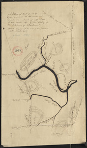
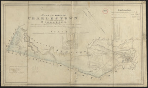
Plan of Charlestown made by John G. Hales, dated August 1830
111.
Plan of Charlestown, made by Samuel Thompson, dated December, 1794.
112.
Plan of Charlton made by Barlow Freeman, dated 1831
113.
Plan of Charlton surveyor's name not given, dated May 22, 1795.
114.
Plan of Chatham, surveyor's name not given, dated 1831
115.
Plan of Chatham, surveyor's name not given, dated May 22, 1795.
116.
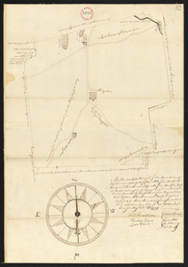
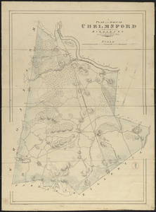
Plan of Chelmsford made by John G. Hales, dated 1831
117.
Plan of Cheshire, surveyor's name not given, dated 1830
118.
Plan of Cheshire, surveyor's name not given, dated May 22, 1795.
119.
Plan of Chester made by J. Gould, dated September 1831
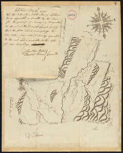
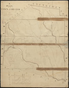
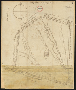
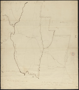
120.
Plan of Chester surveyor's name not given, dated October 8, 1794.
121.
Plan of Chesterfield, surveyor's name not given, dated 1830
122.
Plan of Chesterfield, surveyor's name not given, dated April, 1795.
123.
Plan of Chilmark made by Thomas Dunham, dated May 1831
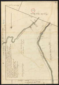
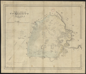
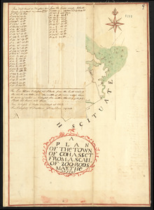
124.
Plan of China (Harlem), Me, surveyor's name not given, dated December 9, 1795.
125.
Plan of Clarksburg, surveyor's name not given, dated 1830
126.
Plan of Clinton, Me., surveyor's name not given, dated 1794.
127.
Plan of Cohasset made by John G. Hales, dated 1831
128.
Plan of Cohasset, surveyor's name not given, dated May 30, 1795.
129.
Plan of Colrain made by Levi Leonard, dated November 29, 1830
130.
Plan of Colrain made by Phineas Munn, dated October, 1794.
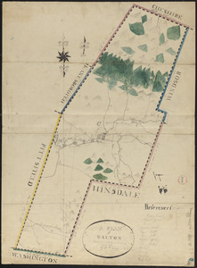
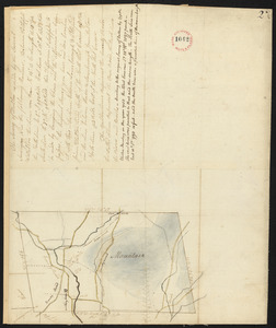
131.
Plan of Colrain, surveyor's name not given, dated May, 1798.
132.
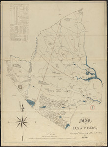
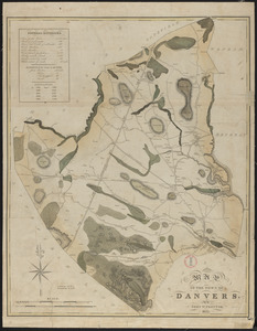
Plan of Concord, made by Ephraim Wood, dated 1794-5.
133.
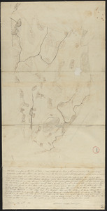
Plan of Concord made by John G. Hales, dated 1830
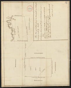
134.
Plan of Conway made by Arthur W. Hoyt, dated 1830
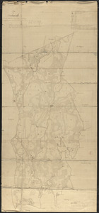
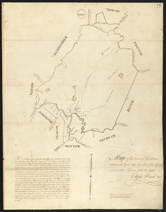
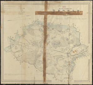
135.
Plan of Conway, surveyor's name not given, dated November, 1794.
136.
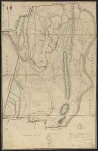
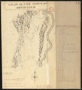
Plan of Cornish, made by John Wingate, dated May 1, 1795.
137.
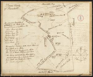
Plan of Cummington, made by Adam Packard, dated May 15, 1795.
138.
Plan of Cummington, surveyor's name not given, dated June 1831
139.
Plan of Cushing surveyed by James Malcolm, dated April 16, 1795.
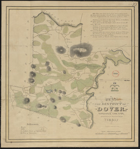
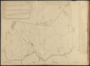
140.
Plan of Cutler's Grant (Porter) made by Nathaniel Merrill, dated 1794-1795.
141.
Plan of Dalton made by M. H. Eames, dated October 27, 1831
142.
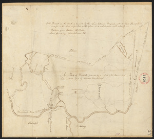
Plan of Dalton, surveyor's name not given, dated 1794-5.
143.
Plan of Dana made by Ephraim Whipple, dated May 18, 1831
144.
Plan of Danvers made by John W. Proctor, dated 1831
145.
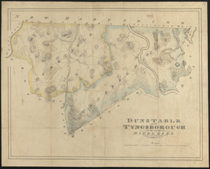
Plan of Danvers made by John W. Proctor, dated 1832
146.
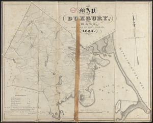
Plan of Danvers surveyed by Gideon Foster, dated May, 1795.
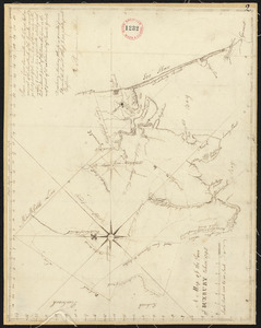
147.
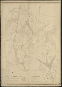
Plan of Dartmouth made by Henry H. Crapo, dated June, 1831
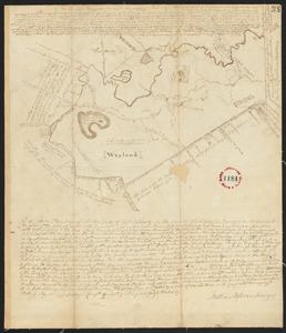
148.
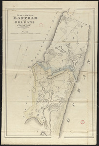
Plan of Dartmouth, made by Zedock Maxfeld, dated May, 1795.
149.
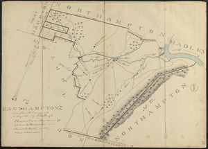
Plan of Dedham, made by Elijah Pond, dated 1795.
150.
Plan of Dedham made by John G. Hales, dated 1831
151.
Plan of Deer Island (Isle au Haut), made by John Peters, Jr., dated May 21. 1795.
152.
Plan of Deerfield made by Arthur W. Hoyt, dated 1830
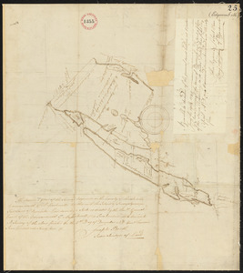
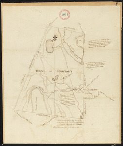
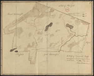
153.
Plan of Deerfield surveyed by D. Hoit, Jr. dated December 1794.
154.
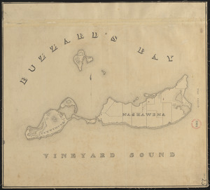
Plan of Dennis made by Benjamin Matthews, Jr., dated 1831
155.
Plan of Dennis surveyed by Elisha Barrett, dated May, 1795.
156.
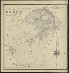
Plan of Dighton made by George Walker, Jr., dated March, 1831
157.
Plan of Dighton, surveyor's name not given, dated 1794.
158.
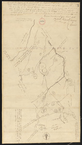
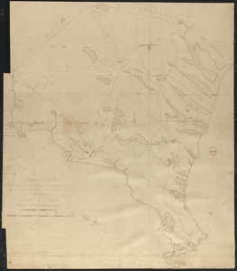
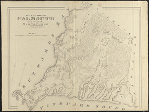
Plan of District of Carlisle, surveyor's name not given, dated 1794-5.
159.
Plan of District of Dover, surveyor's name not given, dated October, 1794.
160.
Plan of Dorchester and Milton, made by Edmund T. Baker, dated September, 1831
161.
Plan of Dorchester made by Mather Withington, dated September, 1794.
162.
Plan of Douglas, made by Aaron Marsh, dated 1794-5.
163.
Plan of Douglas made by Warren Humes, dated October 20, 1831
164.
Plan of Dover made by William Ellis, dated 1831
165.
Plan of Dracut made by B. F. Varnum, dated October 31, 1831
166.
Plan of Dracut, surveyor's name not given, dated 1794.
167.
Plan of Dresden (West part of Pownalboro) surveyed by Benjamin Poor, dated May 21, 1795.
168.
Plan of Dudley made by Zephaniah Keach, dated February 28, 1831
169.
Plan of Dudley surveyed by John Chamberlin dated March 17, 1795.
170.
Plan of Dunstable and Tyngsborough made by John G. Hales, dated 1831
171.
Plan of Dunstable surveyed by Fred French, dated 1794.
172.
Plan of Duxbury made by John Ford, Jr., dated 1833
173.
Plan of Duxbury surveyed by Alden Benjamin, dated 1795.
174.
Plan of East Bridgewater made by Azor Harris and Isaac Alden, dated 1830
175.
Plan of East Sudbury (Wayland) surveyed by Matthias Mossman, dated May 21, 1795.
176.
Plan of Eastham and Orleans, made by John G. Hales, dated 1831
177.
Plan of Eastham, surveyor's name not given, dated May 22, 1795.
178.
Plan of Easthampton made by Justus Dwight, dated May 1831
179.
Plan of Easthampton, made by Simon Parsons, dated November, 1794.
180.
Plan of Easton, made by Nathan Selee, dated May 29, 1795.
181.
Plan of Easton, surveyor's name not given, dated 1830
182.
Plan of Edgartown and Tisbury, made by Benjamin Smith, dated June 1, 1795.
183.
Plan of Edgartown made by Henry H. Crapo, dated 1830
184.
Plan of Edgecomb surveyed by Joseph Beath, dated December 6, 1794.
185.
Plan of Egremont made by David Fairchild, dated December, 1794.
186.
Plan of Egremont made by Moses Loomis, dated 1831
187.
Plan of Elizabeth Islands, etc. (Chilmark), surveyor's name not given, dated May 27, 1795.
188.
Plan of Elizabeth Islands (Nashawena, Cuttyhunk, and Peniquese), surveyor's name not given, dated 1830
189.
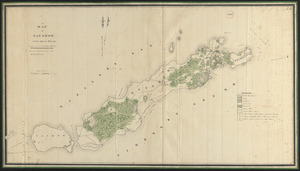
Plan of Elizabeth Islands (Naushon, Pasque, and the Wepeckalt Islands) made by Henry H. Crapo, dated 1837
190.
Plan of Enfield made by E. S. Darling, dated August, 1830
191.
Plan of Erving's Grant (Erving), surveyor's name not given, dated October 1830
192.
Plan of Essex made by Philander Anderson, dated November, 1830
193.
Plan of Fairfield, made by Abraham Sanders, dated May 11, 1795.
194.
Plan of Fairhaven made by Ammittai B. Hammond, dated 1831
195.
Plan of Fall River (Troy), surveyor's name not given, dated August 1831
196.
Plan of Falmouth made by Jesse Boyden, dated 1841
197.
Plan of Falmouth made by John G. Hales, dated 1831
198.
Plan of Falmouth, Maine, made by Joseph Noyes, dated 1794-5.
199.
Plan of Falmouth, surveyor's name not given, dated May 20, 1795.
200.
Plan of Farmington, made by Lemuel Perham, dated May, 1795.
« Previous
Next »
1
2
3
4
5
6
7
8
Limit your search
Place
North and Central America
724
United States
723
Massachusetts
295
Maine
128
Worcester (county)
109
Middlesex (county)
76
Franklin (county)
61
Berkshire (county)
59
more
Place
»
Format
Maps/Atlases
726
Available to use
No known restrictions
726
Date
View distribution
Current results range from
1786
to
1898
Date range begin
Date range end
View larger »
Collection
Town plans, 1794
402
Town plans, 1830
324
Institution
Massachusetts Archives
726