Skip to search
Skip to main content
Skip to first result
Digital Commonwealth
Folders
Sign Up / Log In
Search for
Search
Search
Search
Basic
Advanced
Explore
Map
Collections
Institutions
Formats
For Educators
Primary Source Sets
Lesson Plans
Using Primary Sources
Searching Digital Commonwealth
For Institutions
Join Digital Commonwealth
Conferences, Trainings, & Events
How to Contribute Collections
Digitization Services
Board & Committees
Frequently Asked Questions
About
About Digital Commonwealth
News & Announcements
Copyright & Terms of Use
Harmful Content Statement
Partners
API
Contact Us
Search
Search Constraints
Start Over
Save Search
Your search:
More Like
commonwealth:2227np080
✖
Remove constraint More Like: commonwealth:2227np080
« Prev. |
1
-
100
of
726
|
Next »
Sort
by date (desc)
relevance
title
date (asc)
date (desc)
Number of results to display per page
100
per page
per page
10
per page
20
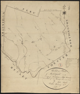
per page
50
per page
100
per page
View results as:
List
list view
Maps
map view
Gallery
grid view
Search Results
1.
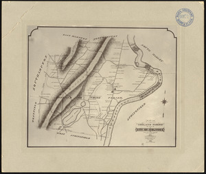
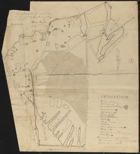
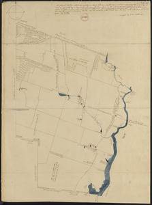
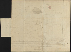
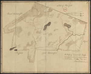
Photographic plan of Ireland (Third) Parish, Springfield, now city of Holyoke, showing residences and names of residents, made...
2.
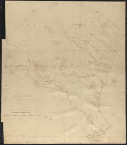
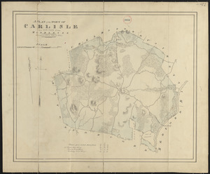
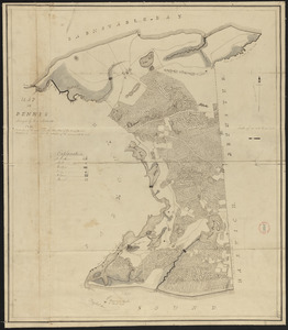
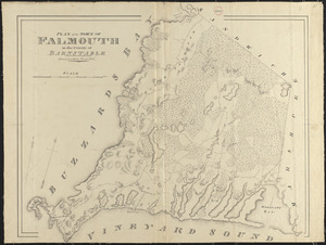
Plan of Falmouth made by Jesse Boyden, dated 1841
3.
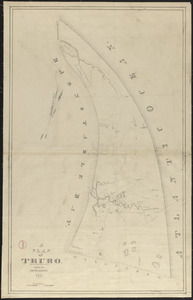
Plan of Truro made by Joshua H Davis, dated 1841
4.
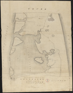
Plan of Wellfleet made by Oliver Arey, dated 1841
5.
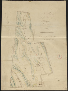
Plan of Goshen made by William Abell dated July 6, 1839
6.
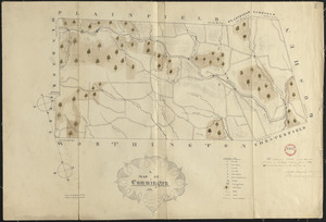
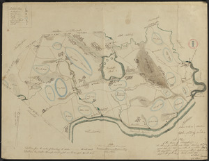
Plan of Charlemont (Zoar) made by John Tobey, dated June 1839
7.
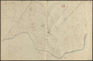
Plan of Rowe (Zoar) made by E. P. Farnsworth, dated 1839
8.
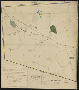
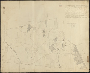
Plan of Hawley made by John Tobey, dated March, 1839
9.
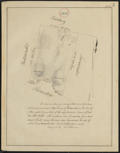
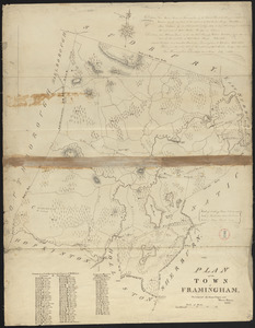
Plan of No Town (Princeton), surveyor's name not given, dated 1838
10.
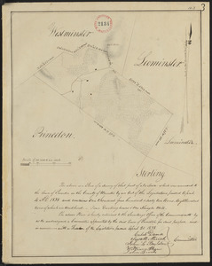
Plan of Westminster (No Town) made by Caleb Dana, dated 1838
11.
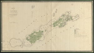
Plan of Elizabeth Islands (Naushon, Pasque, and the Wepeckalt Islands) made by Henry H. Crapo, dated 1837
12.
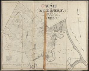
Plan of Duxbury made by John Ford, Jr., dated 1833
13.
Plan of Walpole made by Elijah Hewins, dated December, 1832
14.
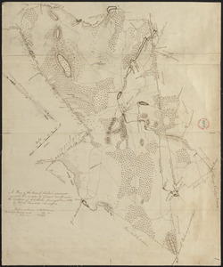
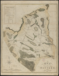
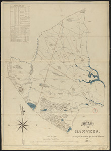
Plan of Danvers made by John W. Proctor, dated 1832
15.
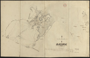
Plan of Salem made by Jonathan P. Saunders, dated 1832
16.
Plan of Dracut made by B. F. Varnum, dated October 31, 1831
17.
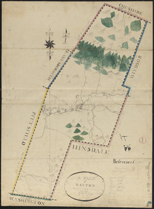
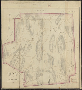
Plan of Dalton made by M. H. Eames, dated October 27, 1831
18.
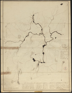
Plan of Tolland made by Luke Barber, dated September 27, 1831
19.
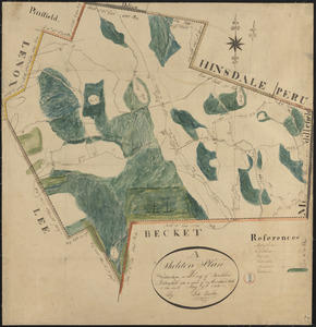
Plan of Becket made by Luke Barber, dated October 26, 1831
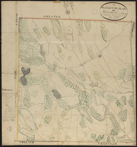
20.
Plan of Townsend, surveyor's name not given, dated October 26, 1831
21.
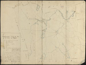
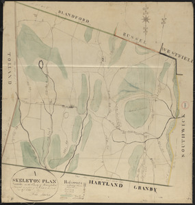
Plan of Blandford made by Luke Barber, dated October 24, 1831
22.
Plan of Warren (Western), surveyor's name not given, dated October 24, 1831
23.
Plan of Douglas made by Warren Humes, dated October 20, 1831
24.
Plan of Holden made by Charles Chaffin, dated October 20, 1831
25.
Plan of Wilmington made by Edmund Parker, dated October 17, 1831
26.
Plan of Burlington made by Bartholomew Richardson, dated October, 1831
27.
Plan of Lynnfield made by Alonzo Lewis dated October 1831
28.
Plan of Mansfield made by Elijah Hewins dated October 1831
29.
Plan of Southbridge made by Barlow Freeman, dated October, 1831
30.
Plan of Sturbridge made by David Wright, dated October 1831
31.
Plan of Windsor made by Elias J. Baldwin, dated October 1831
32.
Plan of Raynham made by Godfrey Robinson, dated September 27, 1831
33.
Plan of Goshen made by John Grant, dated September 19, 1831
34.
Plan of Boxborough made by Hoar and Foster, dated September 1, 1831
35.
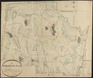
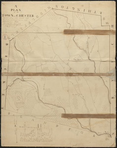
Plan of Chester made by J. Gould, dated September 1831
36.
Plan of Dorchester and Milton, made by Edmund T. Baker, dated September, 1831
37.
Plan of Fall River (Troy), surveyor's name not given, dated August 1831
38.
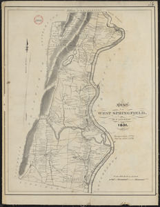
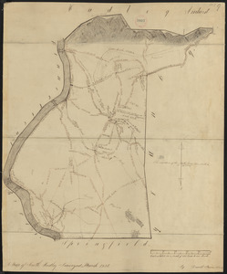
Plan of West Springfield made by J. Lathrop, dated August 1831
39.
Plan of West Springfield made by J. Lathrop, dated August 1831
40.
Plan of Methuen made by Stephen Barker, 2nd, dated July 1831
41.
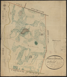
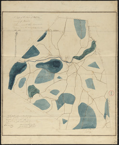
Plan of Granville made by Luke Barber, dated June 29, 1831
42.
Plan of Adams made by Thomas A. Brayton, dated June, 1831
43.
Plan of Cummington, surveyor's name not given, dated June 1831
44.
Plan of Dartmouth made by Henry H. Crapo, dated June, 1831
45.
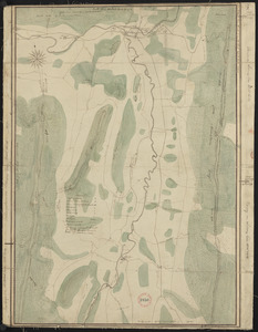
Plan of Russell, surveyor's name not given, dated June 1831
46.
Plan of Savoy made by Levi Leonard, dated June 1831
47.
Plan of Westminster, surveyor's name not given, dated June 1831
48.
Plan of Williamsburg, surveyor's name not given, dated June 1831
49.
Plan of Worthington made by William Packard, dated May 20, 1831
50.
Plan of Dana made by Ephraim Whipple, dated May 18, 1831
51.
Plan of Washington made by Luke Barber, dated May 9, 1831
52.
Plan of Leyden made by H. Newcomb Jr, dated May 3, 1831
53.
Plan of Chilmark made by Thomas Dunham, dated May 1831
54.
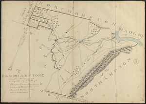
Plan of Easthampton made by Justus Dwight, dated May 1831
55.
Plan of Lenox made by Solomon Cole, dated May 1831
56.
Plan of Southwick made by Amasa Holcomb, dated May, 1831
57.
Plan of Longmeadow, surveyor's name not given, dated April 1831
58.
Plan of New Marlborough made by Henry Wheeler, dated April 1831
59.
Plan of Tisbury made by Thomas Dunham, dated April 1831
60.
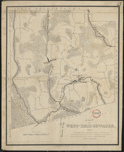
Plan of West Bridgewater, surveyor's name not given, dated 1831
61.
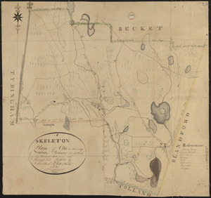
Plan of Otis made by Luke Barber, dated Mar. 10, 1831
62.
Plan of Attleborough made by Joseph W. Capron, dated March, 1831
63.
Plan of Dighton made by George Walker, Jr., dated March, 1831
64.
Plan of South Hadley made by Daniel Paine, dated March 1831
65.
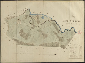
Plan of Wayland (East Sudbury) made by William C Grout, dated March, 1831
66.
Plan of Dudley made by Zephaniah Keach, dated February 28, 1831
67.
Plan of Middlefield made by Luke Barber, dated February 26, 1831
68.
Plan of Orange made by Jonathan Blake, Jr., dated February 15, 1831
69.
Plan of Royalston made by Jonathan Blake, Jr., dated February 3, 1831
70.
Plan of Ward (Auburn) made by Hervey Peirce, dated February 1831
71.
Plan of Mt. Washington, surveyor's name not given, dated January 4, 1831
72.
Plan of Peru, surveyor's name not given, dated January 4, 1831
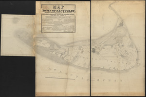
73.
Map of Nantucket made by J. Prescott, dated 1831
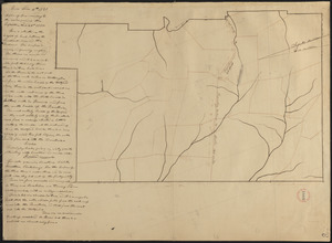
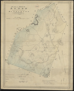
74.
Plan of Acton made by John G. Hales, dated 1831
75.
Plan of Alford made by B. H. Lewis, dated 1831
76.
Plan of Amesbury made by W. Nichols and J. S. Morse, dated 1831
77.
Plan of Ashfield made by Levi Leonard, dated December 25, 1830
78.
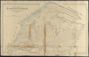
Plan of Barnstable made by John G. Hales, dated 1831
79.
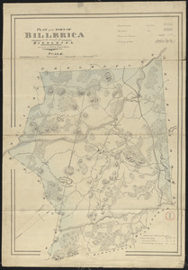
Plan of Billerica made by John G. Hales, dated 1831
80.
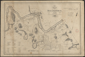
Plan of Bradford made by Benjamin Greenleaf and Jeremiah Spofford, dated 1831
81.
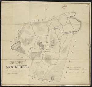
Plan of Braintree, surveyor's name not given, dated 1831
82.
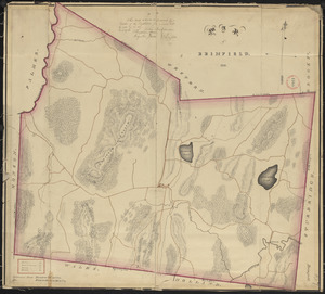
Plan of Brimfield, surveyor's name not given, dated 1831
83.
Plan of Carlisle made by John G. Hales, dated 1831
84.
Plan of Charlton made by Barlow Freeman, dated 1831
85.
Plan of Chatham, surveyor's name not given, dated 1831
86.
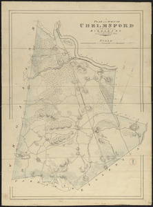
Plan of Chelmsford made by John G. Hales, dated 1831
87.
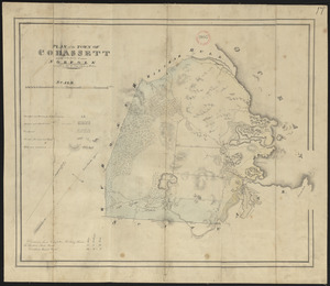
Plan of Cohasset made by John G. Hales, dated 1831
88.
Plan of Danvers made by John W. Proctor, dated 1831
89.
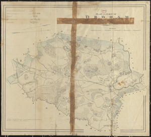
Plan of Dedham made by John G. Hales, dated 1831
90.
Plan of Dennis made by Benjamin Matthews, Jr., dated 1831
91.
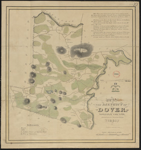
Plan of Dover made by William Ellis, dated 1831
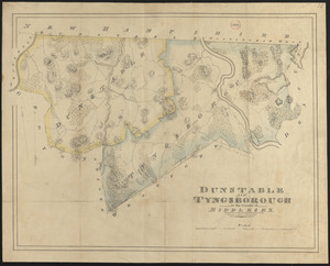
92.
Plan of Dunstable and Tyngsborough made by John G. Hales, dated 1831
93.
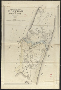
Plan of Eastham and Orleans, made by John G. Hales, dated 1831
94.
Plan of Egremont made by Moses Loomis, dated 1831
95.
Plan of Fairhaven made by Ammittai B. Hammond, dated 1831
96.
Plan of Falmouth made by John G. Hales, dated 1831
97.
Plan of Framingham made by Jonas Clayes and Warren Nixon, dated 1831
98.
Plan of Franklin, surveyor's name not given, dated 1831
99.
Plan of Freetown, surveyor's name not given, dated 1831
100.
Plan of Gardner made by William Young, dated 1831
« Previous
Next »
1
2
3
4
5
…
7
8
Limit your search
Place
North and Central America
724
United States
723
Massachusetts
295
Maine
128
Worcester (county)
109
Middlesex (county)
76
Franklin (county)
61
Berkshire (county)
59
more
Place
»
Format
Maps/Atlases
726
Available to use
No known restrictions
726
Date
View distribution
Current results range from
1786
to
1898
Date range begin
Date range end
View larger »
Collection
Town plans, 1794
402
Town plans, 1830
324
Institution
Massachusetts Archives
726