Skip to search
Skip to main content
Skip to first result
Digital Commonwealth
Folders
Sign Up / Log In
Search for
Search
Search
Search
Basic
Advanced
Explore
Map
Collections
Institutions
Formats
For Educators
Primary Source Sets
Lesson Plans
Using Primary Sources
Searching Digital Commonwealth
For Institutions
Join Digital Commonwealth
Conferences, Trainings, & Events
How to Contribute Collections
Digitization Services
Board & Committees
Frequently Asked Questions
About
About Digital Commonwealth
News & Announcements
Copyright & Terms of Use
Harmful Content Statement
Partners
API
Contact Us
Search
Search Constraints
Start Over
Save Search
Your search:
More Like
commonwealth:2227nj637
✖
Remove constraint More Like: commonwealth:2227nj637
« Prev. |
1
-
20
of
726
|
Next »
Sort
by date (asc)
relevance
title
date (asc)
date (desc)
Number of results to display per page
20
per page
per page
10
per page
20
per page
50
per page
100
per page
View results as:
List
list view
Maps
map view
Gallery
grid view
Search Results
1.
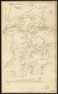
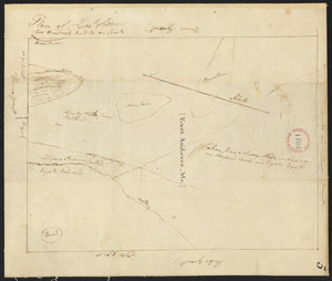
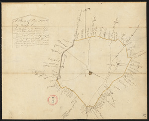
Plan of Vinalhaven made by J. Vinal, in 1786. Scale 200rds to 1".
2.
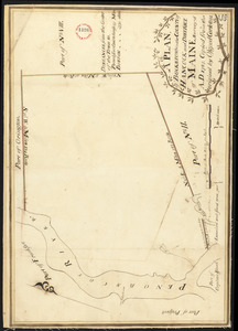
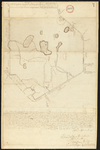
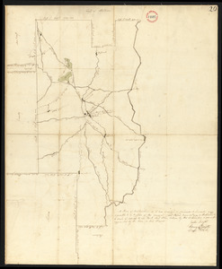
Plan of Bucksport, surveyed by Osgood Carleton, dated 1787.
3.
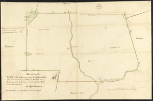
Plan of Poland (Bakerstown) surveyed by Osgood Carleton, dated 1792.
4.
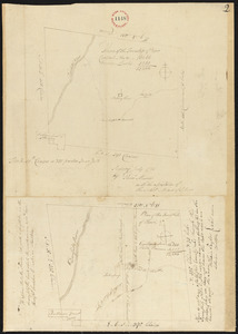
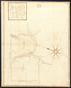
Plan of Rowe surveyed by Phineas Munn dated July 1793.
5.
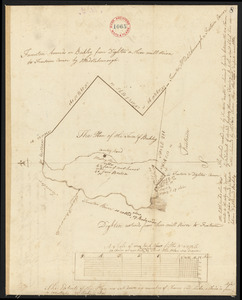
Plan of Acton, made by Jabez Brown, dated November, 1794.
6.
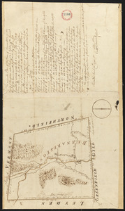
Plan of Adams surveyed by Israel Jones, dated November 1794.
7.
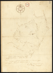
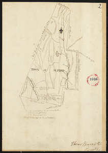
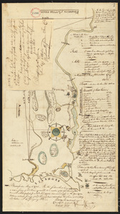
Plan of Alford surveyed by David Fairchild, dated October, 1794.
8.
Plan of Amesbury, made by Christopher Sergent, dated November, 1794.
9.
Plan of Andover (East Andover), surveyor's name not given, dated 1794-5.
10.
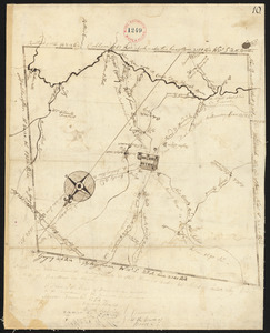
Plan of Ashburnham surveyed by Matthias Mossman, dated 1794-5.
11.
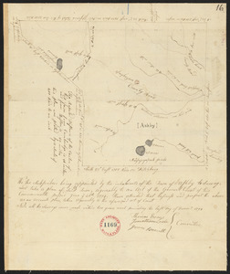
Plan of Ashby, surveyor's name not given , dated 1794.
12.
Plan of Barre surveyor's name not given, dated December, 1794.
13.
Plan of Bedford, surveyor's name not given, dated 1794-5.
14.
Plan of Belchertown, surveyor's name not given, dated December, 1794.
15.
Plan of Belfast surveyed by Alexander Clark, dated 1794.
16.
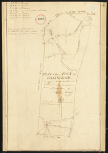
Plan of Bellingham made by Stephen Metcalf, dated December, 1794.
17.
Plan of Berkley, surveyor's name not given, dated 1794-5.
18.
Plan of Bernardston, surveyor's name not given, dated November, 1794.
19.
Plan of Biddeford, made by Partridge Richardson, dated 1794.
20.
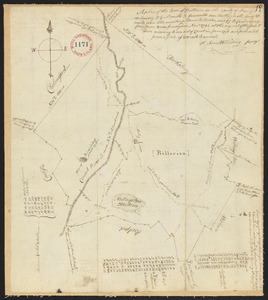
Plan of Billerica, made by Samuel Whiting, dated November, 1794.
« Previous
Next »
1
2
3
4
5
…
36
37
Limit your search
Place
North and Central America
724
United States
723
Massachusetts
295
Maine
128
Worcester (county)
109
Middlesex (county)
77
Franklin (county)
61
Berkshire (county)
59
more
Place
»
Format
Maps/Atlases
726
Available to use
No known restrictions
726
Date
View distribution
Current results range from
1786
to
1898
Date range begin
Date range end
View larger »
Collection
Town plans, 1794
402
Town plans, 1830
324
Institution
Massachusetts Archives
726