Martha's Vineyard Topography and Water Features
Item Information
- Title:
- Martha's Vineyard Topography and Water Features
- Description:
-
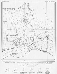
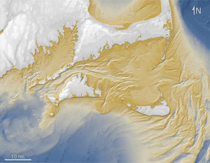
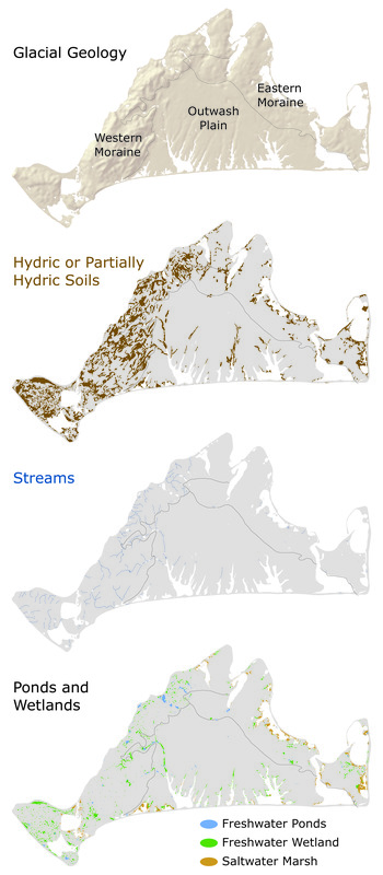
Glacial history strongly controls the distribution of fresh water on and below the Island’s surface. The western moraine is underlain by clay deposits that hold rainfall near the surface and support most of the Island’s wetlands, ponds, streams, and moist or hydric soils. In contrast, the sandy outwash plain allows water to percolate readily into the freshwater aquifer that lies deeply below its surface. The sandy eastern area contains just a few ponds (e.g., Duarte, Fresh, Lily, and Jernegan Ponds) and wetlands (e.g., Dodger’s Hole, Beetle Swamp, and Airport Bog). The Island’s relatively few salt marshes are concentrated on Chappaquiddick and around the great ponds.
- Name on Item:
-
Brian R. Hall [Compiler]
- Date:
-
February 28, 2016
- Format:
-
Maps/Atlases
Objects/Artifacts
- Genre:
-
Book illustrations
- Location:
-
Harvard University
Harvard Forest Archives - Collection (local):
-
Harvard Forest Martha's Vineyard Collection
- Subjects:
-
Coastal
Regional Studies
Geology
- Places:
-
MassachusettsDukes (county)Martha's Vineyard (island)
- Permalink:
- https://ark.digitalcommonwealth.org/ark:/50959/vh53xt020
- Terms of Use:
-
Copyright (c) Brian R. Hall
This work is licensed for use under a Creative Commons Attribution Non-Commercial No Derivatives License (CC BY-NC-ND).