Skip to search
Skip to main content
Digital Commonwealth
Sign Up / Log In
Search for
Search
Search
Search
Basic
Advanced
Explore
Map
Collections
Institutions
Formats
For Educators
Primary Source Sets
Lesson Plans
Using Primary Sources
Searching Digital Commonwealth
For Institutions
Join Digital Commonwealth
Conferences, Trainings, & Events
How to Contribute Collections
Digitization Services
Board & Committees
Frequently Asked Questions
About
About Digital Commonwealth
News & Announcements
Copyright & Terms of Use
Harmful Content Statement
Partners
API
Contact Us
Phillips Academy
Campus Maps from Phillips Academy Archives and Special Collections
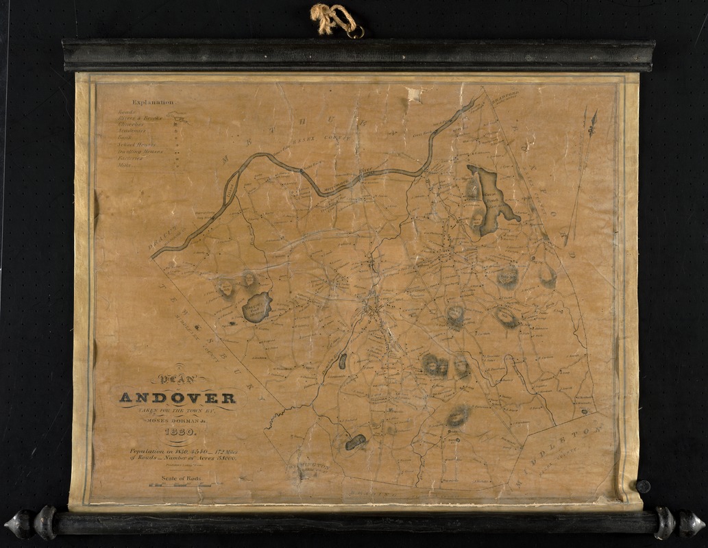
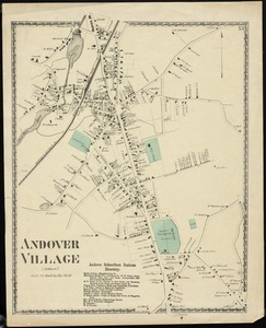
A plan of Andover taken for the town
A plan of Andover taken for the town
×
Item Information
Title:
A plan of Andover taken for the town
Creator:
Dorman, Moses
Contributor:
Pendleton's Lithography
Name on Item:
by Moses Dorman, Jr.
Date:
1830
Format:
Maps/Atlases
Location:
Phillips Academy
Archives and Special Collections
Collection (local):
Phillips Academy Archives and Special Collections
Subjects:
Real property
Landowners
Buildings, structures, etc.
Places:
Massachusetts
>
Essex (county)
>
Andover
Massachusetts
>
Essex (county)
>
North Andover
Massachusetts
>
Essex (county)
>
Lawrence
Extent:
1 map ; 40 x 51 cm.
Permalink:
https://ark.digitalcommonwealth.org/ark:/50959/r781wp53v
Terms of Use:
Rights status not evaluated.
Contact host institution for more information.
Publisher:
Boston : Pendleton's Lithogy
Scale:
Scale [ca. 1:41,140]
Language:
English
Notes:
Shows buildings with names of property owners.
Covers also town of North Andover and a portion of the City of Lawrence, Massachusetts.
Relief shown by hachures.
Includes 1830 statistics.
Identifier:
1513
show more...
View MODS XML
More Like This
Plan of real estate belonging to Phillips Academy, Andover Mass.
Map of the town of Methuen
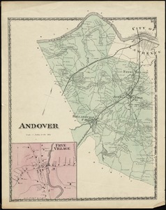
Andover
Andover Village : (Andover)
Find More Like This >>
Tools
Share
Facebook
Pinterest
X
Reddit
Tumblr
Email
Copy link
Add to Folder
Questions/Comments
Cite This Item
IIIF Manifest