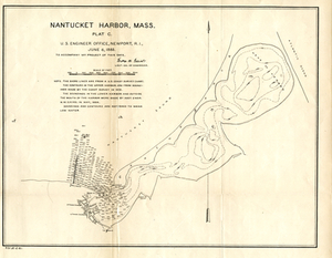
"The shore lines are from a U.S. Coast Survey Chart. The contours in the upper harbor are from soundings made by the Coast Survey in 1872. The soundings in the lower harbor and outside the mouth of the harbor were made by Asst. Engr. N.W. Eayrs, in May, 1884. Soundings and contours are referred to mean low water."