Skip to search
Skip to main content
Digital Commonwealth
Sign Up / Log In
Search for
Search
Search
Search
Basic
Advanced
Explore
Map
Collections
Institutions
Formats
For Educators
Primary Source Sets
Lesson Plans
Using Primary Sources
Searching Digital Commonwealth
For Institutions
Join Digital Commonwealth
Conferences, Trainings, & Events
How to Contribute Collections
Digitization Services
Board & Committees
Frequently Asked Questions
About
About Digital Commonwealth
News & Announcements
Copyright & Terms of Use
Harmful Content Statement
Partners
API
Contact Us
Williams College
Williams College and Williamstown Map Collection, 1876-1987
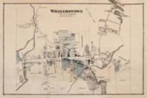
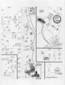
Map of Williamstown, circa 1876
View this item online at Williams College
Item Information
Title:
Map of Williamstown, circa 1876
Description:
Williamstown, Town of Williamstown, circa 1876
Date:
1876
Format:
Maps/Atlases
Location:
Williams College
Collection (local):
Williams College and Williamstown Map Collection, 1876-1987
Subjects:
Williamstown (Mass. : Town)
Places:
Massachusetts
>
Berkshire (county)
>
Williamstown
Link to Item:
http://unbound.williams.edu/williamsarchives/islandora/object/maps:13
Terms of Use:
Contact Archives and Special Collections at archives@williams.edu
Contact host institution for more information.
Language:
English
Notes:
Williams College Archives: Map Collection, large format
Identifier:
maps:13
local: DC2012_001_040
show more...
View MODS XML
More Like This
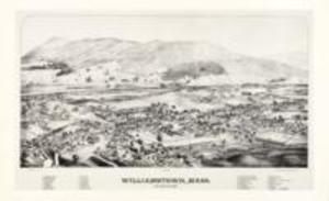
L.R. Burleigh
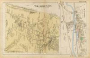
Miller
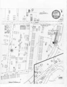
Sanborn Perris
Sanborn Perris
Find More Like This >>
Tools
Share
Facebook
Pinterest
X
Reddit
Tumblr
Email
Copy link
Add to Folder
Questions/Comments
Cite This Item