New Bedford Free Public Library
Map and Chart Collection
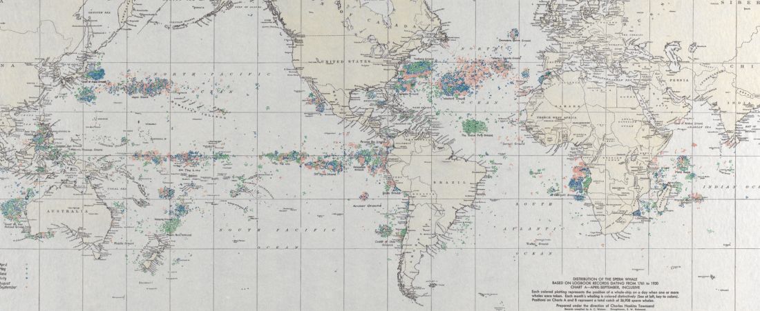
The Map and Chart Collection includes maps, nautical charts, and surveys from the greater New Bedford area and the world. Important records in this collection include recreations of survey maps of the Old Dartmouth area drawn from the field notes of Benjamin Crane, made 1710-1793, which provide the earliest comprehensive look at land ownership in New Bedford, Dartmouth, Westport, and Fairhaven. Another significant group is Maury's Wind and Current Charts and Whale Charts, which track winds, currents, and the number of whale species sighted in various zones of the ocean as reported by logbook records in the mid-19th century. Maps of New Bedford span several centuries, with the bulk of the material focusing on the late-19th and early-20th century.