This site will undergo maintenance on Monday 1/19 from 7AM-5PM and will be temporarily unavailable. We apologize for the inconvenience.
Skip to search
Skip to main content
Digital Commonwealth
Sign Up / Log In
Search for
Search
Search
Search
Basic
Advanced
Explore
Map
Collections
Institutions
Formats
For Educators
Primary Source Sets
Lesson Plans
Using Primary Sources
Searching Digital Commonwealth
For Institutions
How to Contribute Collections
Digitization Services
Frequently Asked Questions
Collection Development Policy
About
About Digital Commonwealth
News & Announcements
Copyright & Terms of Use
Harmful Content Statement
Partners
API
Contact Us
Westborough Public Library
Westborough Map Collection
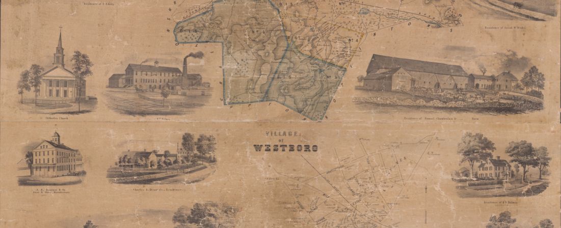
Detail from:
Map of the town of Westboro, Worcester Co., Mass. From an actual survey by G.M. Hopkins, C.E.
View All Items
or
Search for items from this collection...
Search
Search
The collection contains maps and atlases with a focus on Westborough and its surrounding areas.
Locations in this Collection:
Browse by:
Subject
Churches
1
Dwellings
1
Place
Massachusetts
2
North and Central America
2
United States
2
Westborough
2
Worcester (county)
2
Format
Maps/Atlases
2
Available to use
No known restrictions
2
Date
View distribution
Current results range from
1855
to
1878
Date range begin
Date range end
View larger »