Massachusetts Archives
Massachusetts Metropolitan District Water Supply Commission, Quabbin Reservoir, Photographs of Cemeteries, 1928-1945
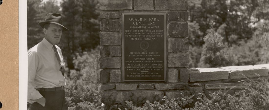
As part of its function to design and construct the Quabbin Reservoir, Dam and Aqueduct (a water supply reservoir for Boston and the metropolitan area), the Metropolitan District Water Supply Commission (1926-1947), a special construction state agency, was required per the Massachusetts Acts of 1927, chapter 321, section 9 to remove interred bodies within cemeteries within the bounds of the Quabbin Reservoir Watershed, and to establish a cemetery to reinter the bodies from the multiple cemeteries. There were approximately 7,500 bodies in 34 cemeteries to be addressed. The new 30-acre cemetery was built in Ware, MA, 2.5 miles from the Quabbin Reservoir Administration Building, Belchertown. Its landscape was designed by Arthur A. Shurcliff (1870-1957). On May 18, 1932, the MDWSC named the new cemetery Quabbin Park Cemetery, which officially opened on August 25, 1932. On October 4, 1944, the cemetery removals from the former cemeteries were completed. Per the Acts of 1939, chapter 176, the MDWSC was authorized to transfer management of Quabbin Park Cemetery to the Metropolitan District Commission (1919-2003) at the completion of the work of the MDWSC, which it did in 1947, per the Acts of 1947, chapter 583. The Cemetery was managed by the MDC, Water Division (1919-1985), Quabbin Section; the MDC, Division of Watershed Management (1985-2003), Quabbin Section; and, since 2003, by the Department of Conservation and Recreation, Division of Water Supply Protection, Office of Watershed Management, Quabbin Region.
Between 1926 and 1932, the MDWSC referred to the new water supply reservoir as the Swift River Reservoir. On October 25, 1932, the MDWSC officially renamed it the Quabbin Reservoir. On April 28, 1938, 4 Massachusetts towns were disincorporated: Dana, Enfield, Greenwich, and Prescott. The boundaries of 6 towns and 3 counties were also relocated on this date.
Beginning in 1927, the MDWSC began a census of the burials in all of the affected cemeteries.
This collection consists of 2,083 photographic prints (5 x 7 inches) and 26 engineering plans.
Each cemetery lot was photographed by the MDWSC engineering photographers, and the photos were supplied with a caption (called ‘titling’ by the engineering photographers).
The photographic prints were annotated by the MDWSC indicating the lot number in the new Quabbin Park Cemetery, or indicating its release to another cemetery. Of the approximately 7,500 bodies, 945 (12.6 percent) were relocated to “outside cemeteries.”
The MDWSC engineers created layout plans of the former cemeteries, and 22 of these plans were also annotated with the photograph numbers. Three MDWSC general plans of the Quabbin Reservoir were also annotated with the location of the cemeteries.
In addition to cemeteries in the 4 disincorporated towns, there are cemeteries in the towns of Belchertown, New Salem, Pelham, Petersham, and Shutesbury.
The digital access project was lead jointly by the Massachusetts Department of Conservation and Recreation (Archives) and the Massachusetts Water Resources Authority (Library), co-operators of the water supply system for greater Boston, and in cooperation with the Massachusetts Archives, and the Department of Conservation and Recreation, Division of Water Supply Protection, Office of Watershed Management.