Search Results

2. Address by Senator Paul Tsongas at Conference on Economic Development and the Role of Investment in Angola, Mozambique, Guinea-Bissau, Cape Verde, Sao Tome & Principe

3. African Liberation; Say Brother National Edition; Say Brother National Edition: African Liberation

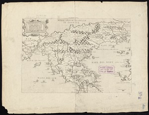
4. L'Afrique, colle tracce degli antichi e recenti viaggi si marittimi che terrestri degli Europei in essa
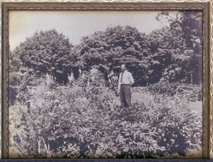
5. Antone Cruz in Queen's Garden Converse Estate, Marion, Massachusetts

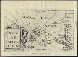
6. Archipelagus Atlanticus cum suis insulis Canariis, Hesperidibus et Azoribus

7. Assassination of Amilcar Cabral

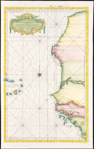
8. Barbariae et Guineae maritimi à freto Gibraltar ad fluvium Gambiae cum Insulis Salfis Flandrisis et Canaricis

9. Bocche del Fiume Negro et Isole di Cape Verde : possedute dà Portoghesi, scoperte da Antonio di Nola Genouese nell' anno 1440, ouero 1460, sotto la protettione...
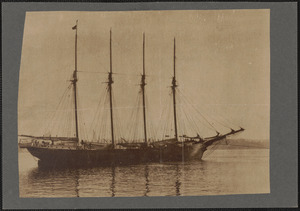
10. Bon voyage, here is the schooner Burkeland
![Camara Family Photograph Collection [c. 1917-1929]](https://bpldcassets.blob.core.windows.net/derivatives/metadata/commonwealth-oai:wm11d7104/image_thumbnail_300.jpg)
11.
Camara Family Photograph Collection [c. 1917-1929]
During the summer of 1989, the Camara Family donated a collection of glass plate negatives to UMass Lowell Libraries Center for Lowell History. These negatives record life in the Portuguese Community of greater Lowell, circa 1920-1925. The identities of the people in the photographs remain a... more

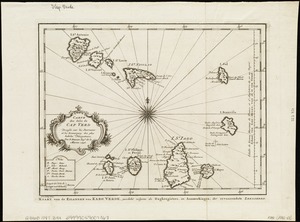
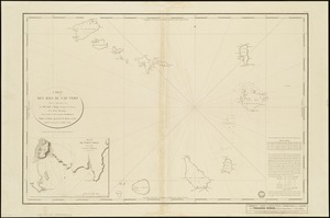
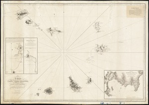
12. The Cape Verd Islands : laid down from the remarks and observations of experienced navigators

13. The Cape Verd Islands, laid down from the remarks and observations of experienced navigators

14. The Cape Verd Islands, laid down from the remarks and observations of experienced navigators
15. Cape Verde, 1987
16. Cape Verde, 1987
17. Cape Verde II

18. Cape Verde Islands, Porto Grande in the island of St. Vincent
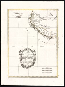
19. Carte de la Guinée : contenant les Isles du Cap Verd, le Senegal, la Côte de Guinée proprement dite, les Royaumes de Loango, Congo, Angola et Benguela, avec les...
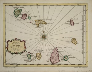
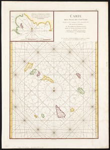
20. Carte des Isles du Cap Verd
21. Carte des Isles du Cap Verd = Kaart van de Eilanden van Kabo Verde, geschikt volgens de Daghregisters, en Aanmerkingen, der ervaarendste Zeelieden
22. Carte des Isles du Cap Verd : levée en 1819 1820 et 1822
23. Carte des isles du Cap-Verd : dressée sur les remarques et les observations les plus exactes des navigateurs
24. Carte reduite des costes occidentales d'Afrique : seconde feuille depuis le Cap Bojador jusqu'a la Riviere de Sierra Léona

25. A chart of the Atlantick Ocean describing the Coast of Africa from Cape Teffalana to Cape Formosa
26. A chart of the Cape Verd Islands

27. A chart of the Cape Verd Islands

28. A chart of the coast of Barbaria with the western, Canaria, & Cape de Verd, isles

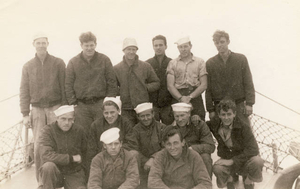
29. A chart of the western coast of Africa, from the Straits of Gibraltar to eleven degrees of north latitude : including the Canary & Cape Verd Islands

30. Coste occidentale d'Afrique, depuis le Détroit de Gibraltar jusqu' au XIe dégré de latitude septentrionale : tirée de la carte de l'Océan Occidental
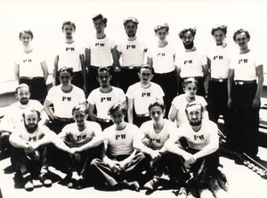
31. Crew of the U-66 German sub that was sunk by the U.S.S. Buckley DE51

32. De cust van Barbaria, Gualata, Arguyn en Geneheo van Capo S Vincente tot Capo Verde
33. Depth Charge Gang on U.S.S. Buckley DE51
34. Il disegno del discoperto della noua Franza : ilquale s'è hauuto ultimamente dalla nouissima nauigatione dè Franzesi in quel luogo: nel quale si uedono tutti...

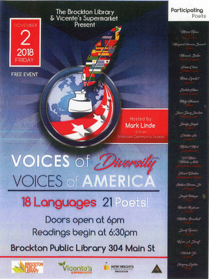
35. Eiland van St. Filippus, of van Fuego, met zyn vuurberg = Ile de St. Philipe ou de Fuego avec son volcan
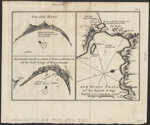
36. Eyland Mayo ; Aussicht des eylandes S. Jago od. St Jacob und der stadt St Jago od. Ribeyro Grande ; Der hafen Praya auf dem eylande St Jago
37. Flyer for the first Voices of Diversity, Voices of America
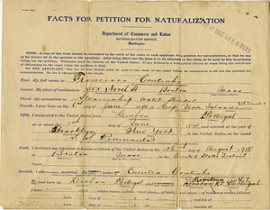
38. Francisco Coutinho facts for naturalization
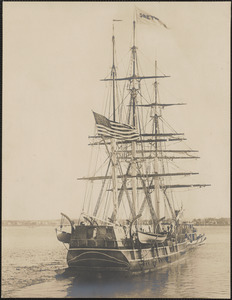
39. From strange seas, the Arcturus

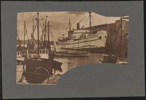
40. Gezigt van Porto Grande, in 't eiland St. Vincent = Vüe de Porto Grande dans l'ile de St. Vincent
41. The grand panorama of a whaling voyage ‘round the world
42. Greyhound being towed out in the stream

43. Grondtekening van de stad en forten van St. Iago = Plan de la ville et des forts de St. Yago

44. Grundriss der stadt und der forts von St. Jago od. Jacob

45. Grundriss von der bay der insel St. Vincent einer von den Eylanden des grünen Vorgebirges

46. Guinea Bissau Conflict

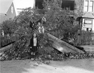
47. High school days
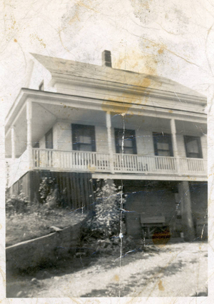
48. The house on the hill
49.
Hurricane, September 21, 1938
The Great New England Hurricane of 1938 was one of the most destructive and powerful storms ever to strike southern New England. This system developed in the far eastern Atlantic, near the Cape Verde Islands on September 4. It made a 12-day journey across the Atlantic and up the eastern seaboard... more