Skip to search
Skip to main content
Skip to first result
Digital Commonwealth
Folders
Sign Up / Log In
Search for
Search
Search
Search
Basic
Advanced
Explore
Map
Collections
Institutions
Formats
For Educators
Primary Source Sets
Lesson Plans
Using Primary Sources
Searching Digital Commonwealth
For Institutions
Join Digital Commonwealth
Conferences, Trainings, & Events
How to Contribute Collections
Digitization Services
Board & Committees
Frequently Asked Questions
About
About Digital Commonwealth
News & Announcements
Copyright & Terms of Use
Harmful Content Statement
Partners
API
Contact Us
Search
Search Constraints
Start Over
Save Search
Your search:
map
✖
Remove constraint map
« Prev.
|
61
-
80
of
34,036
|
Next »
Sort
by relevance
relevance
title
date (asc)
date (desc)
Number of results to display per page
20
per page
per page
10
per page
20
per page
50
per page
100
per page
View results as:
List
list view
Maps
map view
Gallery
grid view
Search Results
61.
Map of Honolulu
62.
Trans-continental map : showing the main lines and proposed extensions of the various trans-continental railroad systems of the...
63.
Map of Scotland
64.
Victory map 1919
65.
Peters World map
66.
Map of Indiana
67.
Queensland road map
68.
Map of Hawaii
69.
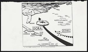
Weather Hurricane Maps
70.
Massachusetts Turnpike map : the main street of Massachusetts
71.
Map of Liberia
72.
Maps of Europe
73.
Map of China : compiled from original surveys & sketches
74.
Lloyd's military maps : showing the principal places of interest
75.
Map of Manitoba
76.
Map of Boston : showing health districts and undrained and filled land
77.
Map of Manitoba
78.
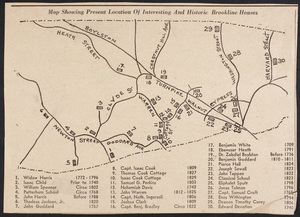
Maps of Beverly
79.
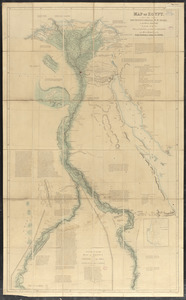
Map of Egypt
80.
Map 1709-1829
« Previous
Next »
1
2
3
4
5
6
7
8
…
1,701
1,702
Limit your search
Subject
Land use--Massachusetts
10,047
Maps--Massachusetts
10,047
Real property--Massachusetts--Boston--Maps
2,356
Boston (Mass.)--Maps
2,182
Landowners--Massachusetts--Boston--Maps
2,154
Roads
1,693
Cities and towns
1,683
Land use mapping
1,680
more
Subject
»
Place
North and Central America
28,473
United States
26,769
Massachusetts
21,398
Suffolk (county)
4,765
Boston
4,604
Essex (county)
2,467
Massachusetts--Worcester County
1,926
Middlesex (county)
1,638
more
Place
»
Format
Maps/Atlases
20,380
Photographs
11,563
Prints
8,859
Manuscripts
2,431
Documents
437
Books
389
Drawings/Illustrations
332
Letters/Correspondence
329
more
Format
»
Available to use
No known restrictions
17,200
Creative Commons license
2,094
Date
View distribution
Current results range from
1482
to
2023
Date range begin
Date range end
View larger »
Unknown
585
Collection
Norman B. Leventhal Map Center Collection
11,713
William P. MacConnell Aerial Photograph Collection, ca. 1950-2000
10,047
Boston and New England Maps (Collection of Distinction)
5,680
Urban Maps (Collection of Distinction)
5,273
Land study maps, 1936-1937
1,680
Maritime Charts and Atlases (Collection of Distinction)
1,110
American Revolutionary War-Era Maps (Collection of Distinction)
848
Lawrence, Mass. Engineering Department. City Sewers
717
more
Collection
»
Institution
Boston Public Library
12,653
Special Collections and University Archives, University of Massachusetts Amherst Libraries
10,535
Massachusetts Archives
2,659
Lawrence Public Library
1,496
Harvard University
724
State Library of Massachusetts
719
New Bedford Free Public Library
487
Historic New England
354
more
Institution
»