Skip to search
Skip to main content
Skip to first result
Digital Commonwealth
Folders
Sign Up / Log In
Search for
Search
Search
Search
Basic
Advanced
Explore
Map
Collections
Institutions
Formats
For Educators
Primary Source Sets
Lesson Plans
Using Primary Sources
Searching Digital Commonwealth
For Institutions
Join Digital Commonwealth
Conferences, Trainings, & Events
How to Contribute Collections
Digitization Services
Board & Committees
Frequently Asked Questions
About
About Digital Commonwealth
News & Announcements
Copyright & Terms of Use
Harmful Content Statement
Partners
API
Contact Us
Search
Search Constraints
Start Over
Save Search
Your search:
ludlow, mass
✖
Remove constraint ludlow, mass
« Prev.
|
41
-
60
of
74
|
Next »
Sort
by relevance
relevance
title
date (asc)
date (desc)
Number of results to display per page
20
per page
per page
10
per page
20
per page
50
per page
100
per page
View results as:
List
list view
Maps
map view
Gallery
grid view
Search Results
41.
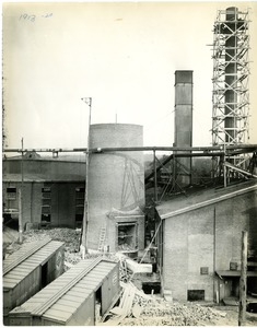
Ludlow Manufacturing Company 1913
42.
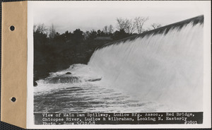
View of main dam spillway, Ludlow Manufacturing Association, Red Bridge, Chicopee River, looking northeasterly, Ludlow and...
43.
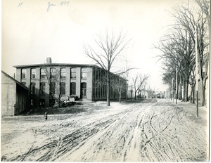
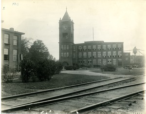
Ludlow Manufacturing Company : Mill no. 7
44.
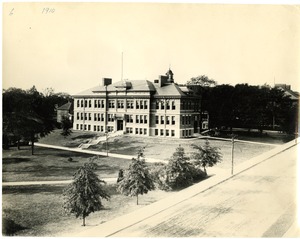
Ludlow High School, 1910.
45.
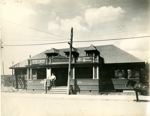
Ludlow Waiting Room
46.
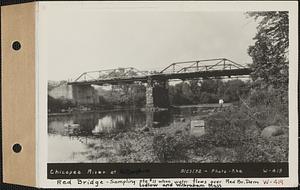
Chicopee River at Red Bridge, sampling Station #11, when water flows over Red Bridge dam, Ludlow and Wilbraham, Mass., Sep. 23,...
47.
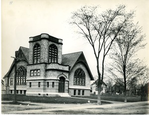
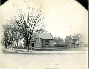
Methodist Church
48.
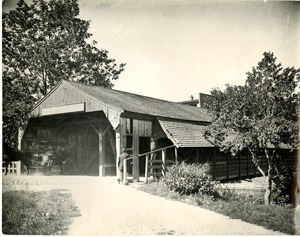
Putts Bridge 1897
49.
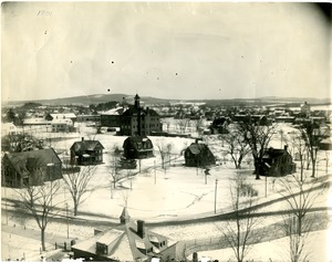
Park Place
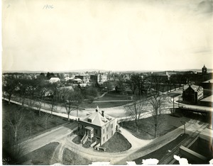
50.
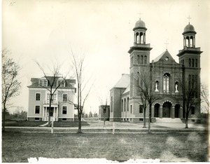
Saint John the Baptist Church
51.
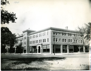
Business Block
52.
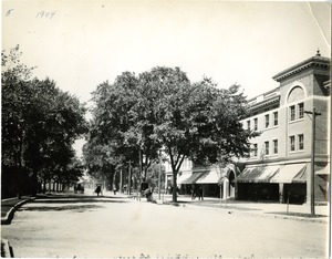
East Street 1904
53.
Textile School
54.
Mill no. 8
55.
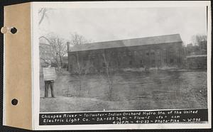
Chicopee River, tailwater, Indian Orchard hydroelectric station of the United Electric Light Co., drainage area = 686 square...
56.
Hubbard Memorial Library
57.
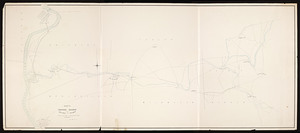
Route of proposed railroad between Holyoke and Palmer / surveyed by Alfred R. Field, engineer.
58.
The Homestead : Delightful luncheons and dinners, with a pleasing atmosphere withal. Overnight and permanent guests... Lilian...
59.
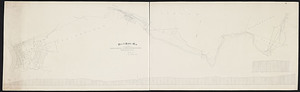
Plan and profile map of the extension of the Springfield, Athol and Northeastern Railroad
60.
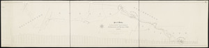
Plan and profile of route of proposed railroad: Belchertown to Chicopee Falls / Geo. A. Ellis, engineer.
« Previous
Next »
1
2
3
4
Limit your search
Subject
waterworks
32
real estate
28
rivers
27
watershed sanitary conditions
27
floods (natural events)
25
dams (hydraulic structures)
15
New England Hurricane, 1938
13
Ludlow Manufacturing Company
11
more
Subject
»
Place
North and Central America
68
United States
68
Massachusetts
67
Hampden (county)
65
Ludlow
59
Chicopee
36
Springfield
6
Palmer
5
more
Place
»
Format
Photographs
57
Letters/Correspondence
7
Manuscripts
5
Maps/Atlases
5
Postcards/Cards
4
Ephemera
3
Available to use
No known restrictions
32
Creative Commons license
6
Date
View distribution
Current results range from
1861
to
2002
Date range begin
Date range end
View larger »
Collection
Massachusetts Metropolitan District Water Supply Commission, Quabbin Reservoir, Photographs of Real Estate, Sanitary Conditions, and Flooding in the Ware River Watershed, and of General Engineering, 1928-1948
28
Photo Archives
22
Sacco-Vanzetti Defense Committee (Collection of Distinction)
5
Massachusetts Metropolitan District Water Supply Commission, Quabbin Reservoir, Photographs of Real Estate in the Swift River Valley, and of General Engineering of Quabbin Reservoir, 1927-1950
4
Massachusetts Board of Railroad Commissioners
3
Ephemera collection (EP001)
2
American Textile History Museum Image Collection
1
Boston Herald-Traveler Photo Morgue
1
more
Collection
»
Institution
Massachusetts Archives
32
Hubbard Memorial Library
22
Boston Public Library
6
State Library of Massachusetts
4
Historic New England
3
Special Collections and University Archives, University of Massachusetts Amherst Libraries
2
American Textile History Museum
1
Chicopee Public Library
1
more
Institution
»