Search


Limit your search
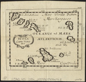
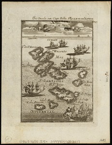
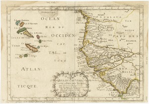
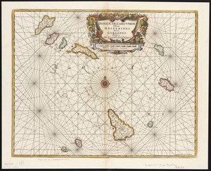
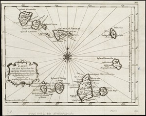
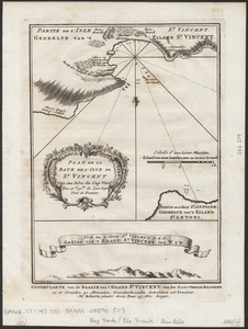
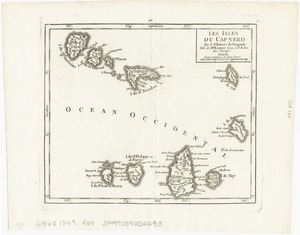
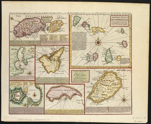
- Cape Verde--Maps--Early works to 180032
- Africa, West--Maps--Early works to 18009
- Nautical charts--Early works to 18006
- Atlantic Coast (Africa)--Maps--Early works to 18005
- Canary Islands--Maps--Early works to 18005
- Community development, Urban--Massachusetts--Boston5
- Dorchester (Boston, Mass.)5
- Dudley Street Neighborhood Initiative5
- Norman B. Leventhal Map Center Collection54
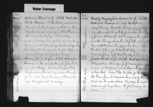
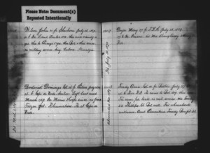
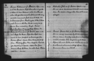
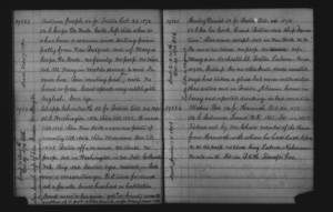
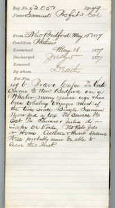
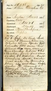
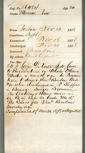
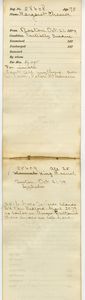
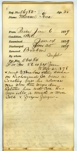
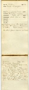
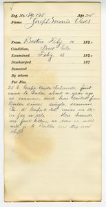
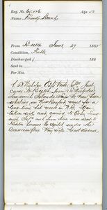
- Tewksbury Almshouse Intake Records [1854-1884]24
- Maritime Charts and Atlases (Collection of Distinction)19
- Mass. Memories Road Show14
- Oral History Collections5
- American Archive of Public Broadcasting Collection3
- Lawrence Sykes Collection3
- Paul Tsongas Digital Archives3