Skip to search
Skip to main content
Skip to first result
Digital Commonwealth
Folders
Sign Up / Log In
Search for
Search
Search
Search
Basic
Advanced
Explore
Map
Collections
Institutions
Formats
For Educators
Primary Source Sets
Lesson Plans
Using Primary Sources
Searching Digital Commonwealth
For Institutions
Join Digital Commonwealth
Conferences, Trainings, & Events
How to Contribute Collections
Digitization Services
Board & Committees
Frequently Asked Questions
About
About Digital Commonwealth
News & Announcements
Copyright & Terms of Use
Harmful Content Statement
Partners
API
Contact Us
Search
Search Constraints
Start Over
Save Search
Your search:
More Like
commonwealth-oai:z029pn16p
✖
Remove constraint More Like: commonwealth-oai:z029pn16p
« Prev.
|
501
-
520
of
534
|
Next »
Sort
by relevance
relevance
title
date (asc)
date (desc)
Number of results to display per page
20
per page
per page
10
per page
20
per page
50
per page
100
per page
View results as:
List
list view
Maps
map view
Gallery
grid view
Search Results
501.
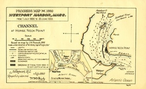
Progress Map for 1893, Westport Harbor, Mass.: From 1. July 1892 to 30. June 1893.
502.
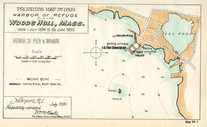
Progress Map for 1895, Harbor of Refuge Woods Holl, Mass.: from 1. July 1894 to 30. June 1895
503.
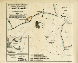
Proposed Work, Harbor of Refuge at Hyannis, Mass.
504.
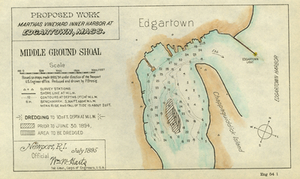
Proposed Work, Martha's Vineyard Inner Harbor at Edgartown, Mass.: Middle Ground Shoal
505.
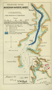
Proposed Work, Wareham, Mass.
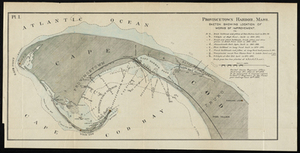
506.
Provincetown Harbor, Mass.
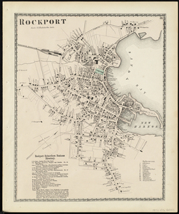
507.
Rockport
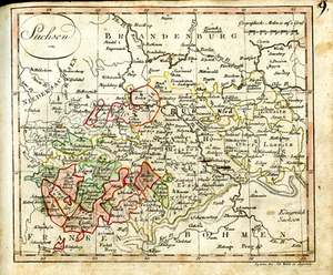
508.
Sachsen
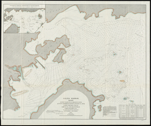
509.
Salem Harbor, Mass. Survey Made in Accordance with Act of Congress Dated August 17, 1894
510.
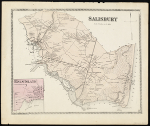
Salisbury
511.
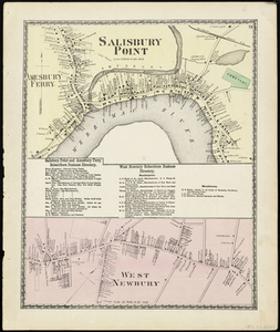
Salisbury Point
512.
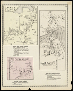
Saugus Center
513.
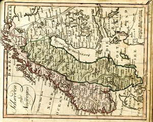
Schweden und Norwegen
514.
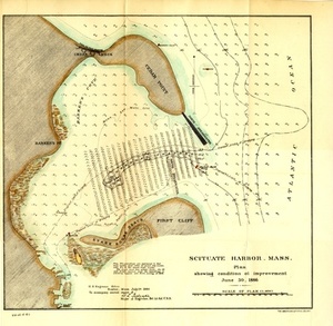
Scituate Harbor, Mass.: Plan Showing Condition of Improvement, June 30, 1886
515.
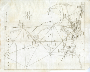
Sketch A. Illustrating the Progress of the Eastern Section of the Survey of the Coast in 1845.
516.
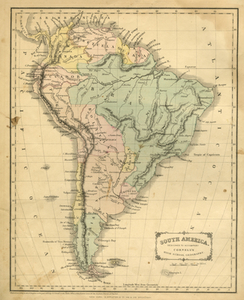
South America: Designed to Accompany Cornell's High School Geography
517.
[Southern Hemisphere]
518.
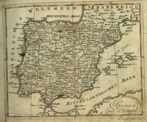
Spanien und Portugal
519.
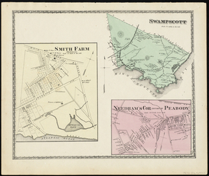
Swampscott
520.
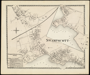
Swampscott
« Previous
Next »
1
2
…
22
23
24
25
26
27
Limit your search
Subject
Massachusetts--Maps
271
Massachusetts
236
Boston (Mass.)--Maps
94
Boston
74
Coastal
73
Essex county
64
Rhode Island--Maps
46
Railroads--Massachusetts--Maps
40
more
Subject
»
Place
North and Central America
500
Massachusetts
425
United States
367
Suffolk (county)
111
Boston
110
Essex (county)
99
Rhode Island
47
Beverly
30
more
Place
»
Format
Maps/Atlases
532
Manuscripts
3
Books
1
Prints
1
Available to use
No known restrictions
196
Creative Commons license
12
Date
View distribution
Current results range from
1631
to
2020
Date range begin
Date range end
View larger »
Unknown
2
Collection
Historic Maps
278
Norman B. Leventhal Map Center Collection
204
Boston and New England Maps (Collection of Distinction)
167
David Judkins Weaver Papers
18
American Revolutionary War-Era Maps (Collection of Distinction)
13
Urban Maps (Collection of Distinction)
11
Massachusetts Board of Harbor and Land Commissioners
10
Massachusetts Board of Railroad Commissioners
9
more
Collection
»
Institution
Salem State University Archives and Special Collections
278
Boston Public Library
204
State Library of Massachusetts
33
Phillips Academy
8
American Antiquarian Society
6
Private Collection
3
Massachusetts Historical Society
1
Melrose Public Library
1
![[Southern Hemisphere]](https://bpldcassets.blob.core.windows.net/derivatives/metadata/commonwealth-oai:bn999f03w/image_thumbnail_300.jpg)