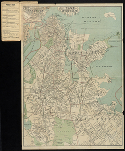
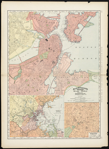
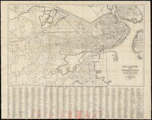
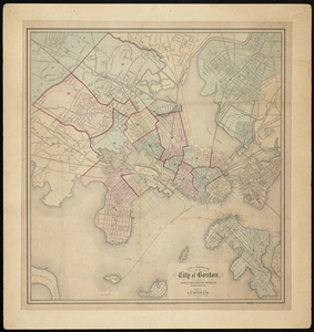
1. Latest map of Boston City, Massachusetts Creator: Geo. H. Walker & Co Format: Maps/Atlases Collection: Historic Maps Date: 1892 Institution: Salem State University Archives and Special Collections
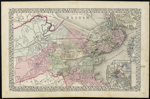
2. Plan of Boston Creator: Mitchell, S. Augustus Format: Maps/Atlases Collection: Historic Maps Date: 1890 Institution: Salem State University Archives and Special Collections
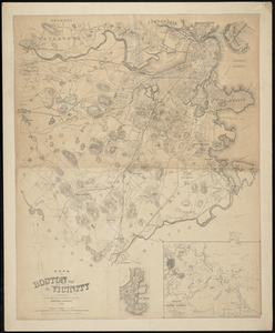
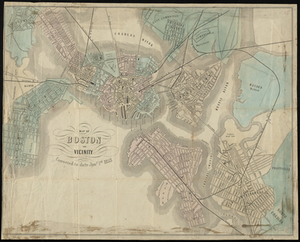
3. Plan of Boston and its Vicinity Prepared from the Best Authorities for the Boston Almanac Creator: George Coolidge; N.S. Dearborn Format: Maps/Atlases Collection: Historic Maps Date: 1868 Institution: Salem State University Archives and Special Collections
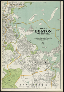
4. Map of Boston and Suburbs Creator: Walker Lith. & Pub. Co Format: Maps/Atlases Collection: Historic Maps Date: 1909 Institution: Salem State University Archives and Special Collections
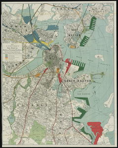
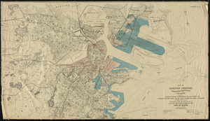
5. Map to Accompany Report of State Board on Docks and Terminal Facilities: Showing Existing Conditions and Proposed Changes at the Port of Boston Creator: Geo. H. Walker & Co Format: Maps/Atlases Collection: Historic Maps Date: 1896 Institution: Salem State University Archives and Special Collections
6. Map of Boston Creator: Rand, McNally & Co Format: Maps/Atlases Collection: Historic Maps Date: 1891 Institution: Salem State University Archives and Special Collections
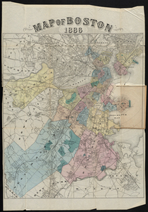
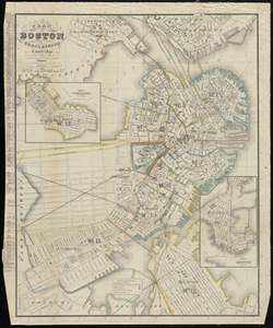
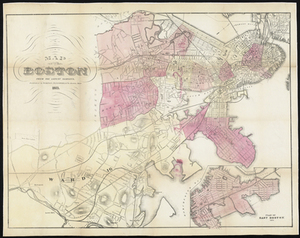
7. Map of Boston 1886 Creator: W.A. Greenough & Co Format: Maps/Atlases Collection: Historic Maps Date: 1886 Institution: Salem State University Archives and Special Collections
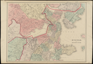
8. Boston and Adjacent Cities Creator: O.W. Gray & Son Format: Maps/Atlases Collection: Historic Maps Date: 1884 Institution: Salem State University Archives and Special Collections
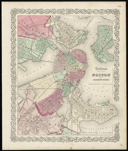
9. Colton's Map of Boston and Adjacent Cities. Creator: J.H. Colton & Co Format: Maps/Atlases Collection: Historic Maps Date: 1855 Institution: Salem State University Archives and Special Collections
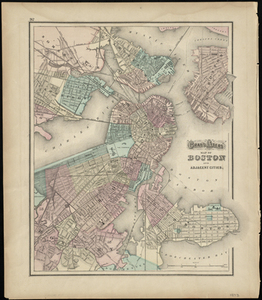
10. Gray's Atlas Map of Boston and Adjacent Cities Creator: Ormando Willis Gray Format: Maps/Atlases Collection: Historic Maps Date: 1873 Institution: Salem State University Archives and Special Collections
11. Plan of Boston: Comprising a Part of Charlestown and Cambridge Creator: George Girdler Smith Format: Maps/Atlases Collection: Historic Maps Date: 1855 Institution: Salem State University Archives and Special Collections
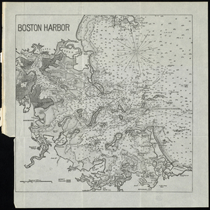
12. Boston Harbor Creator: Rockwell & Churchill, City Printers Format: Maps/Atlases Collection: Historic Maps Date: 1891 Institution: Salem State University Archives and Special Collections
13. Map of Boston, 1875, After the Latest Surveys, with All the Improvements in Progress. A Complete Guide to Strangers. Creator: L. Prang & Co Format: Maps/Atlases Collection: Historic Maps Date: 1875 Institution: Salem State University Archives and Special Collections
14. Map of Boston from the Latest Surveys Creator: Sampson, Davenport & Co; J. Mayer & Co Format: Maps/Atlases Collection: Historic Maps Date: 1873 Institution: Salem State University Archives and Special Collections
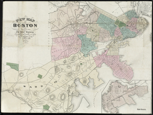
15. New Map of Boston Compiled from the Latest Surveys Creator: A. Williams & Co; Mayer & Co Format: Maps/Atlases Collection: Historic Maps Date: 1870 Institution: Salem State University Archives and Special Collections
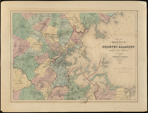
16. Map of Boston and the Country Adjacent, from Actual Surveys Creator: Henry Francis Walling Format: Maps/Atlases Collection: Historic Maps Date: 1872 Institution: Salem State University Archives and Special Collections
17. Map of Boston and vicinity Creator: King & Haven Format: Maps/Atlases Collection: Historic Maps Date: 1853 Institution: Salem State University Archives and Special Collections
18. A New & Complete Map of the City of Boston, with part of Charlestown, Cambridge, Brookline, Dorchester &c. Creator: E.P. Dutton Format: Maps/Atlases Collection: Historic Maps Date: 1868 Institution: Salem State University Archives and Special Collections
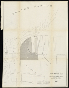
19. Plan of South Boston Flats Showing Location of Sea Walls and Area of Excavations and Filling Creator: Board of Harbor and Land Commissioners of Massachusetts Format: Maps/Atlases Collection: Historic Maps Date: 1876 Institution: Salem State University Archives and Special Collections
20. Map of Boston Proper. Charlestown, South Boston and East Boston Showing Original Territory of Old Boston, the Areas Filled and Reclaimed from Tide Water and the Areas... Creator: Geo. H. Walker & Co Format: Maps/Atlases Collection: Historic Maps Date: 1894 Institution: Salem State University Archives and Special Collections