Skip to search
Skip to main content
Skip to first result
Digital Commonwealth
Folders
Sign Up / Log In
Search for
Search
Search
Search
Basic
Advanced
Explore
Map
Collections
Institutions
Formats
For Educators
Primary Source Sets
Lesson Plans
Using Primary Sources
Searching Digital Commonwealth
For Institutions
Join Digital Commonwealth
Conferences, Trainings, & Events
How to Contribute Collections
Digitization Services
Board & Committees
Frequently Asked Questions
About
About Digital Commonwealth
News & Announcements
Copyright & Terms of Use
Harmful Content Statement
Partners
API
Contact Us
Search
Search Constraints
Start Over
Save Search
Your search:
More Like
commonwealth-oai:ww72bk148
✖
Remove constraint More Like: commonwealth-oai:ww72bk148
« Prev. |
1
-
20
of
391
|
Next »
Sort
by relevance
relevance
title
date (asc)
date (desc)
Number of results to display per page
20
per page
per page
10
per page
20
per page
50
per page
100
per page
View results as:
List
list view
Maps
map view
Gallery
grid view
Search Results
1.
Atlas of the boundaries of the cities of Chicopee and Springfield and towns of Brimfield, East Longmeadow, Hampden, Holland,...
2.
Map of the Hampden Railroad in connection with the Western and Canal roads / W.H. and H.M. Butler, engineers.
3.
Atlas of the boundaries of the towns of Amherst, Enfield, Greenwich, Hadley, Pelham, Prescott, Hampshire County : Leverett,...
4.
Atlas of Massachusetts
5.
Atlas of Springfield City, Massachusetts
6.
Atlas of Springfield city, Massachusetts
7.
Atlas of the boundaries of the city of Springfield, Hampden County
8.
Atlas of the city of Springfield and the town of Longmeadow, Massachusetts
9.
Atlas of the city of Springfield and the town of Longmeadow, Massachusetts : based upon, and carefully compiled from official...
10.
Atlas of the city of Springfield Massachusetts
11.
Indian Orchard
12.
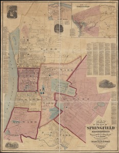
Map of Springfield, Massachusetts
13.
Map of the city of Springfield Massachusetts
14.
Massachusetts official transportation map
15.
Massachusetts Turnpike map : the main street of Massachusetts
16.
Plan of Springfield
17.
The Price & Lee Co's map of the city of Springfield Mass.
18.
Richards standard atlas of the city of Springfield and the town of Longmeadow, Massachusetts
19.
Richards Standard atlas of the city of Springfield and the town of Longmeadow, Massachusetts
20.
Richards standard atlas of the city of Springfield and the town of Longmeadow, Massachusetts [plate 1]
« Previous
Next »
1
2
3
4
5
…
19
20
Limit your search
Subject
Railroads--Massachusetts
59
Springfield (Mass.)--Maps
23
Railroads--Massachusetts--Maps
13
Real property--Massachusetts--Springfield--Maps
13
Massachusetts--Maps
12
Longmeadow (Mass.)--Maps
8
Old Colony Railroad
8
Boston and Maine Railroad--Maps
7
more
Subject
»
Place
North and Central America
391
United States
390
Massachusetts
360
Middlesex (county)
91
Suffolk (county)
74
Boston
73
Worcester (county)
50
Norfolk (county)
47
more
Place
»
Format
Maps/Atlases
291
Documents
99
Manuscripts
2
Books
1
Available to use
No known restrictions
15
Date
View distribution
Current results range from
1827
to
2005
Date range begin
Date range end
View larger »
Unknown
55
Collection
Massachusetts Board of Railroad Commissioners
368
Norman B. Leventhal Map Center Collection
15
Boston and New England Maps (Collection of Distinction)
10
Urban Maps (Collection of Distinction)
8
Massachusetts Real Estate Atlases
5
Massachusetts Board of Harbor and Land Commissioners
3
Institution
State Library of Massachusetts
376
Boston Public Library
15


![Richards standard atlas of the city of Springfield and the town of Longmeadow, Massachusetts [plate 1]](https://bpldcassets.blob.core.windows.net/derivatives/images/commonwealth:3f463814r/image_thumbnail_300.jpg)