Skip to search
Skip to main content
Skip to first result
Digital Commonwealth
Folders
Sign Up / Log In
Search for
Search
Search
Search
Basic
Advanced
Explore
Map
Collections
Institutions
Formats
For Educators
Primary Source Sets
Lesson Plans
Using Primary Sources
Searching Digital Commonwealth
For Institutions
Join Digital Commonwealth
Conferences, Trainings, & Events
How to Contribute Collections
Digitization Services
Board & Committees
Frequently Asked Questions
About
About Digital Commonwealth
News & Announcements
Copyright & Terms of Use
Harmful Content Statement
Partners
API
Contact Us
Search
Search Constraints
Start Over
Save Search
Your search:
More Like
commonwealth-oai:pc289q96g
✖
Remove constraint More Like: commonwealth-oai:pc289q96g
« Prev. |
1
-
20
of
224
|
Next »
Sort
by relevance
relevance
title
date (asc)
date (desc)
Number of results to display per page
20
per page
per page
10
per page
20
per page
50
per page
100
per page
View results as:
List
list view
Maps
map view
Gallery
grid view
Search Results
1.
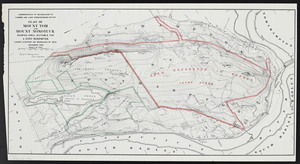
Plan of Mount Tom and Mount Nonotuck: showing area suitable for a state reservation
2.
Atlas of the city of Northampton and the town of Easthampton, Hampshire County, Massachusetts
3.
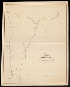
Map of the proposed railroad route from Connecticut State line to the Western railroad in Westfield.
4.
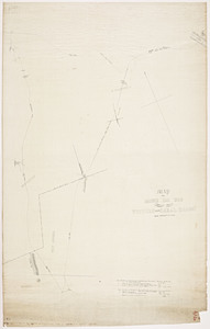
Map of the Hampden Railroad in connection with the Western and Canal roads / W.H. and H.M. Butler, engineers.
5.
Map of the Hampden Railroads in connection with the Western and Canal roads.
6.
Atlas of Massachusetts
7.
Chester
8.
Huntington
9.
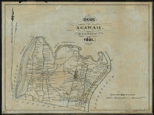
A plan of Agawam
10.
Russell
11.
Atlas of Northampton City, Massachusetts
12.
Atlas of Westfield town, Massachusetts
13.
Atlas of Westfield town, Massachusetts
14.
Westfield
15.
A plan of West Springfield
16.
Atlas of Holyoke City, Massachusetts
17.
Atlas of Holyoke City, Massachusetts
18.
Bird's eye view of the city of Holyoke, and village of South Hadley Falls, Mass. looking north
19.
Combined map of Holyoke and Chicopee
20.
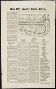
Plan of the new city at Hadley Falls
« Previous
Next »
1
2
3
4
5
…
11
12
Limit your search
Subject
Harbors--Massachusetts--Boston--Maps
58
Boston (Mass.)--Maps
11
Massachusetts--Maps
11
Holyoke (Mass.)--Maps
9
Boston Harbor (Mass.)--Maps
8
Charles River (Mass.)--Maps
7
Connecticut River--Maps
7
Connecticut--Maps
7
more
Subject
»
Place
North and Central America
224
United States
223
Massachusetts
204
Suffolk (county)
82
Boston
78
Plymouth (county)
31
Middlesex (county)
24
Barnstable (county)
22
more
Place
»
Format
Maps/Atlases
180
Books
44
Manuscripts
5
Photographs
2
Available to use
No known restrictions
15
Date
View distribution
Current results range from
1831
to
1921
Date range begin
Date range end
View larger »
Unknown
4
Collection
Massachusetts Board of Harbor and Land Commissioners
202
Norman B. Leventhal Map Center Collection
15
Boston and New England Maps (Collection of Distinction)
14
Urban Maps (Collection of Distinction)
10
Massachusetts Real Estate Atlases
4
Massachusetts Board of Railroad Commissioners
3
Institution
State Library of Massachusetts
209
Boston Public Library
15