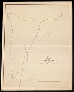
Skip to search
Skip to main content
Skip to first result
Digital Commonwealth
Folders
Sign Up / Log In
Search for
Search
Search
Search
Basic
Advanced
Explore
Map
Collections
Institutions
Formats
For Educators
Primary Source Sets
Lesson Plans
Using Primary Sources
Searching Digital Commonwealth
For Institutions
Join Digital Commonwealth
Conferences, Trainings, & Events
How to Contribute Collections
Digitization Services
Board & Committees
Frequently Asked Questions
About
About Digital Commonwealth
News & Announcements
Copyright & Terms of Use
Harmful Content Statement
Partners
API
Contact Us
Search
Search Constraints
Start Over
Save Search
Your search:
More Like
commonwealth-oai:pc289q93n
✖
Remove constraint More Like: commonwealth-oai:pc289q93n
« Prev. |
1
-
20
of
232
|
Next »
Sort
by relevance
relevance
title
date (asc)
date (desc)
Number of results to display per page
20
per page
per page
10
per page
20
per page
50
per page
100
per page
View results as:
List
list view
Maps
map view
Gallery
grid view
Search Results
1.
Atlas of Brookfield, West Brookfield and No. Brookfield towns, Massachusetts : compiled from recent and actual surveys and records
2.
[Map of the Connecticut River from Springfield to Hadley].
3.
Map of the Hampden Railroad in connection with the Western and Canal roads / W.H. and H.M. Butler, engineers.
4.
Atlas of the city of Springfield and the town of Longmeadow, Massachusetts
5.
Atlas of the city of Springfield and the town of Longmeadow, Massachusetts : based upon, and carefully compiled from official...
6.
Richards standard atlas of the city of Springfield and the town of Longmeadow, Massachusetts
7.
Richards Standard atlas of the city of Springfield and the town of Longmeadow, Massachusetts
8.
Richards standard atlas of the city of Springfield and the town of Longmeadow, Massachusetts [plate 1]
9.
Richards standard atlas of the city of Springfield and the town of Longmeadow, Massachusetts [plate 10]
10.
Richards standard atlas of the city of Springfield and the town of Longmeadow, Massachusetts [plate 9]
11.
Atlas of the boundaries of the city of Springfield, Hampden County
12.
Insurance maps of Ware, Hampshire County, Massachusetts
13.
Palmer
14.
Brookfield
15.
West Brookfield
16.
American Optical Company in 1921 campus map: dates indicate the year of erection or remodeling the several buildings into their...
17.
Map of the town of Southbridge, Mass : including detail plans of Southbridge, Globe village and Sandersdale from recent and...
18.
Plan of the towns of Sturbridge and Southbridge : from actual surveys and records
19.
Atlas of Massachusetts
20.
Atlas of Springfield City, Massachusetts
« Previous
Next »
1
2
3
4
5
…
11
12
Limit your search
Subject
Harbors--Massachusetts--Boston--Maps
58
Springfield (Mass.)--Maps
23
Boston (Mass.)--Maps
13
Massachusetts--Maps
13
Real property--Massachusetts--Springfield--Maps
13
Boston Harbor (Mass.)--Maps
8
Charles River (Mass.)--Maps
7
Connecticut River--Maps
7
more
Subject
»
Place
North and Central America
232
United States
231
Massachusetts
204
Suffolk (county)
84
Boston
80
Plymouth (county)
31
Hampden (county)
24
Middlesex (county)
24
more
Place
»
Format
Maps/Atlases
188
Books
43
Manuscripts
5
Photographs
2
Available to use
No known restrictions
22
Date
View distribution
Current results range from
1827
to
2005
Date range begin
Date range end
View larger »
Unknown
3
Collection
Massachusetts Board of Harbor and Land Commissioners
202
Norman B. Leventhal Map Center Collection
22
Boston and New England Maps (Collection of Distinction)
17
Urban Maps (Collection of Distinction)
12
Massachusetts Real Estate Atlases
5
Massachusetts Board of Railroad Commissioners
2
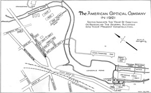
Photographic Collection of the American Optical Company
1
Institution
State Library of Massachusetts
209
Boston Public Library
22
Jacob Edwards Library
1