Skip to search
Skip to main content
Skip to first result
Digital Commonwealth
Folders
Sign Up / Log In
Search for
Search
Search
Search
Basic
Advanced
Explore
Map
Collections
Institutions
Formats
For Educators
Primary Source Sets
Lesson Plans
Using Primary Sources
Searching Digital Commonwealth
For Institutions
Join Digital Commonwealth
Conferences, Trainings, & Events
How to Contribute Collections
Digitization Services
Board & Committees
Frequently Asked Questions
About
About Digital Commonwealth
News & Announcements
Copyright & Terms of Use
Harmful Content Statement
Partners
API
Contact Us
Search
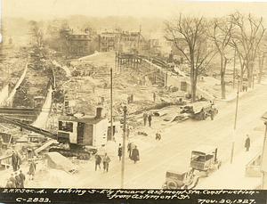
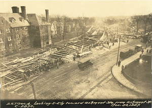
Search Constraints
Start Over
Save Search
Your search:
More Like
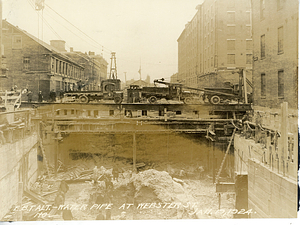
commonwealth-oai:h415s414q
✖
Remove constraint More Like: commonwealth-oai:h415s414q
« Prev. |
1
-
100
of
2,155
|
Next »
Sort
by relevance
relevance
title
date (asc)
date (desc)
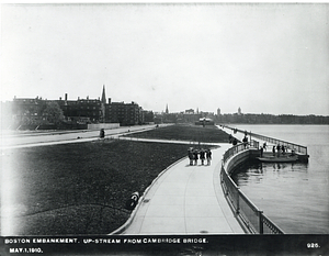
Number of results to display per page
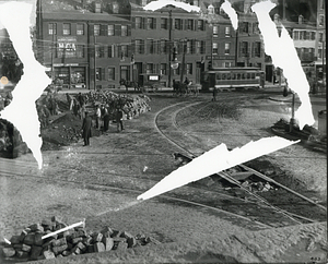
100
per page
per page
10
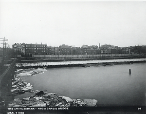
per page
20
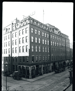
per page
50
per page
100
per page
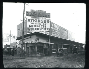
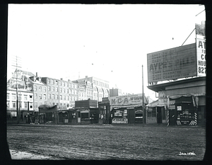
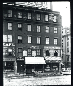
View results as:
List
list view
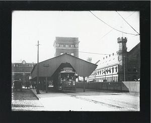
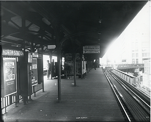
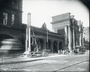
Maps
map view
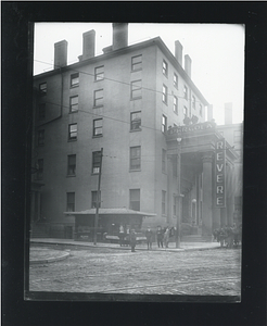
Gallery
grid view
Search Results
1.
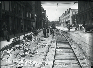
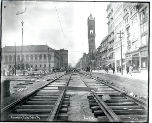
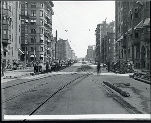
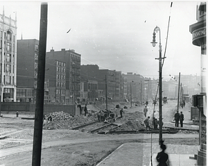
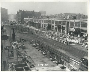
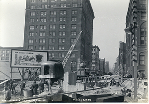
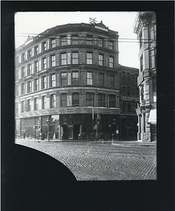
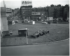
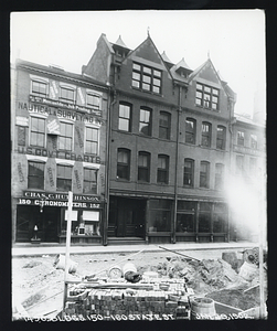
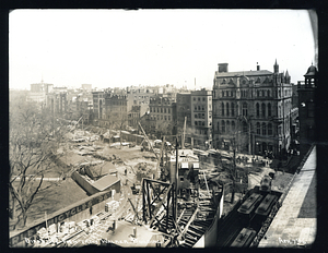
Canal Street progress view
2.
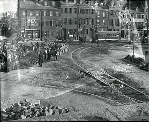
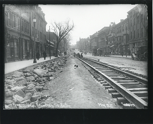
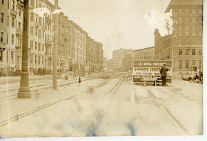
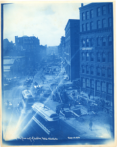
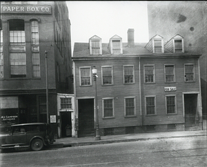
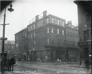
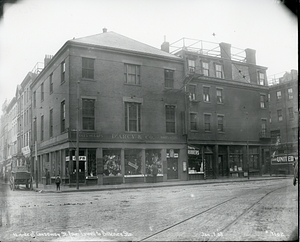
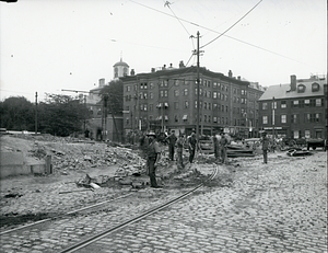
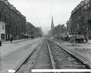
Charles Street at Cambridge Street
3.
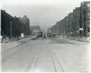
Looking towards the West End from Leverett Circle
4.
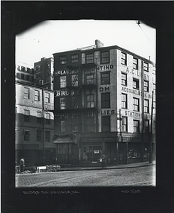
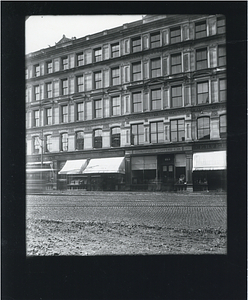
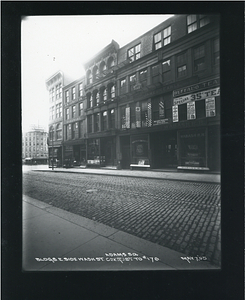
119 Haverhill Street
5.
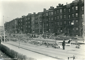
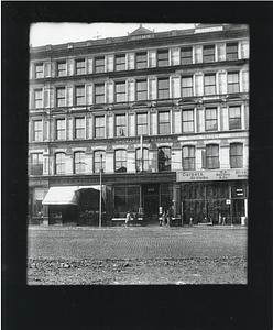
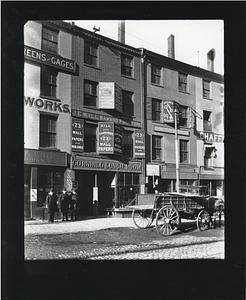
61-71 Haverhill Street
6.
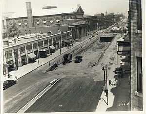
Canal Street at Market Street
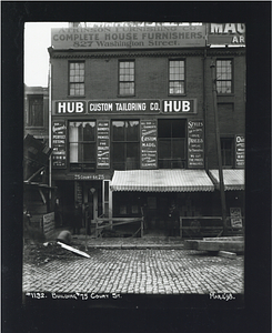
7.
Causeway Street at Canal Street
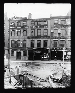
8.
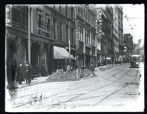
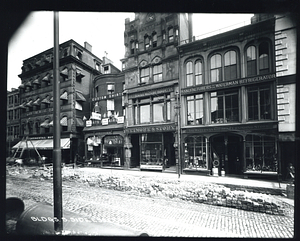
Causeway Street between Canal and Haverhill Streets
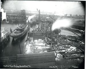
9.
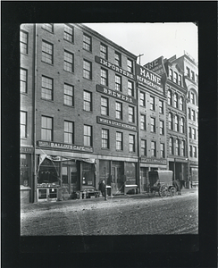
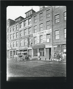
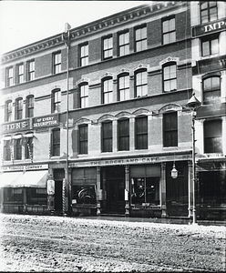
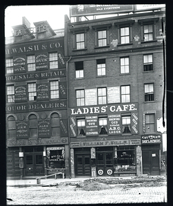
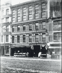
The Rockland Cafe, 27 to 33 Washington Street
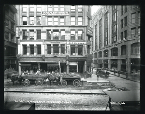
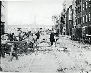
10.
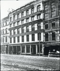
Thomas L. Smith and Sons
11.
Buildings 30-32 Dock Square
12.
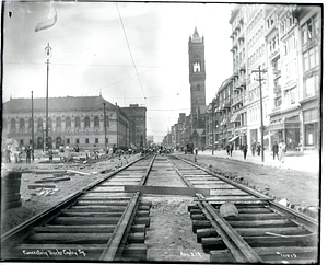
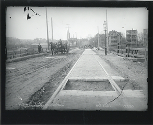
Concreting tracks Copley Square
13.
Concreting tracks Copley Square
14.
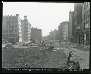
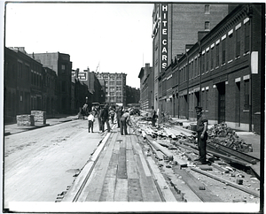
Cross Street widening from North Street to Commercial Street
15.
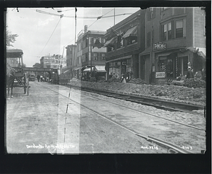
Dorchester Avenue north of Fields Corner
16.
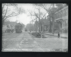
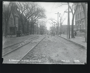
East Broadway, South Boston, progress view
17.
East Broadway, South Boston, progress view
18.
Haymarket Square
19.
Haymarket Square
20.
Looking northerly on Washington Street from Summer Street
21.
Massachusetts Avenue
22.
Mill Street, Dorchester, progress view
23.
Newbury Street
24.
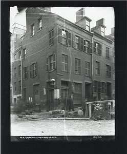
Northeast corner Phillips and Grove Streets
25.
Progress view, Broadway, South Boston
26.
Saint James Avenue at Berkeley Street
27.
Saint James Avenue looking easterly towards Arlington Street
28.
Saint James Avenue looking westerly towards Clarendon Street
29.
Sidewalk, 660 Washington Street
30.
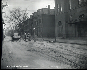
E Street opposite Saint Augustines School
31.
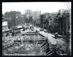
Work on Section 5, looking northerly
32.
Area between Canal, Causeway, Haverhill, Traverse Street from Union Street
33.
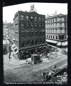
Building sidewalks at corner of Brattle Street and Adams Square
34.
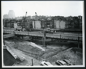
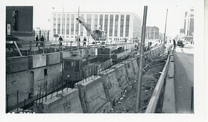
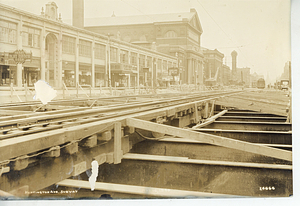
1603 Huntington Avenue subway construction
35.
Dewey Square
36.
Dewey Square
37.
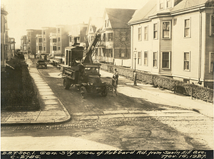
Dorchester Rapid Transit section 1. General south view of Hubbard Road from Savin Hill Avenue
38.
Dorchester Rapid Transit section 4. Looking southeast - Ashmont Station construction from Ashmont Street
39.
Dorchester Rapid Transit section 4. Looking southeast towards Ashmont Station construction - from Ashmont Street
40.
Dorchester Rapid Transit section 4. Looking southeast towards Ashmont Station from Ashmont Street
41.
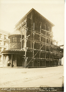
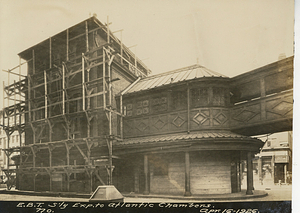
East Boston tunnel - Building over Atlantic Chambers - South side
42.
East Boston tunnel alterations - South view of Lewis Street from Webster Street
43.
East Boston Tunnel alterations - Water pipe at Webster Street
44.
East Boston tunnel south exposure to Atlantic Chambers
45.
Huntington Avenue
46.
Huntington Avenue for Gainsborough Street Looking towards Copley Square
47.
Huntington Avenue from Massachusetts Avenue looking towards Gainsborough Street
48.
Huntington Avenue subway
49.
Huntington Avenue subway
50.
Huntington Avenue subway
51.
Huntington Avenue subway at Exeter Street
52.
Looking southerly from roof of building number 426 Atlantic Avenue
53.
Streetcars in front of the Copley Square Hotel
54.
Underpass looking east on Huntington Avenue
55.
103 Washington Street
56.
107 Washington Street
57.
115 Washington Street
58.
333 Cambridge Street, Boston
59.
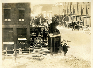
Accident on Causeway Street nearly opposite North Station
60.
Boston embankment upstream from Cambridge Bridge
61.
Brattle Street and Adams Square
62.
Building on east side of Friend Street, corner of Hanover Street
63.
Buildings east side Washington Street Adams Square to 176
64.
Canal at Causeway Street
65.
The Charlesbank from Craigie Bridge
66.
Cornhill Lunch Room
67.
Crawford House, corner of Court Street and Brattle Street., Scollay Square
68.
East bank Charles River between Craigie Bridge and West Boston Bridge from boat
69.
East side of Lowell Street near Causeway Street
70.
Eaton Street at Chambers Street
71.
Leverett Circle
72.
Miller Brothers and Company, 13 to 19 Washington Street
73.
North side of Causeway Street, corner of Billerica Street
74.
North side of Causeway Street from Lowell Street to Billerica Street
75.
North Station
76.
Opposite North Station, street traffic
77.
Revere House
78.
Science Park station
79.
Tearing down the Parkman Market, built 1810, Cambridge Street at North Grove Street
80.
Tower on elevated, near North Station
81.
150-160 State Street
82.
Arlington Street from Boylston Street, looking southerly
83.
B Street at Colony Avenue, South Boston
84.
B Street at Sixth Street, South Boston
85.
B Street, South Boston, progress view
86.
B Street South Boston, Progress View
87.
B Street South Boston, West Fifth Street
88.
Bird's eye view from Walker Building
89.
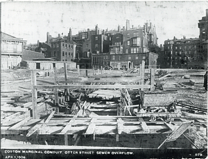
Boston marginal conduit, Otter Street sewer overflow
90.
Boylston Street
91.
Boylston Street at Berkeley Street
92.
Building 75 Court Street
93.
Building corner Washington Street and Hayward Place
94.
Buildings at 144-150 State Street
95.
Buildings south side Essex Street
96.
Charles River Bridge, Foundation 3
97.
Charles Street
98.
Charles Street at Cambridge Street
99.
Charles Street at Cambridge Street
100.
Columbus Avenue looking easterly near West Newton Street
« Previous
Next »
1
2
3
4
5
…
21
22
Limit your search
Subject
Construction projects
671
Streetscapes (Urban design)
596
Boston (Mass.)
585
Local transit
448
Boston Elevated Railway Company
233
Dorchester (Boston, Mass.)
209
South End (Boston, Mass.)
154
Local transit stations
150
more
Subject
»
Place
North and Central America
2,082
United States
2,082
Massachusetts
2,075
Boston
2,020
Suffolk (county)
2,020
Downtown Crossing
214
South End
206
Dorchester
170
more
Place
»
Format
Photographs
2,035
Manuscripts
72
Documents
40
Letters/Correspondence
4
Drawings/Illustrations
4
Paintings
2
Maps/Atlases
1
Prints
1
Available to use
Creative Commons license
44
No known restrictions
1
Date
View distribution
Current results range from
1836
to
2018
Date range begin
Date range end
View larger »
Unknown
6
Collection
Public Works Department Photographs
1,361
Dorchester Rapid Transit System Photographs
128
Government Center Urban Renewal Photographs
74
Huntington Avenue Subway Photographs
62
West End Urban Renewal Photographs
53
Boston Elevated Photographs: South End
47
International Center for the Disabled Records, 1917-2012
46
Boston Elevated Photographs: North Station Lechmere
44
more
Collection
»
Institution
Boston City Archives
1,988
Special Collections and University Archives, University of Massachusetts Amherst Libraries
47
Northeastern University Library
36
Bentley University
27
Public Library of Brookline
25
U.S. Army Natick Soldier Systems Center
19
Historic New England
11
Boston Public Library
1
more
Institution
»