Skip to search
Skip to main content
Skip to first result
Digital Commonwealth
Folders
Sign Up / Log In
Search for
Search
Search
Search
Basic
Advanced
Explore
Map
Collections
Institutions
Formats
For Educators
Primary Source Sets
Lesson Plans
Using Primary Sources
Searching Digital Commonwealth
For Institutions
Join Digital Commonwealth
Conferences, Trainings, & Events
How to Contribute Collections
Digitization Services
Board & Committees
Frequently Asked Questions
About
About Digital Commonwealth
News & Announcements
Copyright & Terms of Use
Harmful Content Statement
Partners
API
Contact Us
Search
Search Constraints
Start Over
Save Search
Your search:
More Like
commonwealth:zk51wb04f
✖
Remove constraint More Like: commonwealth:zk51wb04f
1
-
12
of
12
Sort
by relevance
relevance
title
date (asc)
date (desc)
Number of results to display per page
20
per page
per page
10
per page
20
per page
50
per page
100
per page
View results as:
List
list view
Maps
map view
Gallery
grid view
Search Results
1.
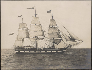
Ship James Arnold cruising off French Rock, J.T. Sherman 1st officer in charge
2.
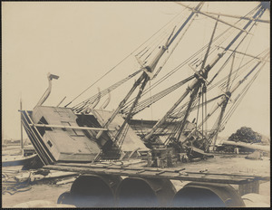
Bark James Arnold hove down
3.
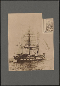
Farewell, here goes the James Arnold on her last voyage from this port
4.
James Arnold (Ship)
5.
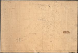
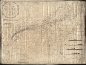
Blunt's new chart of the Atlantic or Western Ocean : Extending from the equator to lat. 74.40 N. long. 31.45 E. to long. 91 W.,...
6.
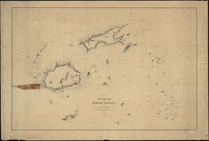
Chart of the Viti Group or Feejee Islands
7.
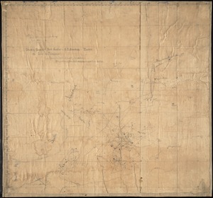
Cruising ground of bark Swallow off coast of Patagonia, J.T. Sherman, Master
8.
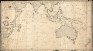
Indian Ocean
9.
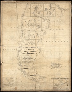
A new chart of the east and west coasts of South America : From the River Plate to Valparaiso, including the Falkland Islands...
10.
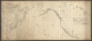
A new chart of the Pacific Ocean : Exhibiting the western coast of America, from Cape Horn to Beerings Straight, the eastern...
11.
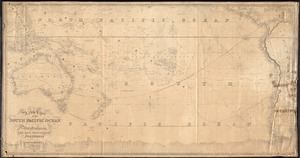
A new chart of the South Pacific Ocean : Including Hustralasia, the East India Islands, Polynesia, and the western coast of...
12.
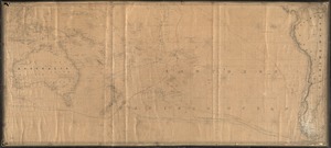
Southern Pacific Ocean
Limit your search
Subject
James Arnold (Ship)
4
Whaling
4
Ships
3
Abraham Barker (Ship)
1
Piers & wharves
1
President (Ship : 1811-1880)
1
Place
Bristol (county)
3
Massachusetts
3
New Bedford
3
North and Central America
3
United States
3
Oceania
2
South America
2
South Pacific
2
more
Place
»
Format
Maps/Atlases
9
Photographs
3
Manuscripts
2
Available to use
Creative Commons license
12
Date
View distribution
Current results range from
1822
to
1959
Date range begin
Date range end
View larger »
Collection
New Bedford Whaling Museum Nautical Charts
9
Joseph G. Tirrell Photograph Collection
2
Rotogravure Collection
1
Institution
New Bedford Whaling Museum
9
New Bedford Free Public Library
3