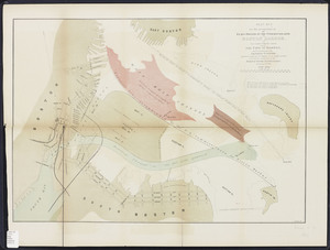
This site will undergo maintenance on Monday 1/19 from 7AM-5PM and will be temporarily unavailable. We apologize for the inconvenience.
Skip to search
Skip to main content
Skip to first result
Digital Commonwealth
Folders
Sign Up / Log In
Search for
Search
Search
Search
Basic
Advanced
Explore
Map
Collections
Institutions
Formats
For Educators
Primary Source Sets
Lesson Plans
Using Primary Sources
Searching Digital Commonwealth
For Institutions
How to Contribute Collections
Digitization Services
Frequently Asked Questions
Collection Development Policy
About
About Digital Commonwealth
News & Announcements
Copyright & Terms of Use
Harmful Content Statement
Partners
API
Contact Us
Search
Search Constraints
Start Over
Save Search
Your search:
More Like
commonwealth:z603vg02j
✖
Remove constraint More Like: commonwealth:z603vg02j
« Prev. |
1
-
20
of
2,394
|
Next »
Sort
by relevance
relevance
title
date (asc)
date (desc)
recently added
Number of results to display per page
20
per page
per page
10
per page
20
per page
50
per page
100
per page
View results as:
List
list view
Maps
map view
Gallery
grid view
Search Results
1.
A plan of the town and harbour of Boston. : And the country adjacent with the road from Boston to Concord shewing the place of...
2.
Boston Harbor
3.
Boston Harbor & vicinity
4.
Copy of a plan of South Bay
5.
J. Schedler's relief map of Boston and environs
6.
Map of Boston Harbor
7.
Map of Boston proper, Charlestown, South Boston and East Boston : showing original territory of old Boston, the areas filled...
8.
Map of the eastern junc. Broad Sound Pier, & Pt. Shirley railroad : steamboat lines and connections : established for the...
9.
Map showing the terminal facilities of Boston
10.
Map to accompany report of State Board on Docks and Terminal Facilities : showing existing conditions and proposed changes at...
11.
Plan no. 2 for the occupation of the flats owned by the Commonwealth in Boston harbor: and for connecting the same with the...
12.
Plan of Boston
13.
Plan of Boston
14.
Plan of Boston
15.
Plan of Boston and its vicinity
16.
Plan of Boston and its vicinity
17.
[Plan of channels and flats as they were before the 200 feet outside of the Mill Dam was filled up]
18.
Plan of the harbour of Boston, from surveys made under the direction of commissioners appointed by a resolve of the...
19.
Plano de la bahia y puerto de Boston
20.
Port facilities at Boston, MA
« Previous
Next »
1
2
3
4
5
…
119
120
Limit your search
Subject
Boston (Mass.)--Maps
2,199
Real property--Massachusetts--Boston--Maps
1,493
Landowners--Massachusetts--Boston--Maps
1,408
Roxbury (Boston, Mass.)--Maps
208
Charlestown (Boston, Mass.)--Maps
108
City planning--Massachusetts--Boston--Maps
105
Dorchester (Boston, Mass.)--Maps
99
Brighton (Boston, Mass.)--Maps
79
more
Subject
»
Place
North and Central America
2,380
United States
2,353
Massachusetts
2,267
Suffolk (county)
2,212
Boston
2,211
Roxbury
226
South Boston
119
Dorchester
117
more
Place
»
Format
Maps/Atlases
2,394
Manuscripts
22
Posters
1
Available to use
No known restrictions
2,122
Creative Commons license
45
Date
View distribution
Current results range from
1708
to
2024
Date range begin
Date range end
View larger »
Unknown
3
Collection
Norman B. Leventhal Map & Education Center Collection
2,059
Boston and New England Maps
2,029
Urban Maps
1,895
American Revolutionary War-Era Maps
147
Maps from AAS
138
Boston Redevelopment Authority Collection
121
Historic Maps
57
Mapping Boston Collection
27
more
Collection
»
Institution
Boston Public Library
2,136
American Antiquarian Society
138
Salem State University Archives and Special Collections
57
State Library of Massachusetts
32
Private Collection
27
Boston Athenaeum
2
Massachusetts Historical Society
2