Skip to search
Skip to main content
Skip to first result
Digital Commonwealth
Folders
Sign Up / Log In
Search for
Search
Search
Search
Basic
Advanced
Explore
Map
Collections
Institutions
Formats
For Educators
Primary Source Sets
Lesson Plans
Using Primary Sources
Searching Digital Commonwealth
For Institutions
Join Digital Commonwealth
Conferences, Trainings, & Events
How to Contribute Collections
Digitization Services
Board & Committees
Frequently Asked Questions
About
About Digital Commonwealth
News & Announcements
Copyright & Terms of Use
Harmful Content Statement
Partners
API
Contact Us
Search
Search Constraints
Start Over
Save Search
Your search:
More Like
commonwealth:x633fd764
✖
Remove constraint More Like: commonwealth:x633fd764
« Prev.
|
8,061
-
8,080
of
10,999
|
Next »
Sort
by relevance
relevance
title
date (asc)
date (desc)
Number of results to display per page
20
per page
per page
10
per page
20
per page
50
per page
100
per page
View results as:
List
list view
Maps
map view
Gallery
grid view
Search Results
8061.
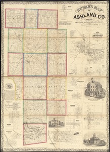
Nunan's map of Ashland Co., Ohio : showing the sections, farms, lots, & villages
8062.
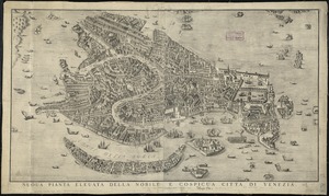
Nuoua pianta eleuata della nobile e cospicua citta di Venezia
8063.
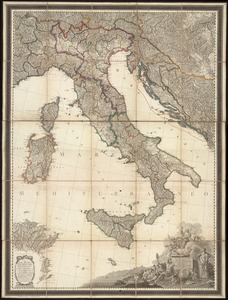
Nuova carta dell'Italia
8064.
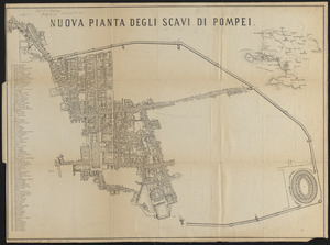
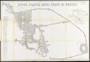
Nuova pianta degli scavi di Pompei
8065.
Nuova pianta degli scavi di Pompei
8066.
Nuova pianta della cittá e porto franco di Venezia
8067.
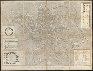
Nuova pianta di Roma moderna : estratta dalla grande del Nolli corretta ed accresciuta de' nomi delle contrade indicati al loro...
8068.
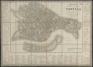
Nuova pianta di Venezia = Neuer plan von Venedig
8069.
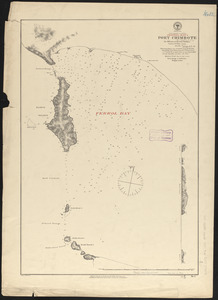
N.w. coast of Peru, Ferrol Bay & Port Chimbote
8070.
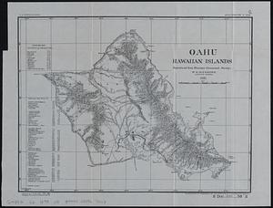
Oahu, Hawaiian Islands
8071.
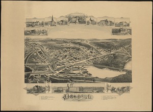
Oakdale, Massachusetts
8072.
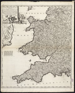
Occidentalior Regni Angliae districtus comprehendens principatum Walliae et Glocestriae ducatum comitatus et provincias...
8073.
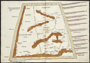
Oceani occidetalis seu terre nove tabula
8074.
Octava Asiae tabula
8075.
Octava Asie tabula continet Scythiam que citra Imaū est & seras
8076.
Octava Europae tabula
8077.
Octava Europe tabula continet Sarmatiam
8078.
Official highway map of the state of Vermont
8079.
Official map of American and Canadian airways and aerial mail routes
8080.
Official map of Boston
« Previous
Next »
1
2
…
400
401
402
403
404
405
406
407
408
…
549
550
Limit your search
Subject
Real property--Massachusetts--Boston--Maps
2,278
Landowners--Massachusetts--Boston--Maps
2,117
Boston (Mass.)--Maps
1,966
Roxbury (Boston, Mass.)--Maps
351
Dorchester (Boston, Mass.)--Maps
317
Cambridge (Mass.)--Maps
266
Brookline (Mass.)--Maps
236
Real property--Massachusetts--Cambridge--Maps
216
more
Subject
»
Place
North and Central America
7,813
United States
6,432
Suffolk (county)
3,337
Boston
3,197
Massachusetts
3,166
Europe
963
Middlesex (county)
616
Canada
427
more
Place
»
Format
Maps/Atlases
10,940
Manuscripts
215
Prints
51
Books
35
Objects/Artifacts
10
Drawings/Illustrations
8
Posters
4
Available to use
No known restrictions
10,931
Creative Commons license
46
Date
View distribution
Current results range from
1482
to
2023
Date range begin
Date range end
View larger »
Collection
Norman B. Leventhal Map Center Collection
10,999
Boston and New England Maps (Collection of Distinction)
5,104
Urban Maps (Collection of Distinction)
4,845
Maritime Charts and Atlases (Collection of Distinction)
750
American Revolutionary War-Era Maps (Collection of Distinction)
615
Boston Redevelopment Authority Collection
86
Institution
Boston Public Library
10,999